Skip to main content
Eyebrow
About Us
Advertise
Subscribe
Contact
Social Media
Bluesky
Facebook
Instagram
LinkedIn
YouTube
Search
Main navigation
News
Products
Features
Categories
Air Quality & Weather Systems
C/AV
Charging, Tolling & RUC
Classification & Data Collection
Detection, Monitoring & Machine Vision
Enforcement
GIS/ Mapping & Location Based Systems
Mass Transit & MaaS
Networking & Communication Systems
Parking & Access Control
Urban Traffic Control
Daily News
ITS World Congress 2025
Show News
Digital Edition
Show Information
eNewsletter
ITS World Congress 2024
Digital Edition
Show Information
eNewsletter
Intertraffic Amsterdam 2024
Event Home
Show Information
eNewsletter
Digital Edition
ITS America 2024
Digital Edition
Show Information
eNewsletter
ITS America 2023
Digital Edition
Show Information
eNewsletter
ITS World Congress 2022
Digital Edition
Show Information
eNewsletter
Intertraffic Amsterdam 2022
Digital Edition
Show Information
eNewsletter
ITS World Congress 2021
Digital Edition
Show Information
eNewsletter
ITS America 2021
Digital Edition
Show Information
eNewsletter
Innovation News 2020
Digital Edition
Show Information
eNewsletter
Calendar
Magazine
Videos
Home
GIS/ Mapping & Location Based Systems
GIS/ Mapping & Location Based Systems
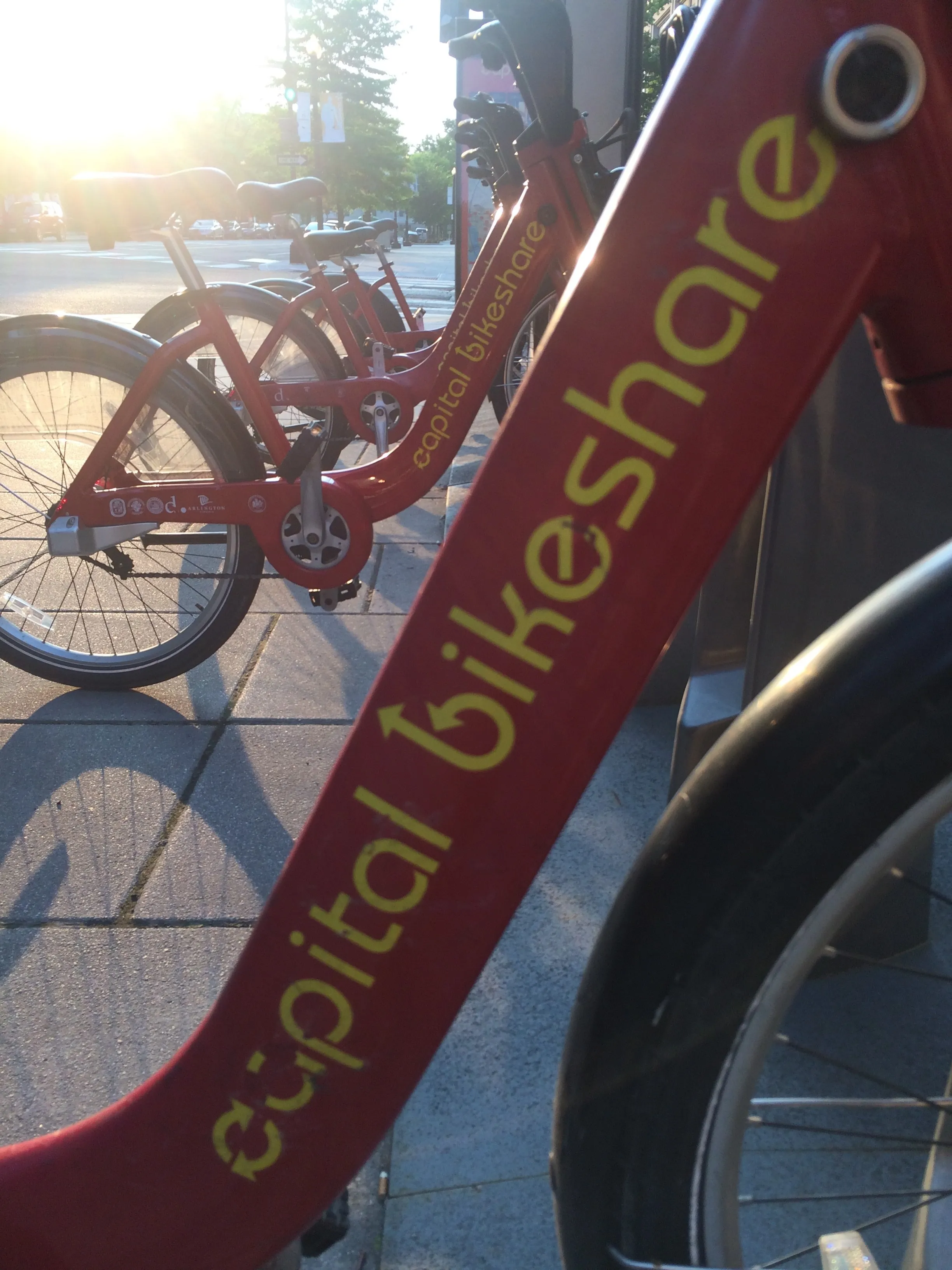
Ito World bike-share data comes to Google Maps
July 21, 2020
Riders will be able to use Maps to open bike-share apps to book and unlock a bike
Read More
Zenzic: calling all CAM creators!
July 17, 2020
UK connected and automated mobility contact database is being updated
Read More
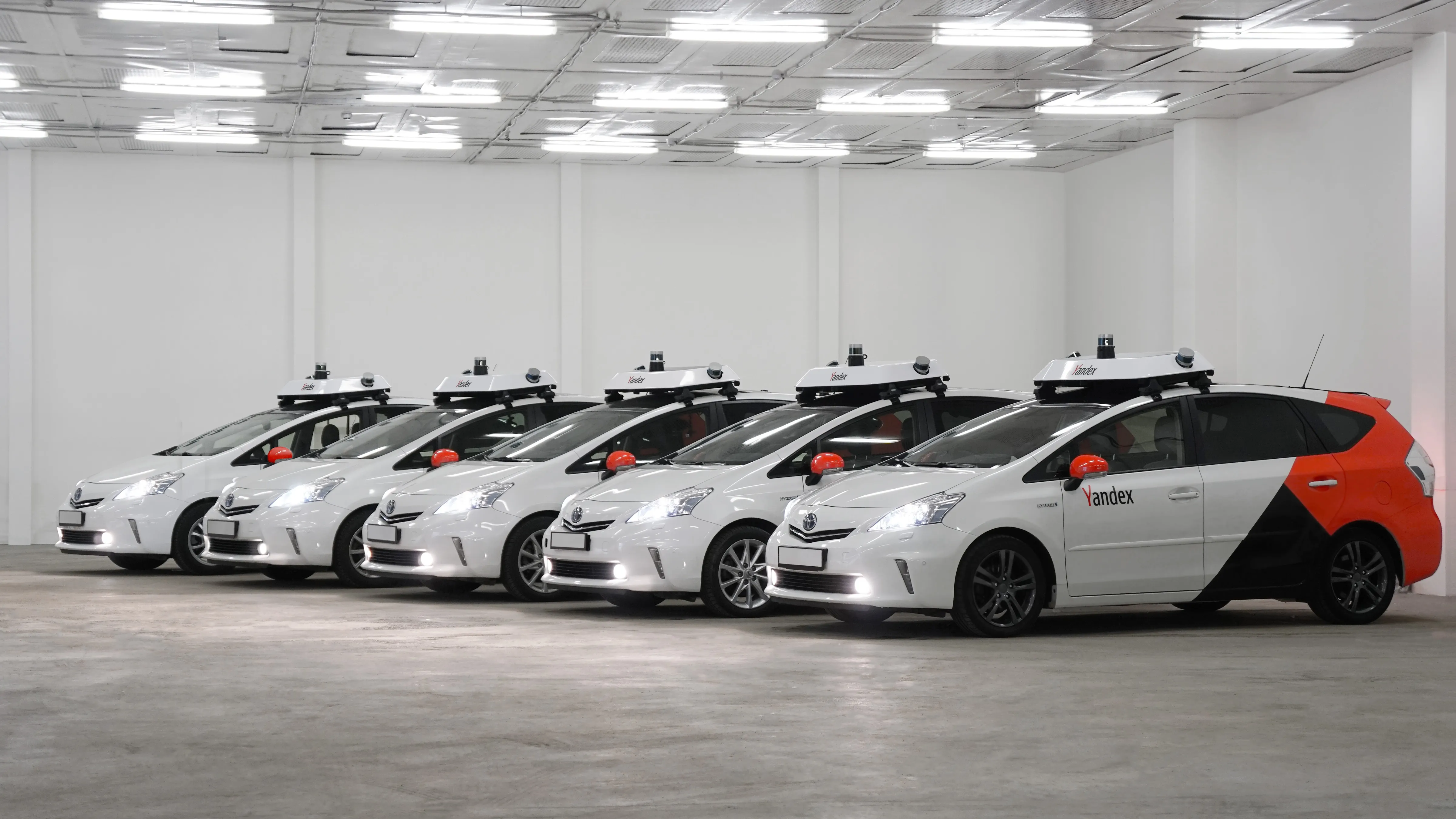
First robo-taxis allowed in Moscow from 2024
July 16, 2020
Russia is keen to make C/AVs a key part of its transport mix
Read More
'Natural successor' Gerodimos is new Aimsun CEO
July 13, 2020
Change at the top of Siemens business comes as Ferrer steps down after two decades in charge
Read More
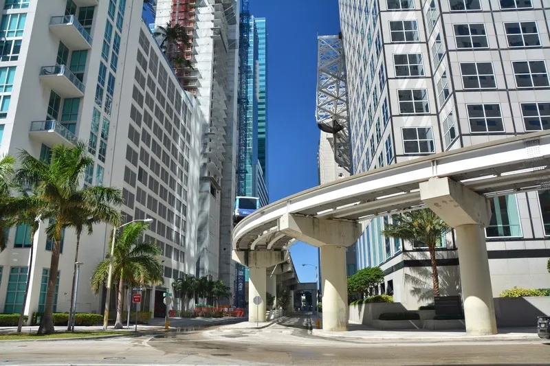
Miami-Dade launches mobility innovation 'playground'
July 2, 2020
Miami-Dade County in Florida and transportation platform CoMotion have launched what they call a 'playground' for urban mobility innovation.
Read More
DiDi aims for 'one million AVs' by 2030
June 26, 2020
Chinese ride-hailing giant predicts mass production of robo-taxis by 2025
Read More
Honeywell forms dedicated drone unit
June 25, 2020
Products to be developed include a fly-by-wire autopilot system
Read More
Here: AI has place in ‘privacy by design’
June 23, 2020
Artificial intelligence may improve traffic in cities and keep location data private, but Here Technologies shows that it only takes four points of anonymous data to predict your identity.
Read More
Mind the gap: Veovo tech supports social distancing
June 5, 2020
New passenger density management system is designed to help transit operators
Read More
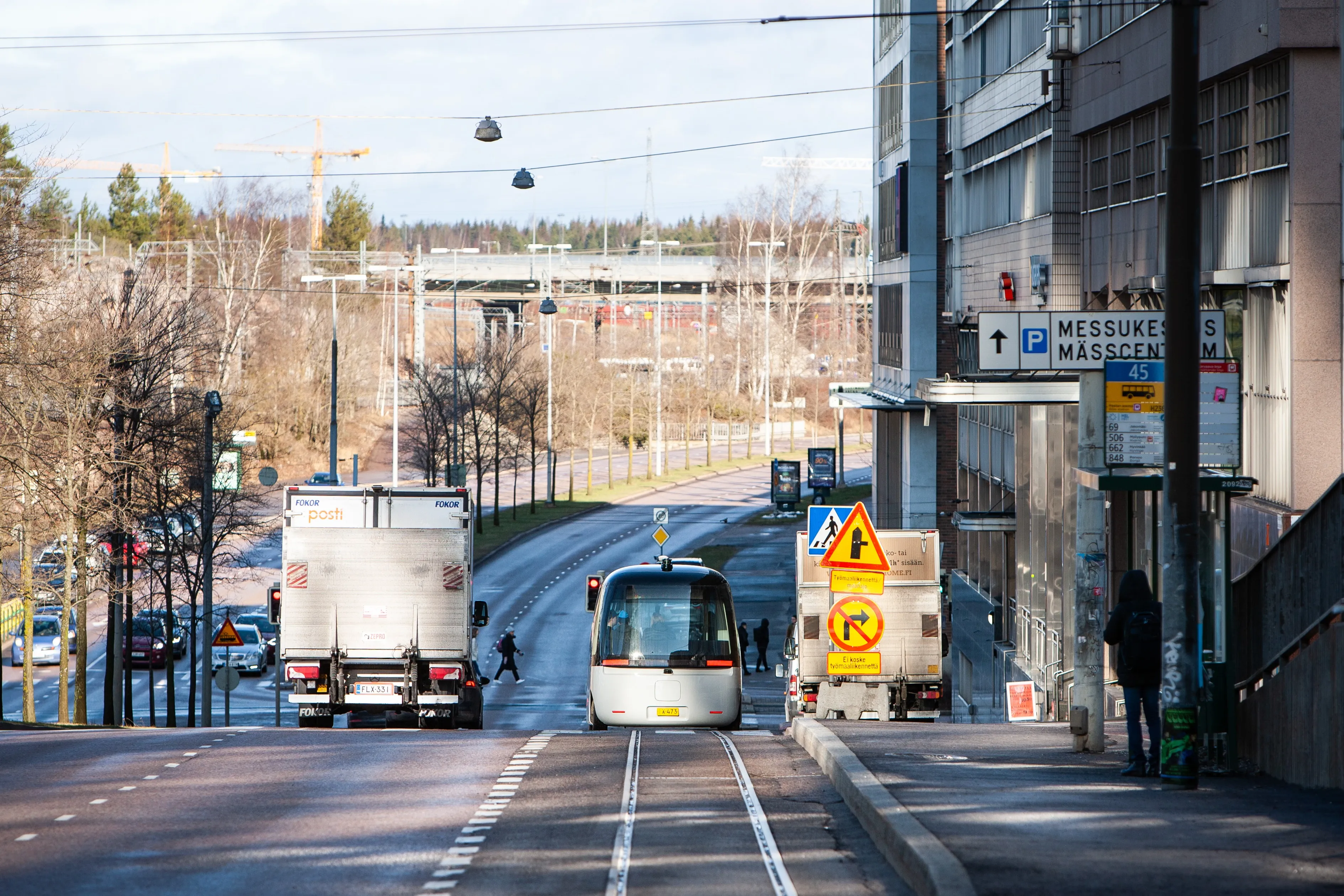
Fabulos robo-buses hit European streets
June 5, 2020
EU-backed AV scheme aims to solve urban first-/last-mile problems
Read More
Pagination
First page
« First
Previous page
‹‹
…
Page
54
Page
55
Page
56
Page
57
Page
58
Page
59
Page
60
Page
61
Page
62
…
Next page
››
Last page
Last »
Editor's Choice
Modaxo buys transport scheduling software provider Siscog
Rotterdam links airport with metro via autonomous bus
EC Road Safety Awards 2025 finalists announced
Highlighted Content
July 14, 2025
Miovision tool allows cities to 'act faster' to prevent crashes
Read More
July 23, 2025
Innovation without the chaos
Read More
July 23, 2025
Modaxo buys transport scheduling software provider Siscog
Read More
July 24, 2025
Rotterdam links airport with metro via autonomous bus
Read More
August 1, 2025
High-precision Theia telephotos for fixed and mobile traffic installations
Read More
Home
News
Products
Features
Categories
Air Quality & Weather Systems
C/AV
Charging, Tolling & RUC
Classification & Data Collection
Detection, Monitoring & Machine Vision
Enforcement
GIS/ Mapping & Location Based Systems
Mass Transit & MaaS
Networking & Communication Systems
Parking & Access Control
Urban Traffic Control
Daily News
ITS World Congress 2025
Show News
Digital Edition
Show Information
eNewsletter
ITS World Congress 2024
Show Information
eNewsletter
Digital Edition
Intertraffic Amsterdam 2024
Event Home
Show Information
eNewsletter
Digital Edition
ITS America 2024
Show Information
eNewsletter
Digital Edition
ITS America 2023
Show Information
eNewsletter
Digital Edition
ITS World Congress 2022
Show Information
eNewsletter
Digital Edition
Intertraffic Amsterdam 2022
Show Information
eNewsletter
Digital Edition
ITS World Congress 2021
Show Information
eNewsletter
Digital Edition
ITS America 2021
Show Information
eNewsletter
Digital Edition
Innovation News 2020
Digital Edition
Show Information
eNewsletter
Calendar
Magazine
Videos