
GIS/ Mapping & Location Based Systems

StreetLight Data provides free VMT metrics
April 17, 2020
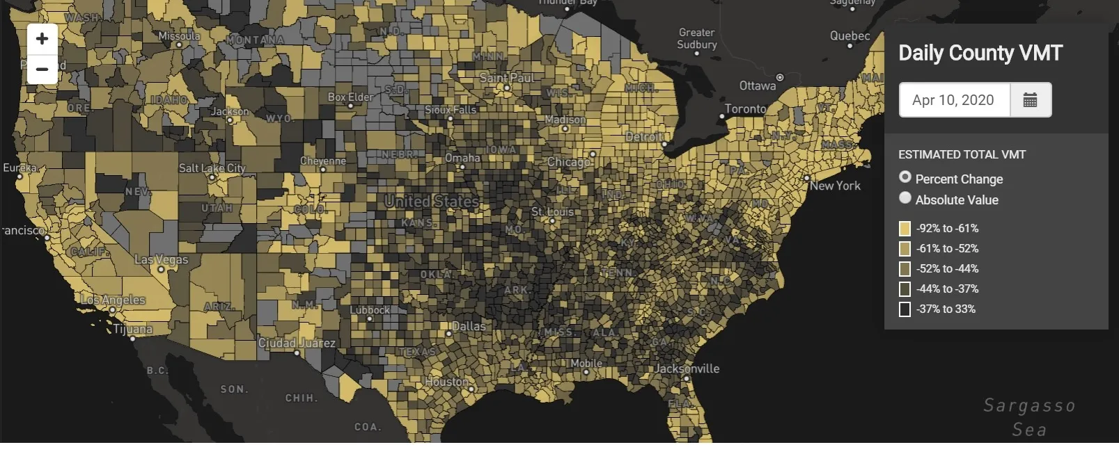
StreetLight Data is offering vehicle miles travelled (VMT) data for US transit agencies to monitor transport networks and understand travel patterns during the Covid-19 pandemic.
Transcend Spatial Solutions rebrands as Rizing
April 16, 2020
Rizing, a privately held multinational services firm that focuses primarily on Sap technology, has rebranded its geospatial business Transcend Spatial Solutions as Rizing.
StreetDrone urges more emphasis on C/AV hardware 
April 15, 2020
A greater reliance is needed on the contribution hardware can make towards safety within autonomous vehicles (AVs), according to a report by StreetDrone.
Via’s on-demand bus for Abu Dhabi health workers 
April 9, 2020
Via has launched an on-demand microtransit shuttle service for medical workers in Abu Dhabi during the coronavirus pandemic.
Distraction danger rises with in-car tech, says TRL
April 2, 2020
The increasing sophistication of in-car technology is creating new dangers in terms of driver distraction, a new study finds.
Toyota demos HD maps for Tokyo AVs
March 31, 2020
Toyota's Research Institute-Advanced Development has demonstrated high definition (HD) maps for autonomous vehicles (AVs) for surface roads in Japan with a relative accuracy of less than 50cm.
Waymo redesigns fifth generation hardware sensor suite
March 16, 2020
Waymo has redesigned its fifth-generation hardware sensor suite with the aim of enabling the scaled deployment of Waymo Driver autonomous vehicles (AVs).
Orange creates Abu Dhabi smart city app
March 9, 2020
Abu Dhabi Municipality (ADM) and Orange Business Services are rolling out a smart cities virtualisation app in the United Arab Emirates (UAE).
On the road with Galileo
February 29, 2020

"The way we're driving is changing..."