TomTom and Esri fusion transform urban mobility

April 28, 2025 Read time: 2 mins

A collaboration between TomTom and Esri will take centre stage at the upcoming Congress with a session titled "Driving Insights: Unlocking the Power of TomTom Historic Traffic Data in ArcGIS.” Led by industry experts Frans Keijzer from TomTom and Jaime Nieves from Esri Spain, this presentation will showcase how integrating TomTom's historical traffic data with the ArcGIS platform has transformed urban mobility in Gran Canaria, Spain.

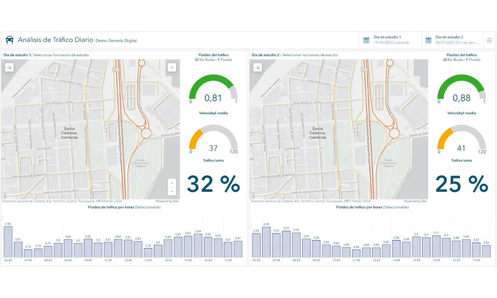
The initiative, spearheaded by Esri Spain and Sagulpa, sought to create a digital twin of the urban area to enhance planning and management. By leveraging TomTom's robust traffic data and using ArcGIS, the team swiftly deployed interactive maps and applications without extensive IT support. Key tools included TomTom Traffic Stats and TomTom Origin-Destination for traffic analysis and ArcGIS Dashboards and ArcGIS Experience Builder for dynamic visualizations.

This session (on Tuesday 20 May 20 from 11.45 to 12.45 in Hall Madrid D) will showcase the significant potential of TomTom Move data when combined with ArcGIS, making it an essential tool for those interested in advancing urban mobility solutions. Attendees will learn about three main applications derived from this initiative: a safety dashboard for monitoring traffic flow, a public transportation and emergency response planning tool, and an event traffic analysis application for managing large-scale events like football matches. These tools provide decision-makers with valuable insights, leading to improved traffic safety and optimised transportation routes.

For more information on companies in this article

Related Content

  • Kapsch is full speed ahead with AIMES ‘Intelligent Corridor’ project
    September 20, 2022
    Kapsch TrafficCom’s David Bolt, VP Sales and Solution Consulting for the APAC region, will provide an update for attendees on how the Kapsch and AIMES Intelligent Corridor project is going and explain six defined use cases focused on congestion management and improving road safety. The project was launched by Kapsch TrafficCom in March of this year together with the University of Melbourne and the Victorian Department of Transport (DOTVic), supported by an Australian Research Council (ARC) Linkage grant from the Federal Government.
  • PTV Flows uses machine learning to 'see' unexpected congestion in advance
    July 5, 2023
    New cloud-based solution can predict traffic snarl-ups up to two hours ahead
  • Arup picks 8 ways ITS can save the planet
    January 6, 2022
    The solutions we need to accelerate carbon-free transport are known, available and ready to be deployed. Tim Gammons from Arup explains what the ITS industry can do now to help…
  • Asking drivers what information they need: radical but effective
    March 19, 2014
    When Texas A&M Transportation Institute was asked to devise a temporary traveller information system for work zones, it started by asking drivers what they need. Robert Brydia explains the thinking, implementation and results. US Interstate 35 (I-35) runs roughly north–south originating in Laredo, Texas and ends 1,500 miles away in Duluth, Minnesota having passed through Oklahoma, Kansas, Missouri and Iowa. Within Texas the I-35 splits into I-35E and I-35W passing through Dallas and Fort Worth respectiv