TomTom and Esri fusion transform urban mobility

April 28, 2025 Read time: 2 mins

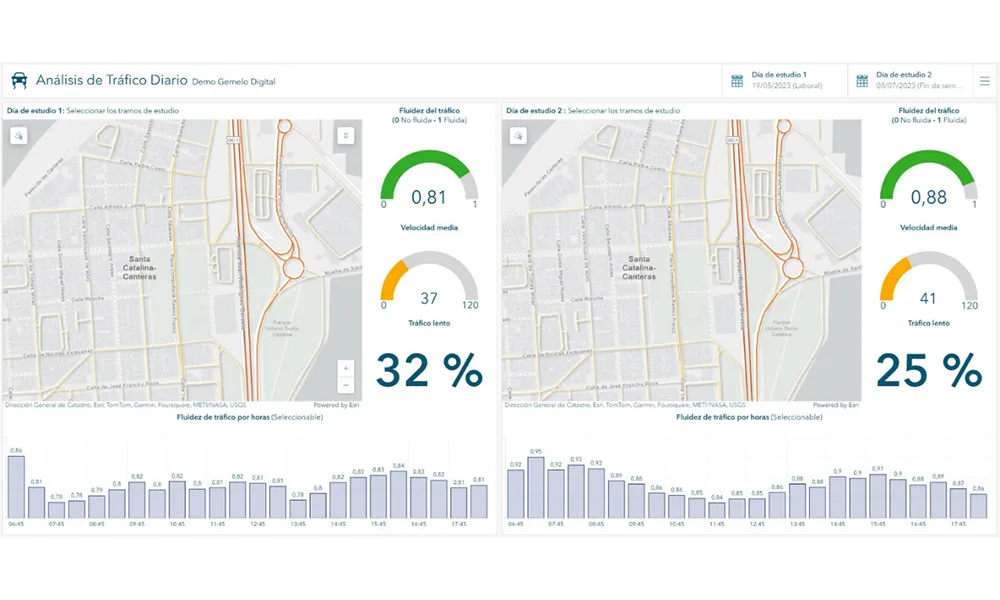
A collaboration between TomTom and Esri will take centre stage at the upcoming Congress with a session titled "Driving Insights: Unlocking the Power of TomTom Historic Traffic Data in ArcGIS.” Led by industry experts Frans Keijzer from TomTom and Jaime Nieves from Esri Spain, this presentation will showcase how integrating TomTom's historical traffic data with the ArcGIS platform has transformed urban mobility in Gran Canaria, Spain.

The initiative, spearheaded by Esri Spain and Sagulpa, sought to create a digital twin of the urban area to enhance planning and management. By leveraging TomTom's robust traffic data and using ArcGIS, the team swiftly deployed interactive maps and applications without extensive IT support. Key tools included TomTom Traffic Stats and TomTom Origin-Destination for traffic analysis and ArcGIS Dashboards and ArcGIS Experience Builder for dynamic visualizations.

This session (on Tuesday 20 May 20 from 11.45 to 12.45 in Hall Madrid D) will showcase the significant potential of TomTom Move data when combined with ArcGIS, making it an essential tool for those interested in advancing urban mobility solutions. Attendees will learn about three main applications derived from this initiative: a safety dashboard for monitoring traffic flow, a public transportation and emergency response planning tool, and an event traffic analysis application for managing large-scale events like football matches. These tools provide decision-makers with valuable insights, leading to improved traffic safety and optimised transportation routes.

For more information on companies in this article

Related Content

  • IBM Big Data helps Dublin improve transport operations
    May 17, 2013
    The city of Dublin is using IBM Big Data identify and solve the root causes of traffic congestion in its public transport network throughout the city, which means improved traffic flow and better mobility for commuters. Integrating data from a citywide network of sensors with geospatial data means that city officials are able to better monitor and manage traffic in real time. To keep the city moving, the council’s traffic control centre works together with local transport operators to manage an extensive ne
  • Inrix expands analytics access
    April 23, 2013
    Data technology company Inrix used the 23rd Annual ITS America Annual Meeting and Exposition to announce a partner program that expands access to the company’s analytics and historical traffic archive. Launch partners Transpo Group and Fehr & Peers, transportation planning and engineering services firms will leverage Inrix analytics and historical traffic data to help transportation agency customers conduct congestion management studies, inform system planning and better measure performance of their road ne
  • Viewpoint on the 2015 ITS World Congress
    September 10, 2014
    The next ITS World Congress will be held in stunning Bordeaux, France, from 5 – 9 October, 2015. Didier Gorteman, Ertico - ITS Europe, chair of the organising committee, explains how the event is shaping up. Q The theme of next year’s ITS World Congress in Bordeaux is “Towards intelligent mobility – Better use of space”. Could you give an overview of how this theme will shape the event? A The EPC chose this theme together with the host organisations. With the word space we want to make a link to space
  • Data made useful by Xerox
    May 21, 2012
    Data is everywhere in transportation systems and in copious amounts. But what is your data telling you about your agency? And are you putting it to use to run your agency better? Xerox is helping agencies make sense of data they already have so transportation managers can find patterns, trends and solutions. During the 2012 ITS America annual meeting, Xerox will showcase a ‘city dashboard’ including heat maps that illustrates transit activity in a city.