TomTom and Esri fusion transform urban mobility

April 28, 2025 Read time: 2 mins

A collaboration between TomTom and Esri will take centre stage at the upcoming Congress with a session titled "Driving Insights: Unlocking the Power of TomTom Historic Traffic Data in ArcGIS.” Led by industry experts Frans Keijzer from TomTom and Jaime Nieves from Esri Spain, this presentation will showcase how integrating TomTom's historical traffic data with the ArcGIS platform has transformed urban mobility in Gran Canaria, Spain.

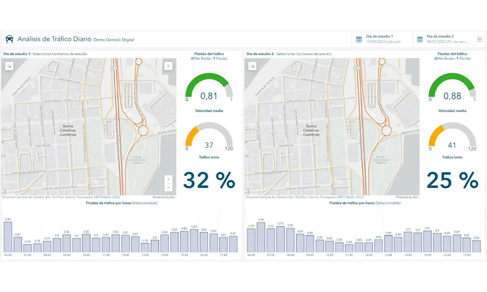
The initiative, spearheaded by Esri Spain and Sagulpa, sought to create a digital twin of the urban area to enhance planning and management. By leveraging TomTom's robust traffic data and using ArcGIS, the team swiftly deployed interactive maps and applications without extensive IT support. Key tools included TomTom Traffic Stats and TomTom Origin-Destination for traffic analysis and ArcGIS Dashboards and ArcGIS Experience Builder for dynamic visualizations.

This session (on Tuesday 20 May 20 from 11.45 to 12.45 in Hall Madrid D) will showcase the significant potential of TomTom Move data when combined with ArcGIS, making it an essential tool for those interested in advancing urban mobility solutions. Attendees will learn about three main applications derived from this initiative: a safety dashboard for monitoring traffic flow, a public transportation and emergency response planning tool, and an event traffic analysis application for managing large-scale events like football matches. These tools provide decision-makers with valuable insights, leading to improved traffic safety and optimised transportation routes.

For more information on companies in this article

Related Content

  • Georgia DoT showcases its connectivity
    March 3, 2020
    Georgia DoT’s regional connected vehicle programme could be a model for the rest of the US. Adam Hill speaks to two men involved in making it a reality – and takes a look at the state’s first-ever Tech Showcase
  • Vehicle manufacturers and local authorities seek satnav solutions
    December 5, 2013
    The increasing capability of satellite navigation is helping vehicle manufacturers and local authorities as well as individual drivers and fleets. In comparison to the physical ITS infrastructure in towns and cities and on motorways and highways, satellite navigation (satnav) systems have come a long way in a short time. Many (if not the majority) individual drivers and fleets use or have access to a satnav and now the vehicle manufacturers and even local authorities are beginning to utilise satnav derived
  • Investment and innovation the future of ITS
    January 31, 2012
    Cisco's Paul Brubaker, former administrator of the US Department of Transportation's (USDOT's) Research and Innovative Technology Administration (RITA), takes a look at how the ITS sector is starting to attract the attention of major corporations and what this will mean for intelligent transportation in the coming years
  • Personal Rapid Transit, clear benefits for European cities
    July 26, 2012
    David Crawford watches the race to get the world's first PRT system up and running. To paraphrase the old joke about buses bunching, you seem to have to wait several decades for a Personal Rapid Transit (PRT) system, and then half a dozen come along together. Currently, in fact, there are well over that number of schemes for driverless electric passenger-carrying 'pod' networks at various stages of planning, design and implementation around the world. Locations range from a straight-off-the-drawing board ne