TomTom and Esri fusion transform urban mobility

April 28, 2025 Read time: 2 mins

A collaboration between TomTom and Esri will take centre stage at the upcoming Congress with a session titled "Driving Insights: Unlocking the Power of TomTom Historic Traffic Data in ArcGIS.” Led by industry experts Frans Keijzer from TomTom and Jaime Nieves from Esri Spain, this presentation will showcase how integrating TomTom's historical traffic data with the ArcGIS platform has transformed urban mobility in Gran Canaria, Spain.

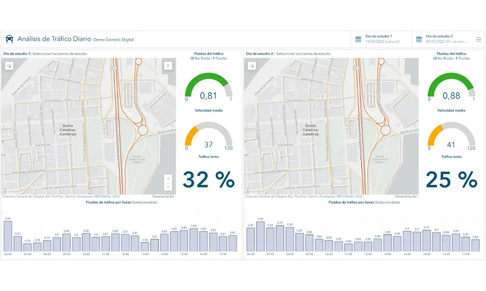
The initiative, spearheaded by Esri Spain and Sagulpa, sought to create a digital twin of the urban area to enhance planning and management. By leveraging TomTom's robust traffic data and using ArcGIS, the team swiftly deployed interactive maps and applications without extensive IT support. Key tools included TomTom Traffic Stats and TomTom Origin-Destination for traffic analysis and ArcGIS Dashboards and ArcGIS Experience Builder for dynamic visualizations.

This session (on Tuesday 20 May 20 from 11.45 to 12.45 in Hall Madrid D) will showcase the significant potential of TomTom Move data when combined with ArcGIS, making it an essential tool for those interested in advancing urban mobility solutions. Attendees will learn about three main applications derived from this initiative: a safety dashboard for monitoring traffic flow, a public transportation and emergency response planning tool, and an event traffic analysis application for managing large-scale events like football matches. These tools provide decision-makers with valuable insights, leading to improved traffic safety and optimised transportation routes.

For more information on companies in this article

Related Content

  • European sustainable urban mobility winners announced
    March 24, 2015
    An imaginative and systematic approach to monitoring and evaluation has won Bremen, Germany the European Sustainable Urban Mobility Plan (SUMP) Award, while Östersund in Sweden has been presented with the European Mobility Week Award for its work on sustainable travel options. Bremen’s interactive web platform was used to obtain feedback from residents and a SWOT (strength, weakness, opportunity and threat) analysis was carried out using this and other data. Five different scenarios were then examined showi
  • First 3D dataset of all Roads in Western Europe completed
    March 2, 2012
    Intermap Technologies has announced the completion of its 3D Roads - the only dataset to provide accurate 3D models for every road, from the largest highway to the smallest urban and rural roads, throughout Western Europe.
  • Lidar: recipes for success
    March 28, 2022
    Lidar is being deployed all over the world - and you can even read a cookbook on the subject...
  • Infrastructure and the autonomous vehicle
    December 12, 2014
    Harold Worrall ponders the effect of autonomous vehicles on transportation infrastructure. For the last century the transportation industry has been focused on the supply of infrastructure to support the ever growing fleet of vehicles and the greater number of miles covered by each vehicle. Our focus has been planning, funding, designing, building and maintaining roadways. Politicians, engineers, planners, financial managers … all of us have had this focus. We have experienced demand growth since the first