Septentrio demos AV localisation tech

Septentrio has provided GPS/global navigation satellite system (GNSS) technology for computer vision supplier Artisense’s Visual Inertial Navigation System (VINS).
January 23, 2020 Read time: 1 min


Septentrio says the GNSS technology provides centimetre-level positioning to the VINS system with the accuracy required for lane-level manoeuvring and Vehicle to Vehicle warning systems. Cameras and inertial sensors continue localisation as the vehicle moves into tunnels or parking garages with no line of sight to GNNS satellites, the company adds.

The VINS is expected to combine computer vision, inertial sensors and GNSS measurements to deliver 3D positioning and orientation information in any environment, even indoors.

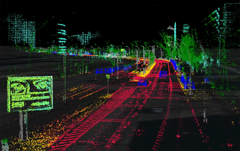
A demonstration at Auto.ai in Berlin offered rides around the German capital in a car featuring VINS technology. One screen inside the car continuously displayed its location as the system continued localisation in all locations including tunnels and parking garages. The second screen featured a real-time 3D point-cloud reconstruction of the car’s surroundings.

Related Content

  • Machine vision makes progress in traffic applications
    June 2, 2014
    Machine Vision technology is easing the burden on hard-pressed control room staff and overloaded communications networks.
  • Land Rover demonstrates remote-control Range Rover Sport
    June 18, 2015
    Jaguar Land Rover, part of the UK Autodrive consortium, has demonstrated a remote control Range Rover Sport research vehicle, showing how a driver could drive the vehicle from outside the car via their smartphone. The smartphone app includes control of steering, accelerator and brakes as well as changing from high and low range. This would allow the driver to walk alongside the car, at a maximum speed of 4mph, to manoeuvre their car out of challenging situations safely, or even to negotiate difficult off
  • Topcon mapping system
    February 6, 2012
    Topcon Positioning Systems (TPS) has announced an addition to its offering of high-accuracy, mobile mapping solutions. The IP-S2 HD Mapping System is a vehicle-mounted surveying and mapping system featuring a high-definition LiDAR scanner from Velodyne Lidar.
  • Driver aids make inroads on improving safety
    November 12, 2015
    In-vehicle anti-collision systems continue to evolve and could eliminate some incidents altogether. John Kendall rounds up the current developments. A few weeks ago, I watched a driver reverse a car from a parking bay at right angles to the road, straight into a car driving along the road. The accident happened at walking pace, no-one was hurt and both cars had body panels that regain their shape after a low speed shunt.