Septentrio demos AV localisation tech

Septentrio has provided GPS/global navigation satellite system (GNSS) technology for computer vision supplier Artisense’s Visual Inertial Navigation System (VINS).
January 23, 2020 Read time: 1 min


Septentrio says the GNSS technology provides centimetre-level positioning to the VINS system with the accuracy required for lane-level manoeuvring and Vehicle to Vehicle warning systems. Cameras and inertial sensors continue localisation as the vehicle moves into tunnels or parking garages with no line of sight to GNNS satellites, the company adds.

The VINS is expected to combine computer vision, inertial sensors and GNSS measurements to deliver 3D positioning and orientation information in any environment, even indoors.

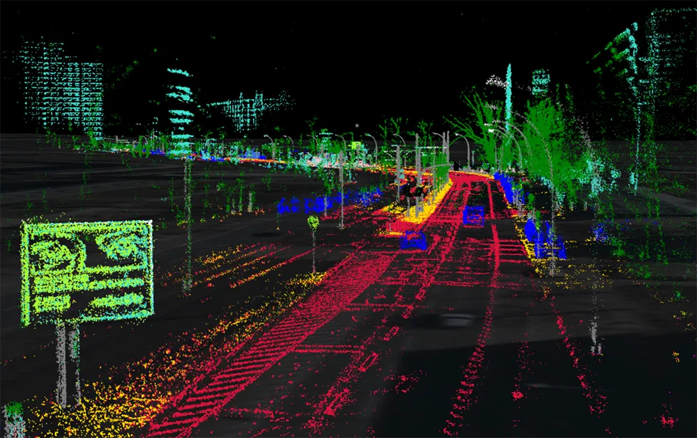
A demonstration at Auto.ai in Berlin offered rides around the German capital in a car featuring VINS technology. One screen inside the car continuously displayed its location as the system continued localisation in all locations including tunnels and parking garages. The second screen featured a real-time 3D point-cloud reconstruction of the car’s surroundings.

Related Content

  • Daimler’s double take sees machine vision move in-vehicle
    December 13, 2013
    Jason Barnes looks at Daimler’s Intelligent Drive programme to consider how machine vision has advanced the state of the art of vision-based in-vehicle systems. Traditionally, radar was the in-vehicle Driver Assistance System (DAS) technology of choice, particularly for applications such as adaptive cruise control and pre-crash warning generation. Although vision-based technology has made greater inroads more recently, it is not a case of ‘one sensor wins’. Radar and vision are complementary and redundancy
  • Debating a cost-effective means of road user charging
    July 20, 2012
    Does GPS/GNSS-based technology provide a cost-effective means of charging or tolling on a national or international level, or are the issues pertaining to effective enforcement an obstacle. Here, leading equipment manufacturers debate the issue.
  • Here to lead vehicle hazard warning pilot in Finland
    July 1, 2015
    Mapping and navigation specialist Here has been selected by Finnish traffic agencies Finnish Transport Agency (FTA) and Trafi, the Finnish Transport Safety Agency to lead a pilot project to enable vehicles to communicate safety hazards to others on the road. Here will also work with traffic information management service company Infotripla in implementing the project, which will be the first to implement a road hazard warning messaging system as described in the Intelligent Transportation Systems (ITS)
  • Cloud computing technology benefits GIS
    July 17, 2012
    Geographic Information Systems are a relatively late adopter of cloud computing,but the benefits of host services for geospatial data and analysis are becoming clear. Jason Barnes reports Both the concept and the reality of cloud computing have been around for some time. More and more industry sectors are entrusting external service providers with the provision of their computing services via the internet. However, the Geographic Information System (GIS) industry has been slow to embrace the trend. This is