Septentrio demos AV localisation tech

Septentrio has provided GPS/global navigation satellite system (GNSS) technology for computer vision supplier Artisense’s Visual Inertial Navigation System (VINS).
January 23, 2020 Read time: 1 min


Septentrio says the GNSS technology provides centimetre-level positioning to the VINS system with the accuracy required for lane-level manoeuvring and Vehicle to Vehicle warning systems. Cameras and inertial sensors continue localisation as the vehicle moves into tunnels or parking garages with no line of sight to GNNS satellites, the company adds.

The VINS is expected to combine computer vision, inertial sensors and GNSS measurements to deliver 3D positioning and orientation information in any environment, even indoors.

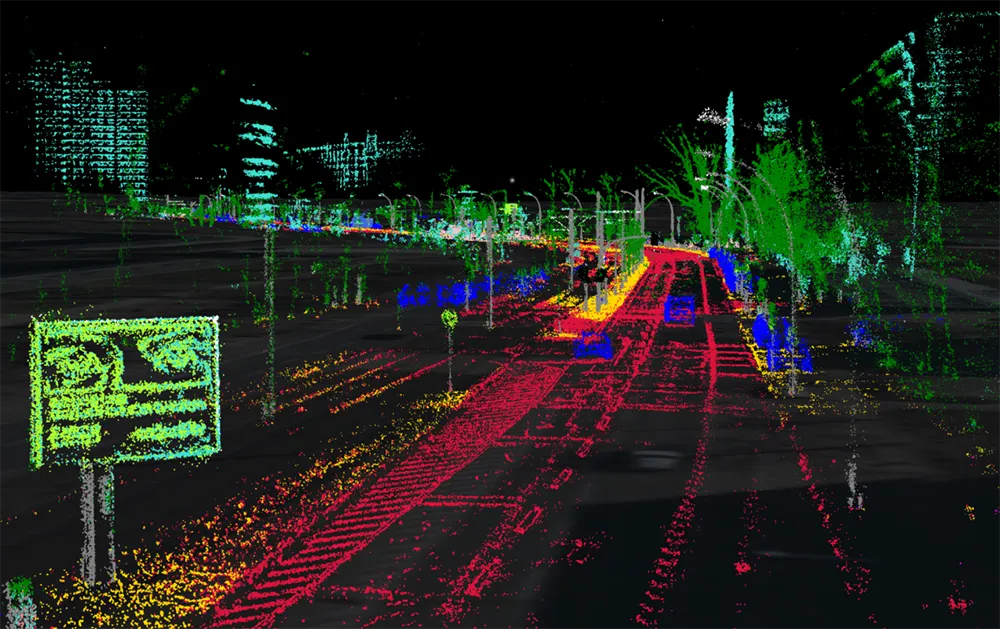
A demonstration at Auto.ai in Berlin offered rides around the German capital in a car featuring VINS technology. One screen inside the car continuously displayed its location as the system continued localisation in all locations including tunnels and parking garages. The second screen featured a real-time 3D point-cloud reconstruction of the car’s surroundings.

Related Content

  • Mucca demos multi-vehicle collision avoidance tech
    March 26, 2020
    A project whose members include Connected Places Catapult and Cranfield University has developed technology which could reduce the number of vehicle collisions on UK motorways.
  • Control room tech ends data overload
    July 22, 2021
    There have never been so many data sources available to traffic control centre operators – but too much data can be as bad as too little when making decisions. Adam Hill asks how control room technology companies can help operators screen out the white noise
  • Advanced V2X solution combines DSRC and GNSS
    December 5, 2014
    Swiss wireless communications specialist and Australia connected vehicle technology provider Cohda Wireless have joined forces to develop an advanced vehicle to vehicle/infrastructure (V2X) solution. Offering best in class performance, the MK5 was recently demonstrated at the 2014 ITS World Congress in Detroit and is suitable for first-mount automotive electronics, aftermarket products and roadside infrastructure. Cohda’s dedicated short-range communications (DSRC) based V2X system uses accurate satel
  • Bluetooth and Wi-Fi offer new options for travel time measurements
    November 20, 2013
    New trials show Bluetooth and Wi-Fi signals can be reliably used for measuring travel times and at a lower cost than an ANPR system, but which is the better proposition depends on many factors. Measuring travel times has traditionally relied automatic number plate (or licence plate) recognition (ANPR/ALPR) cameras capturing the progress of vehicles travelling along a pre-defined route. Such systems also have the benefit of being able to count passing traffic and have become a vital tool in dealing with c