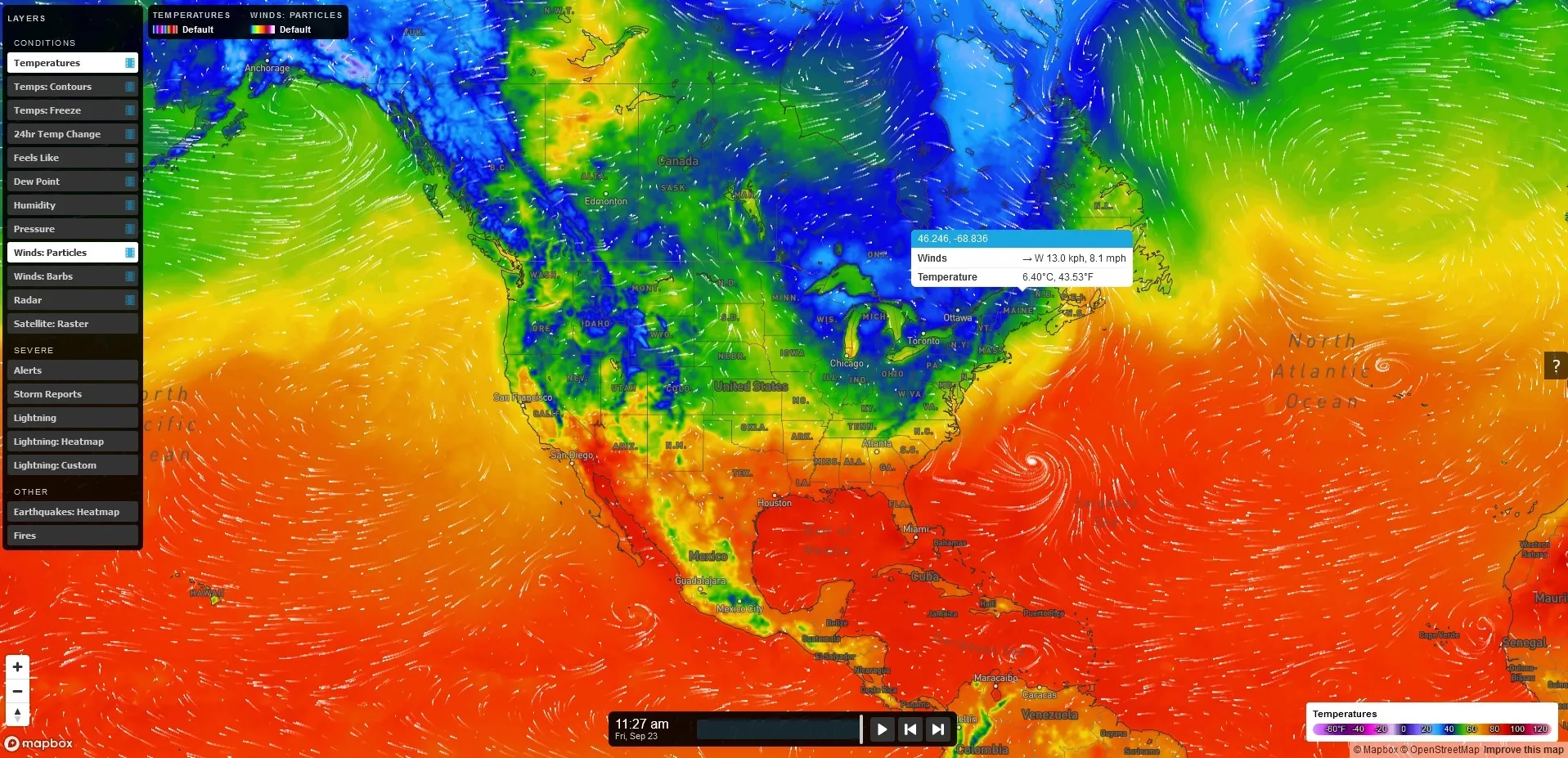
Vaisala forecasts the Xweather

Data ranges from road conditions and air quality to heat wave detection and lightning strikes
By Adam Hill October 3, 2022 Read time: 2 mins
Vaisala's XWeather suite provides weather and environmental data

Vaisala has launched Xweather, a forecast and observation suite of services providing real-time and hyperlocal weather and environmental data via sensors and machine learning.

Information ranges from road conditions and air quality to heat wave detection and lightning strikes, using what Vaisala calls "a combination of intelligent hardware and software, utilising the latest artificial intelligence and machine learning technologies".

The firm says Xweather brings a new level of accuracy to forecasting by combining massive amounts of weather and environmental data from several sources.

“Until now, the lack of real-time, local data has been a major source for error in weather and environment forecasting," says Samuli Hänninen, head of Xweather.

"With Xweather, businesses and developers can utilise data about the environment in real time from a hyperlocal location that is relevant for them."

Solutions include predicting the availability of renewable energy - such as wind and solar - to increased driving safety and air quality monitoring.

Xweather can also be used to predict lightning strikes at roadsides, which means infrastructure and rescue services can be mobilised quickly to manage a potential fire and thus protect homes and lives.

“Understanding is not enough: we need to take action," continues Hänninen. "We want to help organisations not only think and plan, but to act. The data and insight are available now, let’s together put that data to work."

Xweather data products can be delivered as API or enterprise package and include:

MapsGL – high-quality, vector-based weather data, imagery, and visualisations.

Automotive – Weather, road weather, and air quality information for infotainment, navigation, advanced driver assistance, and autonomous driving.

Lightning – Real-time lightning data, including classification of strikes and their damage potential.

Renewable energy – Historic data sets and forecasted wind and solar data.

Air quality – Air Quality Index and a hyperlocal Air Quality Forecast service connected to local sensors for street level AQ information and forecasts. 

Solutions for businesses with Xweather include Wx Beacon, Thunderstorm Manager, Wx Horizon and RoadAI.
 

For more information on companies in this article

Related Content

  • Wireless traffic data in real time
    January 31, 2012
    The effect of moving objects on the electromagnetic landscape set up by cellular telephony networks can be detected and interpreted to give real-time traffic data across large geographical areas at low cost. Here, we revisit the Celldar concept. Global economic downturn has pushed public-sector agencies, transport administrations among them, to push even harder for cost efficiencies. Unfortunately, when it comes to transport safety and efficiency the public sector often has to work up to a cost rather than
  • Virtual traffic management centres, a new direction in traffic monitoring
    January 30, 2012
    David Crawford picks up a new direction trend in traffic monitoring The surprise winner in the Traffic Management Centre (TMC) category of the recently-announced 2011 OSMOSE (Open Source for MObile and SustainablE city) Awards for European innovations in urban transport, is the Danish city of Aalborg - which doesn't have a TMC. Alternatively, one might consider its 'virtual' TMC as a signpost for the future in medium-sized cities.
  • MetService to supply road weather information to New Zealand road alliance
    May 9, 2017
    The Milford Road Alliance, a partnership between the New Zealand Transport Agency and Downer NZ to ensure the safe and efficient management of activities on State Highway 94, is to implement new and enhanced weather forecast services from MetService. Climbing through the Southern Alps, State Highway 94 is one of the highest highways in New Zealand. It includes the Milford Road which stretches from Te Anau through Fiordland National Park to Milford Sound and the high-altitude alpine conditions, a steep and r
  • Cooperative infrastructure systems waiting for the go ahead
    February 3, 2012
    Despite much research and technological promise, progress towards cooperative infrastructure system deployment is still slow. Here, Robert Cone and John Miles take a considered look at how and when it might come about. From a systems engineering viewpoint it looks logical and inevitable that vehicles should be communicating between themselves and with the road infrastructure. But seen from a business viewpoint the case is not proven.