Vaisala forecasts the Xweather

Data ranges from road conditions and air quality to heat wave detection and lightning strikes
By Adam Hill October 3, 2022 Read time: 2 mins
Vaisala's XWeather suite provides weather and environmental data

Vaisala has launched Xweather, a forecast and observation suite of services providing real-time and hyperlocal weather and environmental data via sensors and machine learning.

Information ranges from road conditions and air quality to heat wave detection and lightning strikes, using what Vaisala calls "a combination of intelligent hardware and software, utilising the latest artificial intelligence and machine learning technologies".

The firm says Xweather brings a new level of accuracy to forecasting by combining massive amounts of weather and environmental data from several sources.

“Until now, the lack of real-time, local data has been a major source for error in weather and environment forecasting," says Samuli Hänninen, head of Xweather.

"With Xweather, businesses and developers can utilise data about the environment in real time from a hyperlocal location that is relevant for them."

Solutions include predicting the availability of renewable energy - such as wind and solar - to increased driving safety and air quality monitoring.

Xweather can also be used to predict lightning strikes at roadsides, which means infrastructure and rescue services can be mobilised quickly to manage a potential fire and thus protect homes and lives.

“Understanding is not enough: we need to take action," continues Hänninen. "We want to help organisations not only think and plan, but to act. The data and insight are available now, let’s together put that data to work."

Xweather data products can be delivered as API or enterprise package and include:

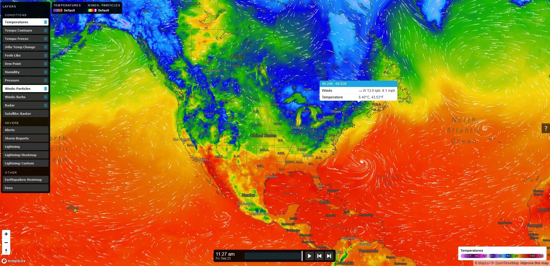
MapsGL – high-quality, vector-based weather data, imagery, and visualisations.

Automotive – Weather, road weather, and air quality information for infotainment, navigation, advanced driver assistance, and autonomous driving.

Lightning – Real-time lightning data, including classification of strikes and their damage potential.

Renewable energy – Historic data sets and forecasted wind and solar data.

Air quality – Air Quality Index and a hyperlocal Air Quality Forecast service connected to local sensors for street level AQ information and forecasts. 

Solutions for businesses with Xweather include Wx Beacon, Thunderstorm Manager, Wx Horizon and RoadAI.
 

For more information on companies in this article

Related Content

  • Telegra showcases TopXview
    June 6, 2018
    Telegra is here at ITS America Detroit with a range of ITS solutions that provide better utilisation of existing resources and deploying new technologies in understandable, yet safe and future-proof ways. As the company points out, this is of real value in a world of rapidly evolving information technologies, and even faster growing traffic problems. As one of the leading ITS solutions providers in the world, Telegra says it has unmatched expertise built on 25 years of continuous focus on innovation, and
  • Pioneering IntelliDrive technologies in Michigan
    February 2, 2012
    Pete Goldin reports on upgrades to the USDOT's Michigan Test Bed, where IntelliDrive technologies are being pioneered
  • Changing roles in data collection for traffic management
    January 23, 2012
    Transport for Greater Manchester's David Hytch discusses the evolving roles of the public and private sector in managing and disseminating data. Data services for traffic management were once the sole preserve of public sector organisations, they being uniquely placed and equipped for the work involved. Now, though, this is changing. There is even a presumption in some countries that the private sector will take a greater, if not actually a lead, role in the provision of information for transport management
  • Iteris partners with Here on advanced traffic data and analytics
    June 18, 2014
    Iteris has been selected, along with Here, to compete with a small group of other companies to provide traffic data and analytics for the I-95 Corridor Coalition, which stretches nearly 2,000 miles from Maine to Florida. Iteris will work in partnership with Here to deliver advanced traffic analytics to support the Coalition, allowing decision-makers to closely monitor traffic and weather conditions, measure performance, optimise operations, and communicate actionable information to traffic engineers.