Siemens launches Zephyr air monitoring

Integrated with traffic management systems, it measures a range of pollutants
By David Arminas July 3, 2020 Read time: 2 mins
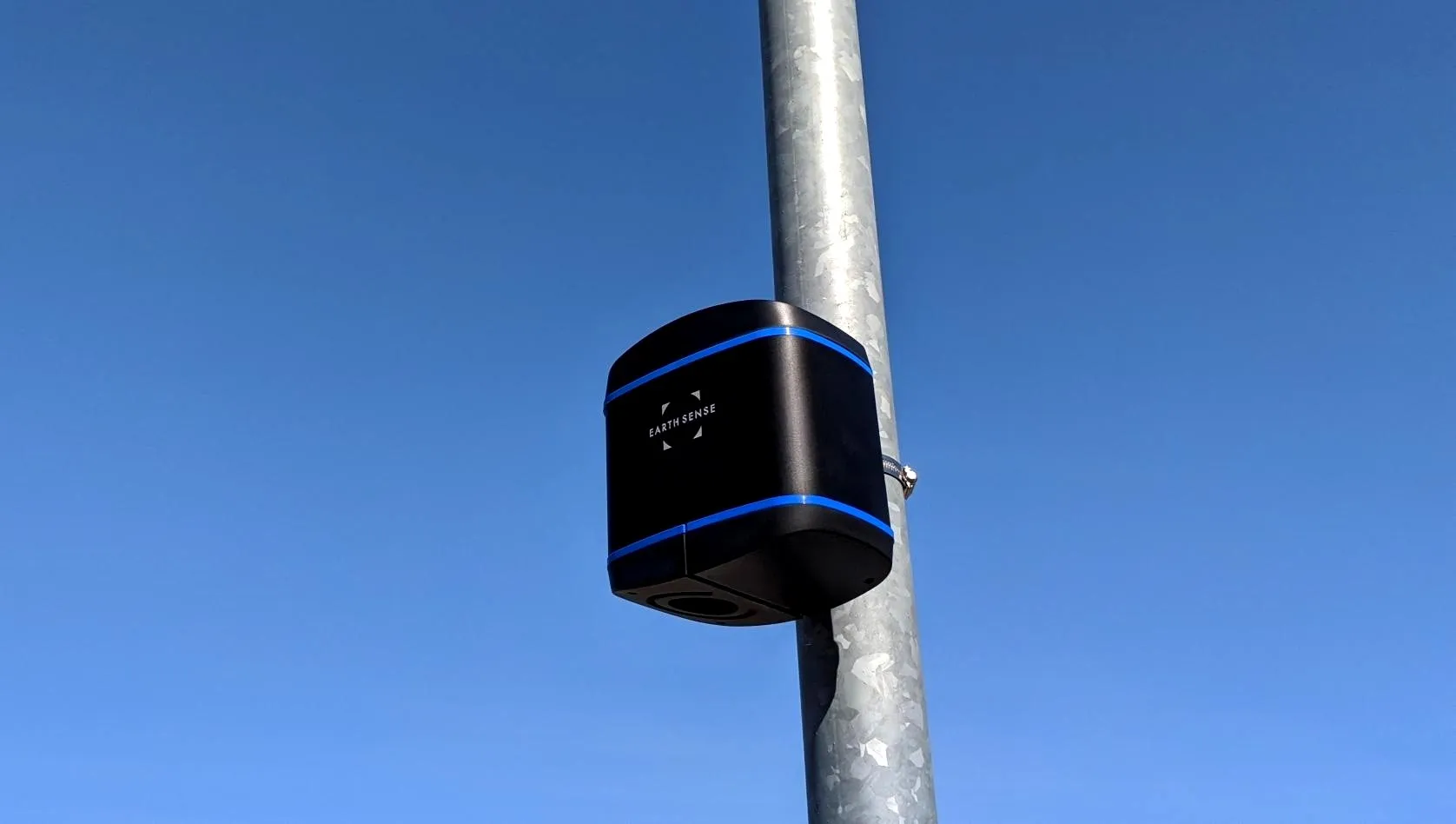
Zephyr is easy to install on any traffic signal pole or lighting column

Siemens Mobility and air quality experts EarthSense have launched the Zephyr air quality measurement system for traffic management.

By fully integrating the Zephyr air quality sensor with the traffic signal controller and traffic management system, quality can be measured and monitored in real time.

This allows authorities to make meaningful and timely interventions through Siemens Mobility’s Stratos traffic management system, implementing strategies based on reliable pollution data and prevailing air quality levels.

Zephyr, which is offered as a managed service, has a compact air quality sensor which measures a range of pollutants as well as temperature and humidity to capture an accurate picture of the ambient air quality.

The sensor has a replaceable cartridge system and active sampling process to measure nitrogen dioxide (NO2), nitrogen monoxide (NO), and ozone (O3), as well as particulate matters PM1, PM2.5 and PM10.

Carbon monoxide (CO), hydrogen sulphide (H2S) and sulphur dioxide (SO2) can also be measured, if required, explained Wilke Reints, managing director for the intelligent traffic systems section of Siemens Mobility in the UK.

The system’s real-time monitoring capabilities helps cities meet their air quality targets without putting too much pressure on local economies.

Siemens says that Zephyr is quick and easy to install and commission on any traffic signal pole or lighting column, either as part of a new scheme or retrofitted to existing infrastructure.

It comes in power options, including solar with battery backup and mains.

The device can be connected to low voltage, extra-low voltage and third-party controllers through either a rack-mounted or signal head-mounted power supply.

For more information on companies in this article

Related Content

  • Report analyses multiple ITS projects to highlight cost and benefits
    March 16, 2015
    Every year in America cost benefit analysis is carried out on dozens of ITS installations and pilot studies and the findings, along with the lessons learned, are entered into the Department of Transportation’s (USDOT’s) web-based ITS Knowledge Resources database. This database holds more than 1,600 reports and periodically the USDOT reviews the material on file to draw conclusions from this wider body of evidence. It has just published one such review ITS Benefits, Costs, and Lessons Learned: 2014 Update Re
  • AGD retrofit LED pedestrian signals aid carbon savings
    February 28, 2014
    AGD Systems’ 924 and 924R LED wait indicator solution provides UK local authorities with the means to upgrade pedestrian crossing wait indicator bulb units to the latest high intensity LED technology, as traditional filament light bulbs are gradually phased out, AGD can provide a cost effective retrofit LED kit or a complete. Delivering power savings of up to 80 per cent over existing lamp-based units, AGD’s 924 and 924R retrofit kits are easy to install and fully compatible with all main industry cont
  • The scourge of poor air quality and rising pollution levels and how they can be tackled
    December 20, 2021
    Arguably, air pollution is one of the greatest challenges facing our world today. It impacts people, economies and the environment. It is clear that policymakers must act swiftly to improve air quality. ITS has a huge role to play in providing solutions. Here, Swarco, as a solution provider, shares inside tips on how to use modern ITS to save lives, economies and the environment.
  • UK drivers get real time traffic information boost
    August 9, 2012
    The UK Highways Agency is trialling a system to add commercially available traffic data to its existing sources to monitor how well traffic is flowing on England's motorways and strategic roads. Similar data sources are already used by satellite navigation devices, smartphones, and applications like Google maps. Better real-time data will allow agency staff to respond more quickly to incidents and identify delays and communicate them to drivers so they can take alternative routes if necessary.