StreetLight Data provides free VMT metrics

StreetLight Data is offering vehicle miles travelled (VMT) data for US transit agencies to monitor transport networks and understand travel patterns during the Covid-19 pandemic.
By Adam Hill April 17, 2020 Read time: 2 mins
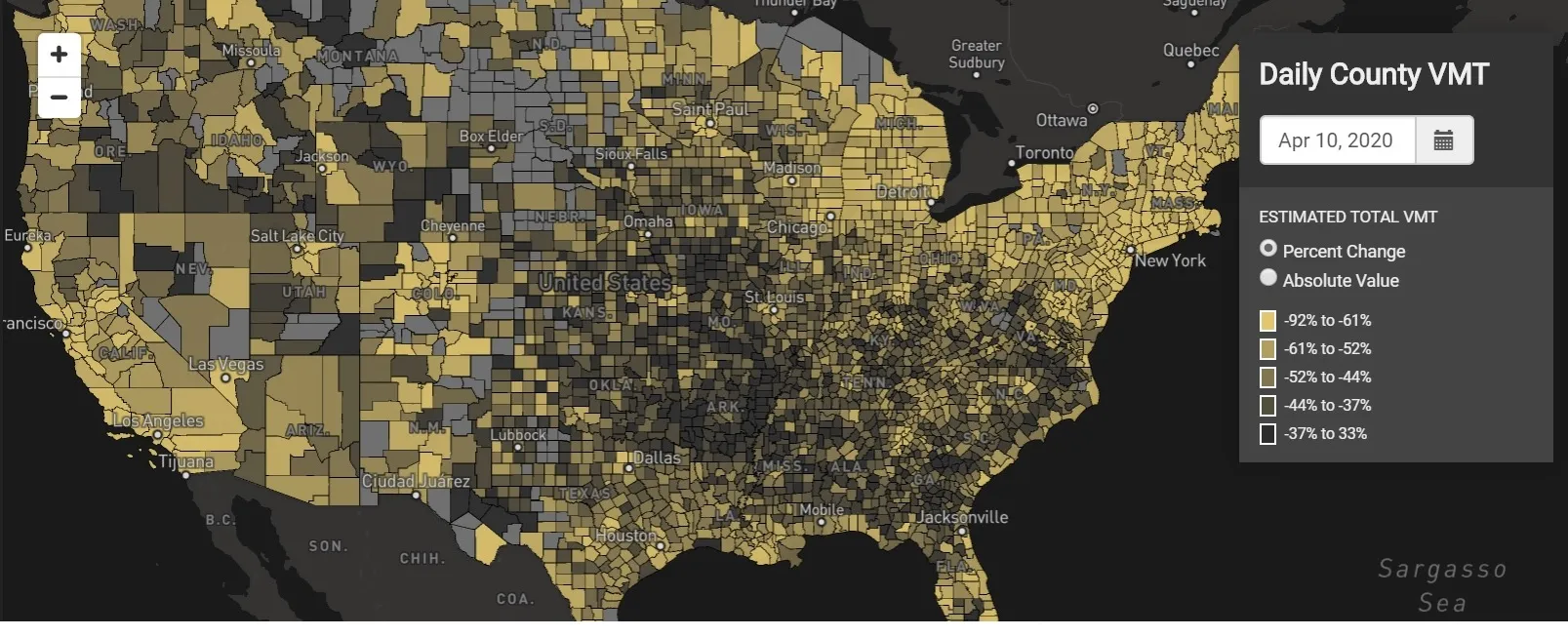
StreetLight Data maps VMT across the US

There has been massive disruption to travel patterns since February and Streetlight’s information covers more than 3,100 counties across the US, updated three times a week.

Designed to measure the transportation impact on communities, it is free to planners, researchers and engineers, as well as federal, state and local governments.

"Transportation professionals make critical budget and planning projections based on gas tax revenue and other factors derived from VMT,” explains CEO Laura Schewel.

“The recent massive drop in travel is throwing off all those plans. This data-driven map gets the key metrics out quickly, with local granularity, to those who need them. Planners, like everyone else, are adjusting to a new reality and we’re here to help navigate it. We hope this, in some way, can help our transportation community in this difficult and unprecedented time."

Location intelligence provider Cuebiq is working with StreetLight, and has developed what it calls a ‘near-real time’ mobility index to improve the outbreak forecast and response.

“StreetLight fused Cuebiq’s index with its own algorithms that transform GPS data into contextualised, aggregated and normalised travel patterns, as well as its deep repositories of data depicting historical VMT,” the company said in a statement.

The data is available here.

For more information on companies in this article

Related Content

  • Transport planning consultation is culturally important
    February 2, 2012
    Andrew Bardin Williams explores the efforts under way in North Dakota to consult with native tribes during the early stages of transportation project development. These efforts have led to the signing of a Programmatic Agreement between the state DOT and local tribes and the creation of a tribal consultation committee that allows Native Americans to advise on the identification, evaluation and treatment of historic properties, including those of religious and cultural significance
  • Travel information is heading towards smartphones
    January 30, 2012
    Travel information services are undergoing a step change as rapid increase in sales of smartphones brings ITS technology to consumers' fingertips. A virtuous circle of expanding capability is under way in traffic and travel information services, promising much for drivers and reduction of road congestion. A recent rapid rise in sales of smartphones has boosted numbers of vehicles carrying GPS enabled devices and so brought expansion of traffic data available for analysis and dissemination. Greater numbers o
  • Technology holds the key to painless parking
    March 21, 2014
    Parking has been the most innovative of all the transportation sectors in the past five years. Richard Harris, Solution Director, Xerox Services outlines some of the key drivers and trends
  • Quantela taps into streetlight infrastructure 
    August 9, 2021
    Quantela's Massachusetts location will serve as its new US HQ