StreetLight Data provides free VMT metrics

StreetLight Data is offering vehicle miles travelled (VMT) data for US transit agencies to monitor transport networks and understand travel patterns during the Covid-19 pandemic.
By Adam Hill April 17, 2020 Read time: 2 mins
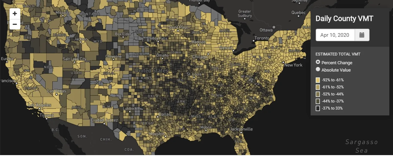
StreetLight Data maps VMT across the US

There has been massive disruption to travel patterns since February and Streetlight’s information covers more than 3,100 counties across the US, updated three times a week.

Designed to measure the transportation impact on communities, it is free to planners, researchers and engineers, as well as federal, state and local governments.

"Transportation professionals make critical budget and planning projections based on gas tax revenue and other factors derived from VMT,” explains CEO Laura Schewel.

“The recent massive drop in travel is throwing off all those plans. This data-driven map gets the key metrics out quickly, with local granularity, to those who need them. Planners, like everyone else, are adjusting to a new reality and we’re here to help navigate it. We hope this, in some way, can help our transportation community in this difficult and unprecedented time."

Location intelligence provider Cuebiq is working with StreetLight, and has developed what it calls a ‘near-real time’ mobility index to improve the outbreak forecast and response.

“StreetLight fused Cuebiq’s index with its own algorithms that transform GPS data into contextualised, aggregated and normalised travel patterns, as well as its deep repositories of data depicting historical VMT,” the company said in a statement.

The data is available here.

For more information on companies in this article

Related Content

  • Inertial sensors dramatically improve GNSS for ITS applications
    January 18, 2012
    Phil Harris, Thales UK, on how fused sensor data can significantly enhance GNSS-based positioning systems' performance in urban areas. Global Navigation Satellite System (GNSS)-based positioning is unique among available positioning technology due to its universal coverage and low equipment cost. By measuring the distances between an unknown position (such as a vehicle), and at least three known positions (GPS satellites), the unknown position can be calculated in three dimensions (latitude, longitude, and
  • A new way to manage parking demand
    July 21, 2021
    Parking permit changes at one US campus could provide a model for encouraging active travel options post-Covid – and for transit ticketing adjustments as commuting patterns change
  • Revealed: future of mobility in Hamburg
    October 7, 2021
    From 11-15 October, the ITS World Congress will present a myriad of innovations
  • Iteris partners with Here on advanced traffic data and analytics
    June 18, 2014
    Iteris has been selected, along with Here, to compete with a small group of other companies to provide traffic data and analytics for the I-95 Corridor Coalition, which stretches nearly 2,000 miles from Maine to Florida. Iteris will work in partnership with Here to deliver advanced traffic analytics to support the Coalition, allowing decision-makers to closely monitor traffic and weather conditions, measure performance, optimise operations, and communicate actionable information to traffic engineers.