WhereIsMyTransport maps out urban future

Tech start-up says it will be emerging world's 'citymapper' by 2023
By Adam Hill September 17, 2020 Read time: 2 mins
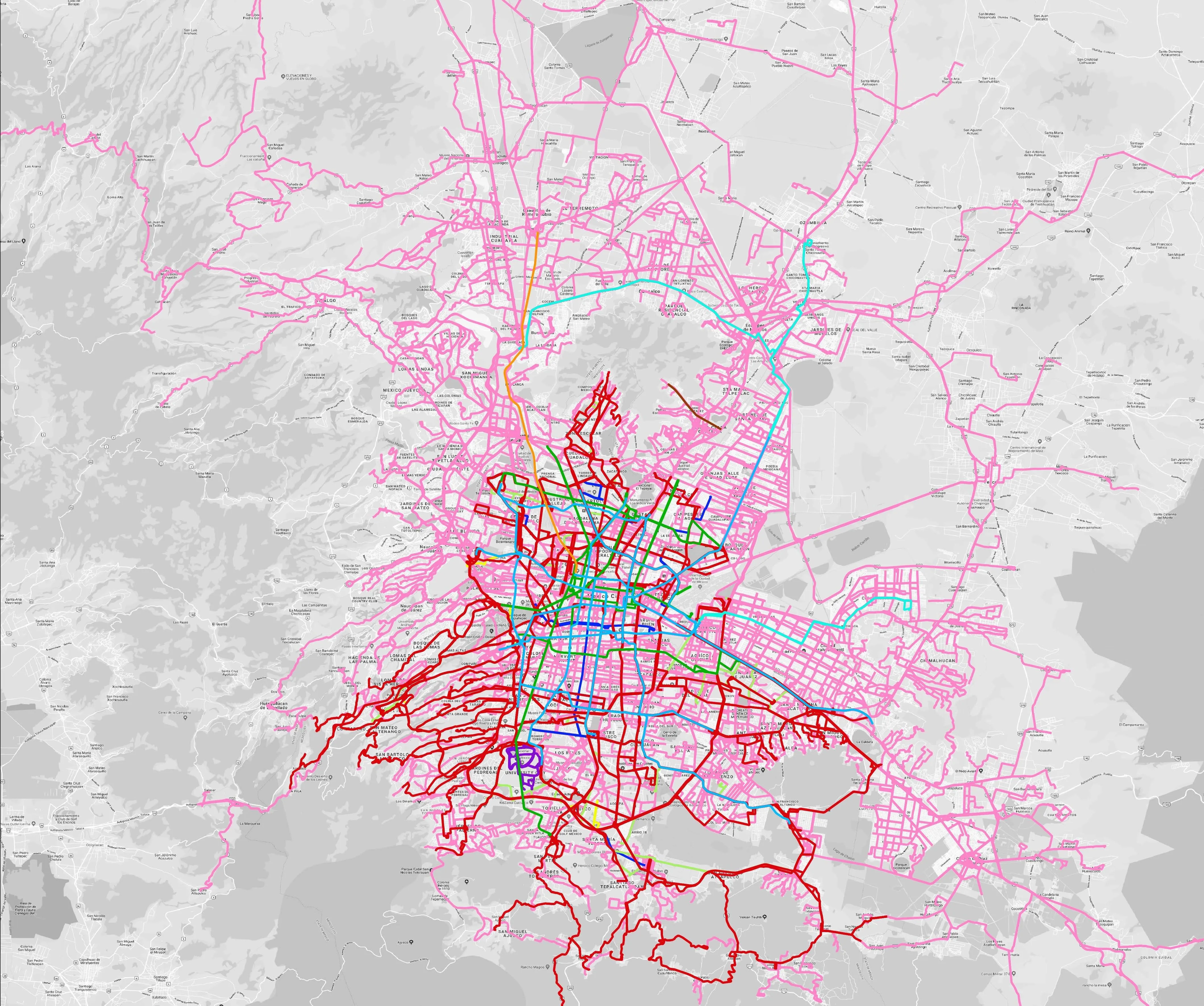
Mexico City is among the conurbations whose networks have been mapped (© WhereIsMyTransport)

WhereIsMyTransport says it is on course to map public transport networks in 30 of the world's biggest cities over the next three years.

The tech start-up, which received funding from both Google and Toyota Tsusho this year, has mapped one million kilometres of formal and informal networks worldwide so far.

Digitalising transport - particularly the 'informal' networks such as commuter minibuses which are vital in many cities - will be of considerable benefit to local economies.

CEO Devin de Vries says: "The production and maintenance of this mobility data is a fundamental first step towards transforming the public transport experience for hundreds of millions of people, and with it the social, cultural and economic landscape of these cities."

The firm began collecting public transport data in emerging markets in 2015, concentrating on the thousands of routes and vehicles owned and run by independent operators, which are effectively unmapped and offline. 

Most recently, WhereIsMyTransport mapped - and now maintains datasets for - the public transport networks in Mexico City, Dhaka (capital of Bangladesh), and the province of Gauteng in South Africa - metro areas with a combined population of more than 55 million. 

The company will collect public transport information in another 27 cities, of which 19 are megacities with populations greater than 10 million, including Bangkok and Rio de Janeiro.

To do this, it uses local teams of data collectors on the ground who map entrances, exits, stairs, gates and platforms at stations and interchanges. 

“We manage and maintain our data, updating it weekly, and integrating it with consumer products and planning tools that support a better public transport experience for everyone, everywhere," insists de Vries.

For more information on companies in this article

Related Content

  • Vaisala: Weather data is vital for connected vehicles
    August 26, 2016
    Vaisala’s Dr Kevin Petty explains why the weather will continue to play a big part in road safety and traffic management in the smart cities of the future. The world is becoming increasingly connected. Thanks to advances in information and communications technology, the cities we live in are becoming ‘smart’, with everything from education to law enforcement managed by integrated tech solutions in a bid to improve quality of life.
  • Cooperative infrastructure systems waiting for the go ahead
    February 3, 2012
    Despite much research and technological promise, progress towards cooperative infrastructure system deployment is still slow. Here, Robert Cone and John Miles take a considered look at how and when it might come about. From a systems engineering viewpoint it looks logical and inevitable that vehicles should be communicating between themselves and with the road infrastructure. But seen from a business viewpoint the case is not proven.
  • Trends in automotive technology
    March 14, 2012
    Continental has become a leading player in vehicle technology and telematics. The firm’s executive board chairman Elmar Degenhart describes to Jason Barnes Continental’s views on the ‘megatrends’ of the automotive industry Strategic moves to diversify Continental’s business from rubber-related products began in the late 1990s with the acquisition of ITT Teves and its brake business. This brought on board know-how relating to the then new electronic stability control (ESC) systems which today form an import
  • Latest TomTom map update for automotive, government and enterprise customers
    April 19, 2012
    TomTom has announced the availability of its latest map product update for automotive, government, and enterprise customers. Some of the enhancements include continued expansion in India with the addition of over 2,000 km of roads in 47 cities, the addition of 64,000km of roads with navigable coverage in Brazil, improvements in Mexico, the Mega Manila area of the Philippines, full coverage of Croatia, and the introduction of a MultiNet map for Namibia and Botswana in Africa. TomTom claims its maps now cover