WhereIsMyTransport maps out urban future

Tech start-up says it will be emerging world's 'citymapper' by 2023
By Adam Hill September 17, 2020 Read time: 2 mins
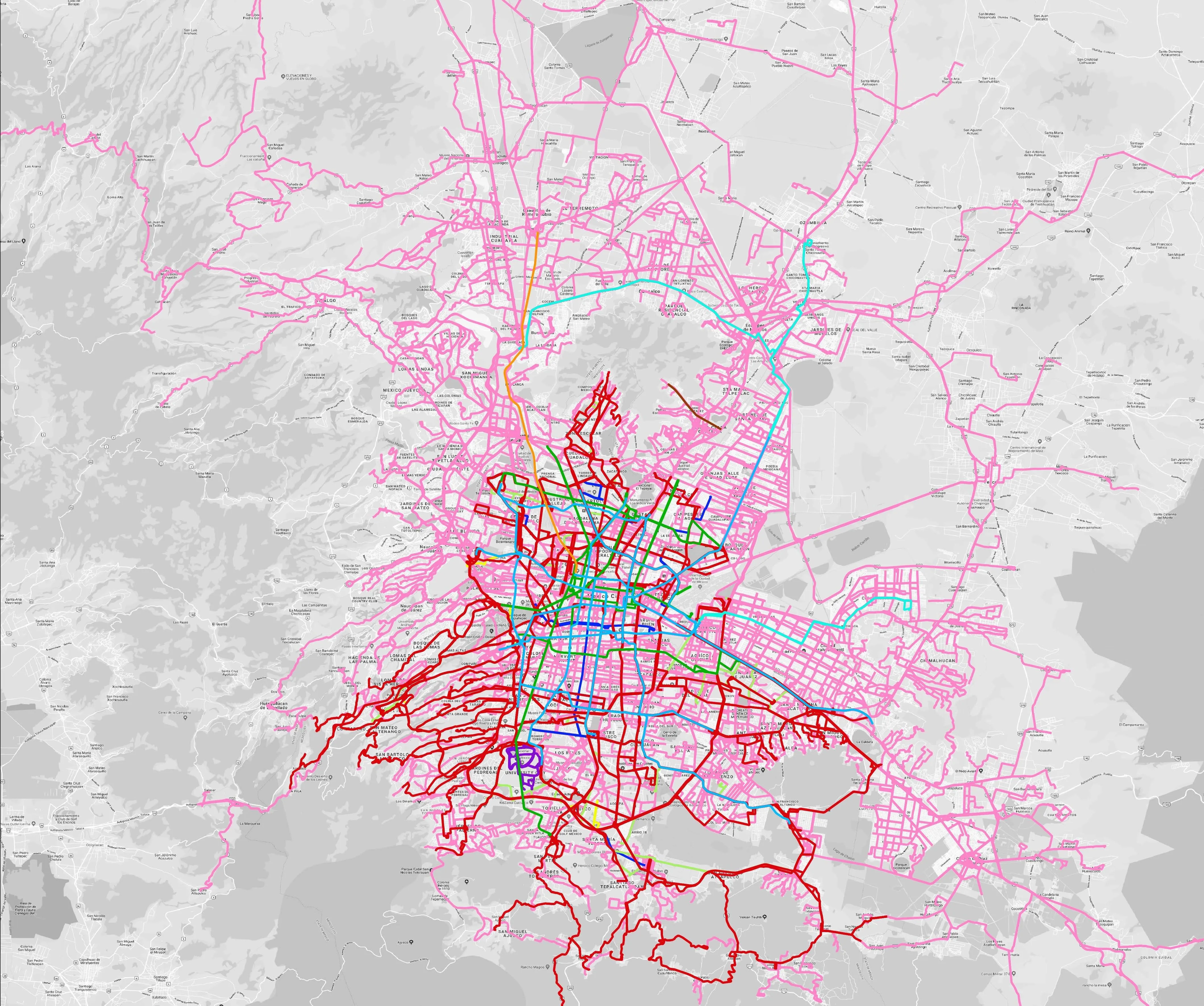
Mexico City is among the conurbations whose networks have been mapped (© WhereIsMyTransport)

WhereIsMyTransport says it is on course to map public transport networks in 30 of the world's biggest cities over the next three years.

The tech start-up, which received funding from both Google and Toyota Tsusho this year, has mapped one million kilometres of formal and informal networks worldwide so far.

Digitalising transport - particularly the 'informal' networks such as commuter minibuses which are vital in many cities - will be of considerable benefit to local economies.

CEO Devin de Vries says: "The production and maintenance of this mobility data is a fundamental first step towards transforming the public transport experience for hundreds of millions of people, and with it the social, cultural and economic landscape of these cities."

The firm began collecting public transport data in emerging markets in 2015, concentrating on the thousands of routes and vehicles owned and run by independent operators, which are effectively unmapped and offline. 

Most recently, WhereIsMyTransport mapped - and now maintains datasets for - the public transport networks in Mexico City, Dhaka (capital of Bangladesh), and the province of Gauteng in South Africa - metro areas with a combined population of more than 55 million. 

The company will collect public transport information in another 27 cities, of which 19 are megacities with populations greater than 10 million, including Bangkok and Rio de Janeiro.

To do this, it uses local teams of data collectors on the ground who map entrances, exits, stairs, gates and platforms at stations and interchanges. 

“We manage and maintain our data, updating it weekly, and integrating it with consumer products and planning tools that support a better public transport experience for everyone, everywhere," insists de Vries.

For more information on companies in this article

Related Content

  • Include ITS in policy decisions from the start, not as an afterthought
    February 1, 2012
    DG TREN's Fotis Karamitsos, on why the European Commission's new ITS Action Plan is looking to the past for future direction. The European Commission's (EC's) new Action Plan for the Deployment of Intelligent Transport Systems in Europe, which was announced as 2008 drew to a close, intends that transport and travel become 'cleaner; more efficient, including energy efficient; and safer and more secure'. At first sight, that wording might be interpreted as marking a significant policy shift within Europe, wit
  • Watch your step: the sidewalk robots are here
    March 14, 2023
    The way we order and pay for goods has changed radically – but what about how those goods are delivered? Gordon Feller looks at how sidewalk robots might reshape the urban landscape
  • Dubai metro - the world's longest automated rail system
    July 31, 2012
    David Crawford reviews the recent opening of Dubai's Red Line. The US$7.6bn Dubai Metro, the Phase I Red Line of which started partial operation in September 2009, will be the world's longest driverless rail system on its planned completion in 2011. With a total length of some 75km, it will then overtake the 68.7km Vancouver SkyTrain and be able to carry over 1.2 million passengers on a typical day.
  • Lyft, Uber have mixed impact on San Fran mobility
    May 14, 2018
    The extent to which ride-hailing has become a real force in the mobility landscape of San Francisco is great for consumers – but there are downsides, a report finds. Andrew Stone takes a look. Uber and Lyft, the two major ride-hailing platforms in San Francisco, are out-competing local cab firms in many ways - and are firmly established as a significant part of the daily mobility mix there, a recent study reveals. Researchers mined publicly-available data derived from the application programming interface