WhereIsMyTransport maps out urban future

Tech start-up says it will be emerging world's 'citymapper' by 2023
By Adam Hill September 17, 2020 Read time: 2 mins
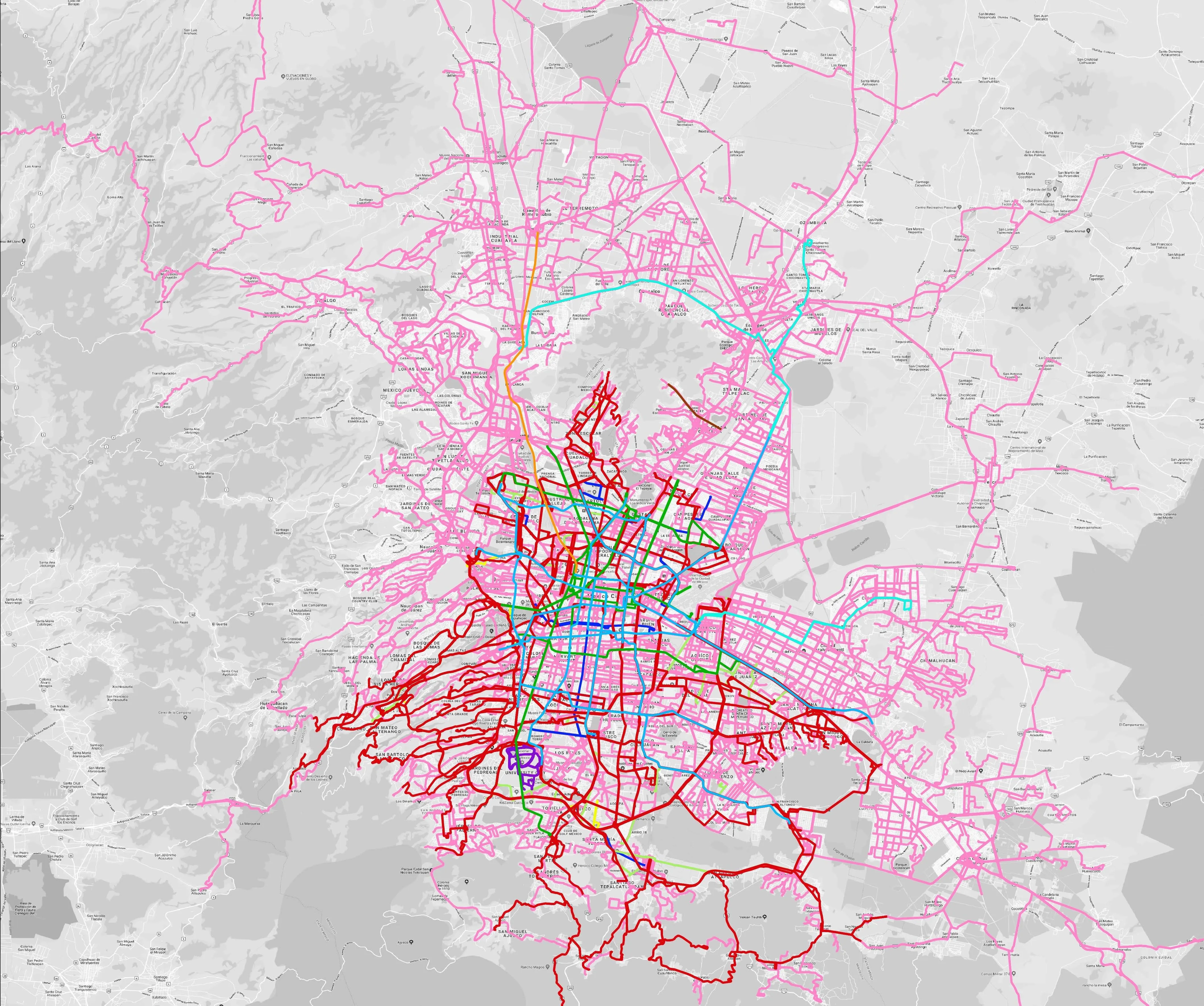
Mexico City is among the conurbations whose networks have been mapped (© WhereIsMyTransport)

WhereIsMyTransport says it is on course to map public transport networks in 30 of the world's biggest cities over the next three years.

The tech start-up, which received funding from both Google and Toyota Tsusho this year, has mapped one million kilometres of formal and informal networks worldwide so far.

Digitalising transport - particularly the 'informal' networks such as commuter minibuses which are vital in many cities - will be of considerable benefit to local economies.

CEO Devin de Vries says: "The production and maintenance of this mobility data is a fundamental first step towards transforming the public transport experience for hundreds of millions of people, and with it the social, cultural and economic landscape of these cities."

The firm began collecting public transport data in emerging markets in 2015, concentrating on the thousands of routes and vehicles owned and run by independent operators, which are effectively unmapped and offline. 

Most recently, WhereIsMyTransport mapped - and now maintains datasets for - the public transport networks in Mexico City, Dhaka (capital of Bangladesh), and the province of Gauteng in South Africa - metro areas with a combined population of more than 55 million. 

The company will collect public transport information in another 27 cities, of which 19 are megacities with populations greater than 10 million, including Bangkok and Rio de Janeiro.

To do this, it uses local teams of data collectors on the ground who map entrances, exits, stairs, gates and platforms at stations and interchanges. 

“We manage and maintain our data, updating it weekly, and integrating it with consumer products and planning tools that support a better public transport experience for everyone, everywhere," insists de Vries.

For more information on companies in this article

Related Content

  • Castrol and TomTom to study impact of stop-start driving
    July 22, 2013
    Engine oil manufacturer Castrol has partnered with TomTom to study the impact of stop-start driving patterns across the world. The study will uncover the traffic conditions in fifty key cities and regions around the globe, including New York, Sydney, Beijing, Bangkok, Jakarta, Kuala Lumpur, Moscow, Rio de Janeiro, London, Istanbul and Hong Kong. The report published by Castrol and TomTom in September 2013. Castrol’s studies already show that drivers can experience as many as 18,000 stop-starts every year.
  • New Zealand launches first road risk mapping scheme
    December 12, 2014
    Four cities in New Zealand are collaborating with the New Zealand Transport Agency and Auckland Transport in the urban kiwiRAP programme - a risk assessment process for urban road transport. The scheme begins in Auckland, Tauranga, Christchurch, and Dunedin later this month and is a development of the successful highways programme that has used crash data and risk mapping to identify where road funds are best spent to save lives since 2005, reports the Sun Live news website.
  • Cost of global road deaths & injuries: $3.6 trillion a year, says iRAP
    August 16, 2024
    Latest annual Safety Insights Explorer report reveals scale of human and financial burden
  • GridMatrix goes back to the future in New York City
    September 25, 2023
    Legacy traffic management infrastructure doesn’t have to be a marker of the past: software upgrades can bring it into the present in a cost-effective and timely way, says Gordon Feller