WhereIsMyTransport maps out urban future

Tech start-up says it will be emerging world's 'citymapper' by 2023
By Adam Hill September 17, 2020 Read time: 2 mins
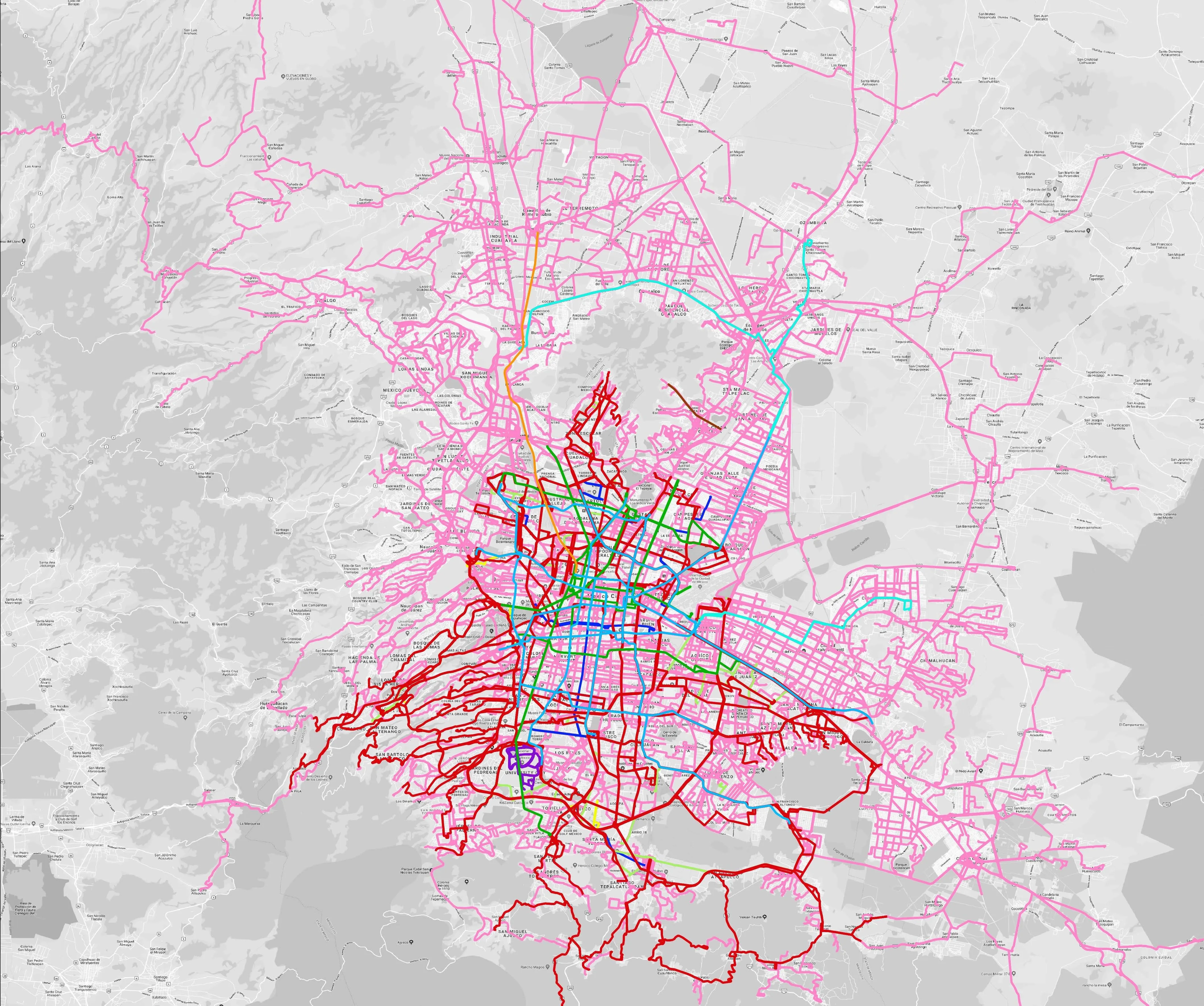
Mexico City is among the conurbations whose networks have been mapped (© WhereIsMyTransport)

WhereIsMyTransport says it is on course to map public transport networks in 30 of the world's biggest cities over the next three years.

The tech start-up, which received funding from both Google and Toyota Tsusho this year, has mapped one million kilometres of formal and informal networks worldwide so far.

Digitalising transport - particularly the 'informal' networks such as commuter minibuses which are vital in many cities - will be of considerable benefit to local economies.

CEO Devin de Vries says: "The production and maintenance of this mobility data is a fundamental first step towards transforming the public transport experience for hundreds of millions of people, and with it the social, cultural and economic landscape of these cities."

The firm began collecting public transport data in emerging markets in 2015, concentrating on the thousands of routes and vehicles owned and run by independent operators, which are effectively unmapped and offline. 

Most recently, WhereIsMyTransport mapped - and now maintains datasets for - the public transport networks in Mexico City, Dhaka (capital of Bangladesh), and the province of Gauteng in South Africa - metro areas with a combined population of more than 55 million. 

The company will collect public transport information in another 27 cities, of which 19 are megacities with populations greater than 10 million, including Bangkok and Rio de Janeiro.

To do this, it uses local teams of data collectors on the ground who map entrances, exits, stairs, gates and platforms at stations and interchanges. 

“We manage and maintain our data, updating it weekly, and integrating it with consumer products and planning tools that support a better public transport experience for everyone, everywhere," insists de Vries.

For more information on companies in this article

Related Content

  • Tanzania road safety takes Ten Steps forward
    March 3, 2023
    International Road Federation among key stakeholders in 30-month implementation
  • New Mexico City airport 'the most advanced worldwide'
    February 13, 2015
    The new international airport being built in Mexico City is "probably the most advanced modern airport project worldwide," Dr Bernardo Lisker, international director of The Mitre Corporation, has said. "This is an enormously important project for Mexico, without which the nation's economy would suffer a bottleneck very soon," said Lisker, who will be discussing the technical vision of the airport at BNamericas' Mexico Infrastructure Summit taking place 18–19 February. "Building the new airport in the
  • Vaisala's RoadAI can optimise maintenance
    August 20, 2019
    Alerts for natural disasters are ones that most of us would rather do without, writes Adam Hill. But the ITS industry still needs help to deal with more common meteorological issues Google Maps has added SOS alerts to its service. For those of us more used to using the phone app to navigate from a metro station to an unfamiliar restaurant, this may seem extreme. But this is not what Google has in mind. Its SOS messages are for “hurricane forecast cones, earthquake shake-maps and flood forecasts”. That
  • Entrust Datacard merger helps secure digital future in IoT era
    November 5, 2014
    s smart devices and e-transactions proliferate in the Internet of Things (IoT) era, newly-merged business Entrust Datacard is uniquely placed to secure the connections between them, says its CEO Todd Wilkinson. The company, formed from Datacard Group and Entrust and formally united at CARTES SECURE CONNEXIONS this week, combines broad and deep expertise in hardware and software together with the know-how to combine them.