WhereIsMyTransport maps out urban future

Tech start-up says it will be emerging world's 'citymapper' by 2023
By Adam Hill September 17, 2020 Read time: 2 mins
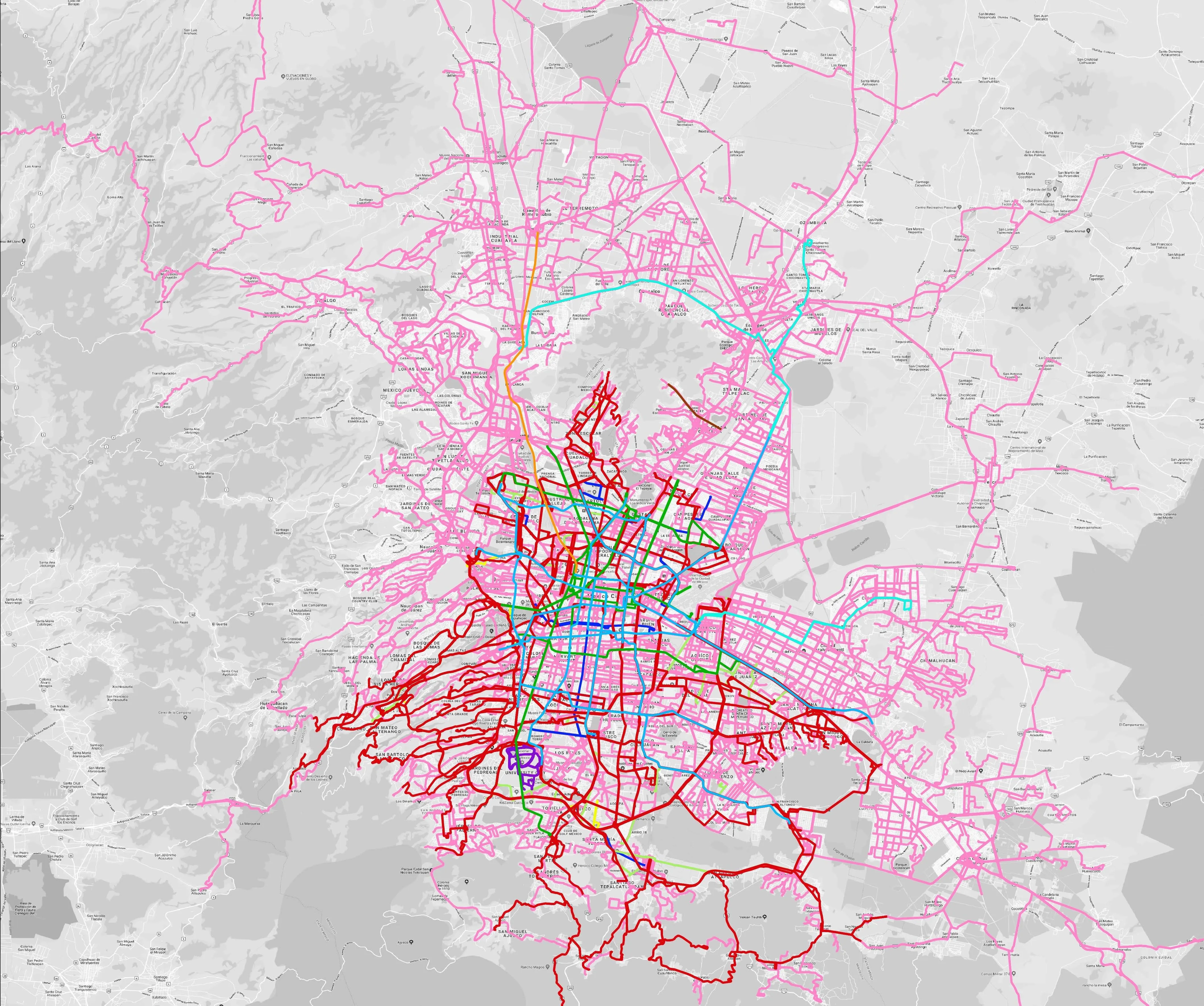
Mexico City is among the conurbations whose networks have been mapped (© WhereIsMyTransport)

WhereIsMyTransport says it is on course to map public transport networks in 30 of the world's biggest cities over the next three years.

The tech start-up, which received funding from both Google and Toyota Tsusho this year, has mapped one million kilometres of formal and informal networks worldwide so far.

Digitalising transport - particularly the 'informal' networks such as commuter minibuses which are vital in many cities - will be of considerable benefit to local economies.

CEO Devin de Vries says: "The production and maintenance of this mobility data is a fundamental first step towards transforming the public transport experience for hundreds of millions of people, and with it the social, cultural and economic landscape of these cities."

The firm began collecting public transport data in emerging markets in 2015, concentrating on the thousands of routes and vehicles owned and run by independent operators, which are effectively unmapped and offline. 

Most recently, WhereIsMyTransport mapped - and now maintains datasets for - the public transport networks in Mexico City, Dhaka (capital of Bangladesh), and the province of Gauteng in South Africa - metro areas with a combined population of more than 55 million. 

The company will collect public transport information in another 27 cities, of which 19 are megacities with populations greater than 10 million, including Bangkok and Rio de Janeiro.

To do this, it uses local teams of data collectors on the ground who map entrances, exits, stairs, gates and platforms at stations and interchanges. 

“We manage and maintain our data, updating it weekly, and integrating it with consumer products and planning tools that support a better public transport experience for everyone, everywhere," insists de Vries.

For more information on companies in this article

Related Content

  • SsangYong’s Tivoli model gets TomTom maps and navigation
    March 2, 2015
    TomTom has partnered with with South Korea’s SsangYong Motor Company in a deal which will see TomTom’s maps and navigation software included in the all-new Tivoli model throughout Europe beginning in May 2015. Drivers across Europe will now benefit from TomTom’s superior turn-by-turn navigation, featuring advanced lane guidance to navigate even the most complex junctions. Drivers will also have the advantage of TomTom Routes, which provide the fastest route based on actual speed data, for every road, for e
  • New IBM study details the future of automotive industry
    January 19, 2015
    IBM has revealed results of its new Automotive 2025 Global Study, outlining an industry ripe for disruptive changes that are breaking down borders of the automotive network. The study forecasts that while the automotive industry will offer a greater personalised driving experience by 2025, fully autonomous vehicles or fully automated driving will not be as commonplace as some think. The report also indicates that consumers not only want to drive cars; they want the opportunity to innovate and co-create t
  • Seoul is Smart City of 2022
    November 17, 2022
    Award at Smart City Expo World Congress focused on digital inclusion and mobility
  • Smarter transport remains key to smart cities
    January 9, 2018
    Colin Sowman looks at some of the challenges and solutions that will provide enhanced transport efficiency in tomorrow’s smarter cities. However you define a ‘smart city’, one of the key ingredients will be an efficient transport system. As most governments and city authorities face financial constraints, incremental improvements in the existing systems is the most likely way forward. In London, new trains and signalling are improving the capacity of the Underground but that then reveals previously