WhereIsMyTransport maps out urban future

Tech start-up says it will be emerging world's 'citymapper' by 2023
By Adam Hill September 17, 2020 Read time: 2 mins
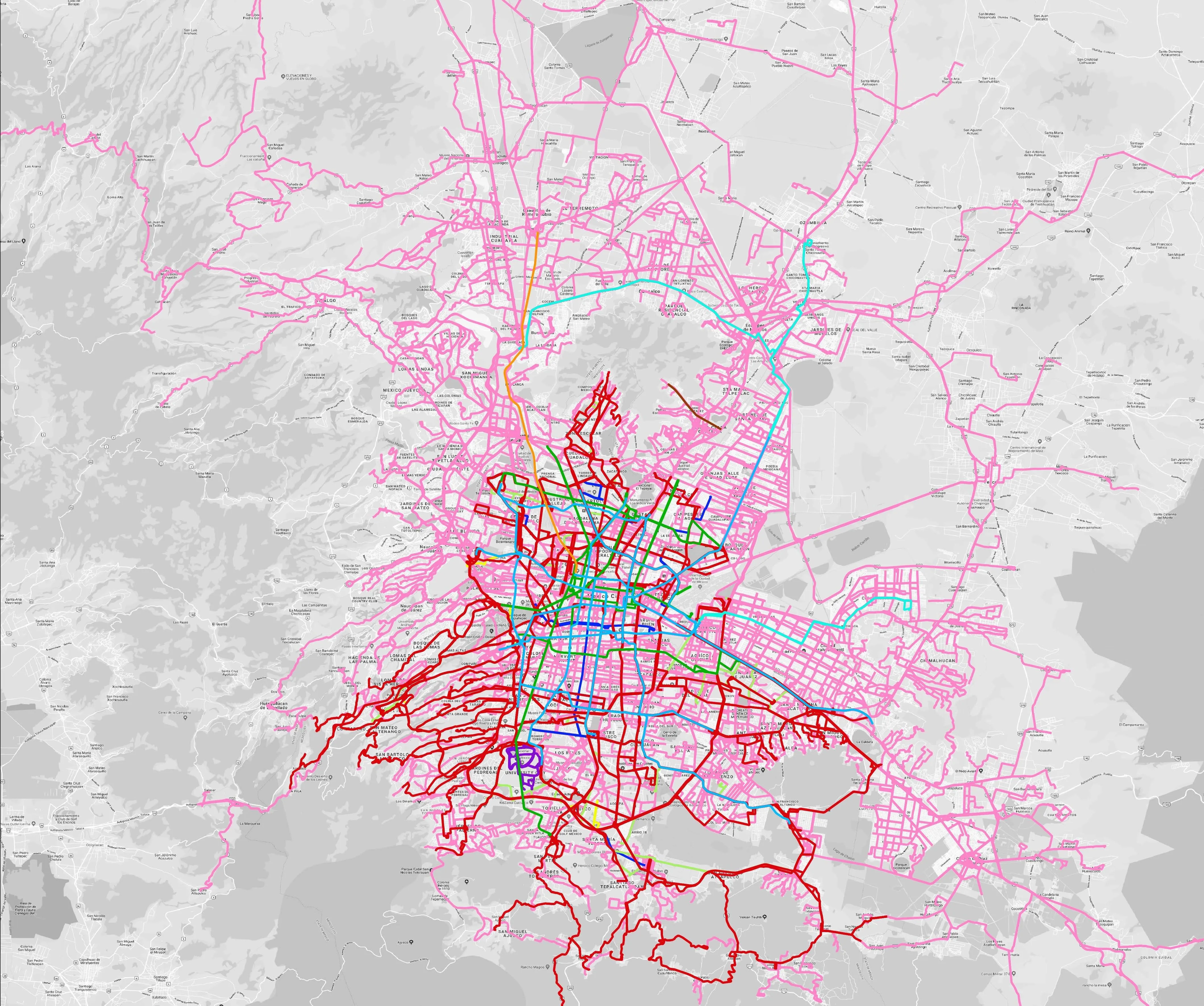
Mexico City is among the conurbations whose networks have been mapped (© WhereIsMyTransport)

WhereIsMyTransport says it is on course to map public transport networks in 30 of the world's biggest cities over the next three years.

The tech start-up, which received funding from both Google and Toyota Tsusho this year, has mapped one million kilometres of formal and informal networks worldwide so far.

Digitalising transport - particularly the 'informal' networks such as commuter minibuses which are vital in many cities - will be of considerable benefit to local economies.

CEO Devin de Vries says: "The production and maintenance of this mobility data is a fundamental first step towards transforming the public transport experience for hundreds of millions of people, and with it the social, cultural and economic landscape of these cities."

The firm began collecting public transport data in emerging markets in 2015, concentrating on the thousands of routes and vehicles owned and run by independent operators, which are effectively unmapped and offline. 

Most recently, WhereIsMyTransport mapped - and now maintains datasets for - the public transport networks in Mexico City, Dhaka (capital of Bangladesh), and the province of Gauteng in South Africa - metro areas with a combined population of more than 55 million. 

The company will collect public transport information in another 27 cities, of which 19 are megacities with populations greater than 10 million, including Bangkok and Rio de Janeiro.

To do this, it uses local teams of data collectors on the ground who map entrances, exits, stairs, gates and platforms at stations and interchanges. 

“We manage and maintain our data, updating it weekly, and integrating it with consumer products and planning tools that support a better public transport experience for everyone, everywhere," insists de Vries.

For more information on companies in this article

Related Content

  • Here demonstrates precise mapping, data analytics
    July 31, 2015
    Here, a leader in navigation, mapping and location experiences, will come to the 2015 ITS World Congress with a powerful message: precise maps and connected data analytics hold the key to ITS. As the company points out, a city in motion generates a tremendous quantity of data, yet for the most part these data are still untapped and their potential value not fully leveraged. They are likely not shared with a broad network and probably not examined in a wider context with other data.
  • Do buses need subsidies in congestion charging areas
    June 20, 2016
    David Crawford takes a look at the debate surrounding bus subsidies. Subsidies for public transport are a well-known and frequently-used policy tool directed at reducing the high environmental and social costs of peak-period traffic congestion. But at the end of last year the Swedish Centre for Transport Studies published a working paper entitled ‘Should buses still be subsidised in Stockholm?’ This concluded that the subsidy levels currently being applied in Stockholm could be nearly halved by setting bus
  • Syracuse models post-industrial revival for US cities
    August 13, 2015
    A connective corridor in Syracuse, New York State, could be a model for other post-industrial cities, as David Crawford discovers. The aim of the city of Syracuse’ 5.6km-long Connective Corridor in Onandaga County in upstate New York is to create a model ‘complete street’ for use in wider regeneration schemes. Key transport-sector components are traffic calming, high-quality transit with accessible passenger information, plus walkability and bike-friendliness.
  • IRD joins Canadian data vault project
    April 9, 2021
    IRD will collect roadside data to improve resilience of Canada’s prairie road network