XYZT.ai adds time to the mobility equation

Timestamps on critical ITS data allow organisations to drive additional insights
By Andrew Bardin Williams April 29, 2024 Read time: 2 mins
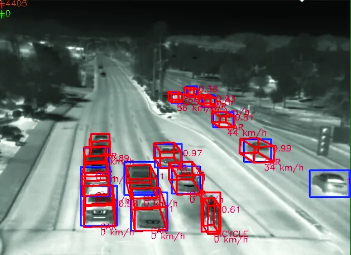
Data from Hamburg (image: XYZT.ai)

Location information has revolutionised the transportation industry, giving organisations pinpoint accuracy of vehicles, hazards and other road users across a variety of ITS applications dealing with traffic monitoring, autonomous driving, collision avoidance, pedestrian safety and others.

Belgian company XYZT.ai has taken this visibility one step further by adding timestamps to critical ITS data, allowing organisations to drive additional insights that take travel time and time of day into account. The company then presents this data in a visually appealing way that makes it easier for users to understand and work with the data in a meaningful way.

The City of Hamburg, for example, uses XYZT.ai for mobility analytics with floating vehicle data from Inrix.

According to Bart Adams, the company’s CTO, most companies look at data in the aggregate to identify trends and patterns - but it’s also important to be able to look at individual events that take place at a certain time. This includes a fleet manager tracking delivery timeframes, a delivery service optimising routes during the morning rush hour or a traffic engineer auditing travel times displayed on variable message signs. Adding time on top of location data and then presenting it in a way that is easy to consume makes this possible.

“There are billions of data points generated across a city every day,” said Lida Joly, XYZT.ai CEO, at last week's ITS America Conference & Expo 2024 in Phoenix, AZ. “It’s important that people are able to visualise this data in an effective way that allows them to make cities safer and better.”

For more information on companies in this article

Related Content

  • See the future of traffic clearly with Flir
    July 24, 2025

    Flir is redefining how cities move, and visitors to the company’s stand will step into a world where AI, thermal imaging, and real-time analytics converge to create safer, smarter, and more efficient transportation systems.

  • Waymo opens AV dataset to researchers
    September 3, 2019
    Waymo is making its Waymo Open Dataset for autonomous vehicles (AVs) available to the research community for free. Waymo is hoping the data will help researchers make advances in 2D and 3D perception and progress in areas such as domain adaptation and behaviour prediction. The company says each segment of driving data captures 20 seconds of continuous driving, allowing researchers to develop models to track and predict the behaviour of other road users. This dataset covers dense and suburban environmen
  • Kerb your enthusiasm, warns Passport
    March 4, 2019
    Dynamic kerbside management is crucial if urban authorities are to address increasingly chaotic situations caused by the gig economy and mobility innovation, says Adam Warnes at Passport Demand for the kerbside is growing and changing and it’s no surprise when you consider the recent innovations within the mobility industry. For starters, there are new modes of transport, including ride-shares, electric vehicles (EVs), dockless cycles, last-mile consolidations and autonomous vehicles (AVs). Secondly, the
  • Iowa DOT to use new Inrix Safety Alerts to help prevent rear-end collisions
    May 3, 2017
    Iowa Department of Transportation (DOT) has renewed its traffic data services contract with Inrix and will also employ Inrix Dangerous Slowdowns, a newly launched service that warns drivers and DOTs of sudden reductions in speed or stopped traffic on the road. Dangerous Slowdowns is part of the new Inrix Safety Alerts product suite which also includes Inrix Incidents and Inrix Road Weather, to provide real-time insight on roadways to inform drivers and make roadways safer. The Safety Alerts product suite co