XYZT.ai adds time to the mobility equation

Timestamps on critical ITS data allow organisations to drive additional insights
By Andrew Bardin Williams April 29, 2024 Read time: 2 mins
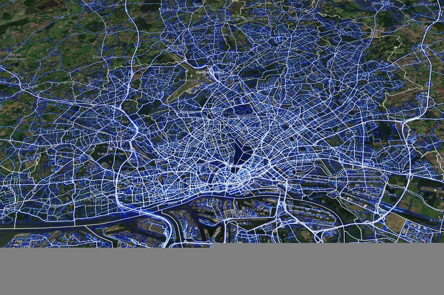
Data from Hamburg (image: XYZT.ai)

Location information has revolutionised the transportation industry, giving organisations pinpoint accuracy of vehicles, hazards and other road users across a variety of ITS applications dealing with traffic monitoring, autonomous driving, collision avoidance, pedestrian safety and others.

Belgian company XYZT.ai has taken this visibility one step further by adding timestamps to critical ITS data, allowing organisations to drive additional insights that take travel time and time of day into account. The company then presents this data in a visually appealing way that makes it easier for users to understand and work with the data in a meaningful way.

The City of Hamburg, for example, uses XYZT.ai for mobility analytics with floating vehicle data from Inrix.

According to Bart Adams, the company’s CTO, most companies look at data in the aggregate to identify trends and patterns - but it’s also important to be able to look at individual events that take place at a certain time. This includes a fleet manager tracking delivery timeframes, a delivery service optimising routes during the morning rush hour or a traffic engineer auditing travel times displayed on variable message signs. Adding time on top of location data and then presenting it in a way that is easy to consume makes this possible.

“There are billions of data points generated across a city every day,” said Lida Joly, XYZT.ai CEO, at last week's ITS America Conference & Expo 2024 in Phoenix, AZ. “It’s important that people are able to visualise this data in an effective way that allows them to make cities safer and better.”

For more information on companies in this article

Related Content

  • Smart cities: first, define your strategy
    April 27, 2020
    How smart are we really being about smart mobility? Martin Howell of Worldline UK and Ireland reckons we could do better – but to do so you have to start asking the right questions…
  • The benefits of Lidar
    March 21, 2022

    While Lidar is gaining ground in the ITS industry, it has not yet reached the level of mass adoption where it shows up frequently in requests for proposals (RFPs) from cities and DoTs.

  • How intelligent video security supports smart mobility
    April 1, 2021
    The ease of getting from point A to point B, the effective movement of goods and services, and the flexibility and integration of various modes of transportation are key aspects of mobility today. Jayden Xu, senior manager, ITS Solutions, at Hikvision, details the role of intelligent video security technology for improved traffic management
  • MIT study combines traffic data for smarter signal timings
    April 1, 2015
    Researchers at Massachusetts Institute of Technology (MIT) have found a method of combining vehicle-level data with less precise, but more comprehensive, city-level data on traffic patterns to produce better information than current systems provide. They claim this reduce delays, improve efficiency, and reduce emissions. The new findings are reported in a pair of papers by assistant professor of civil and environmental engineering Carolina Osorio and alumna Kanchana Nanduri, published in the journals Tra