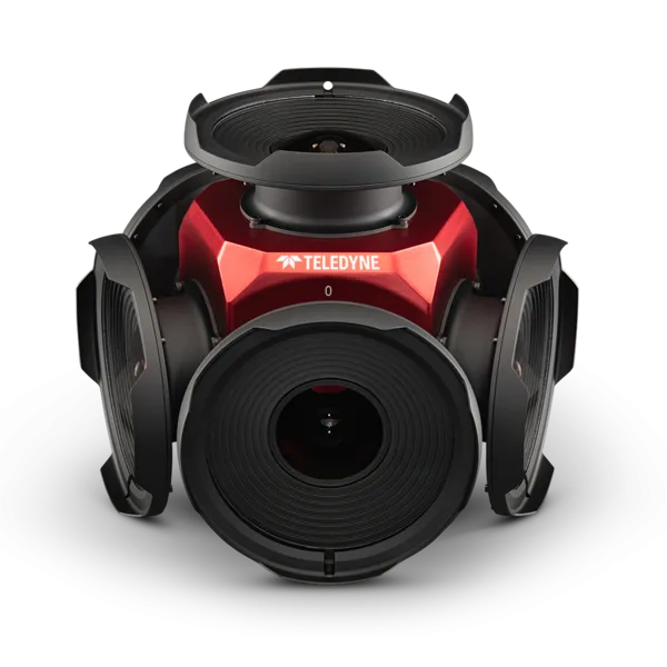
Teledyne positions itself with Ladybug6

Camera captures 360° images from moving platforms for HD mapping and asset inspection
By Adam Hill February 21, 2023 Read time: 1 min
Ladybug6: 360° view

Teledyne Flir is now shipping its new Ladybug6 camera for high accuracy 360° spherical image capture.

The high-resolution unit is designed to capture images from moving platforms in all weather conditions. Applications include panoramic street image production, road and asset inspections, and feature extraction for HD map generation.

Mike Lee, senior product manager at Teledyne Flir, says: “For applications that require high accuracy imaging like high-definition mapping, road surveying and asset inspection, the Ladybug6 gives users precision trigger control and resolution in a field-proven format.”

The manufacturer says support for Global Navigation Satellite Systems (GNSS) and advanced APIs, combined with hardware inputs, enable precise camera settings and trigger control.

Ladybug6's industrial-grade design and out-of-the-box factory calibration produce 72 Megapixel (MP) images with pixel values that are spatially accurate within +/- 2 mm at a 10m distance.

For more information on companies in this article

Related Content

  • Multi-platform mapping with Robin
    May 24, 2016
    3D Laser Mapping’s new multi-platform mapping system, Robin, provides three alternative mapping options in one solution, allowing users to benefit from the ability to map areas via walking, driving or flying. Robin integrates a 12 MP camera (for drive) and 18MP (for walk and fly), two GNSS antennas, GIS grade IMU navigation system, touch screen control unit, three mounting systems, capture software, a post-processing software package and has a field of view of 330 degrees. Long-range and precision versi
  • Versilis & Haas to offer Safety Cloud alerts
    May 4, 2021
    Versilis safety gates are now integrated with Haas Alert’s C-V2X digital alert solution
  • 3D lane geometry for TomTom Orbis Maps
    January 7, 2025
    New development uses AI, including fundamental vision models
  • Improving the positional accuracy of GNSS road user charging
    July 23, 2012
    The European GINA project is intended to address and overcome many of the institutional, technical and public acceptance hurdles currently faced by satellite-based road user charging schemes. Dave Tindall and Denis Naberezhnykh, TRL, and Laure Dezes, ERF, write. Pay-as-you-drive Road User Charging (RUC), whereby demand (or congestion) is managed by applying appropriate tariffs in order to encourage drivers to make their journeys at less busy times, on less congested routes or even on different modes, could