Teledyne positions itself with Ladybug6

Camera captures 360° images from moving platforms for HD mapping and asset inspection
By Adam Hill February 21, 2023 Read time: 1 min
Ladybug6: 360° view

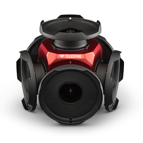
Teledyne Flir is now shipping its new Ladybug6 camera for high accuracy 360° spherical image capture.

The high-resolution unit is designed to capture images from moving platforms in all weather conditions. Applications include panoramic street image production, road and asset inspections, and feature extraction for HD map generation.

Mike Lee, senior product manager at Teledyne Flir, says: “For applications that require high accuracy imaging like high-definition mapping, road surveying and asset inspection, the Ladybug6 gives users precision trigger control and resolution in a field-proven format.”

The manufacturer says support for Global Navigation Satellite Systems (GNSS) and advanced APIs, combined with hardware inputs, enable precise camera settings and trigger control.

Ladybug6's industrial-grade design and out-of-the-box factory calibration produce 72 Megapixel (MP) images with pixel values that are spatially accurate within +/- 2 mm at a 10m distance.

For more information on companies in this article

Related Content

  • Intertraffic Awards 2022: enter now!
    December 15, 2021
    Exhibitors have until 20 January to enter the awards: there are three categories
  • Basler debuts new IP network camera at Intertraffic
    February 6, 2014
    Germany-headquartered camera manufacturer Basler will be at Intertraffic Amsterdam 2014 with a an extensive selection of ace GigE and ace USB cameras as well as IP cameras suitable for ITS applications, and also to present the world premiere of a new generation IP network camera with unique real-time trigger function and YUV feature.
  • Adaptive introduces Vidar 5MP
    December 21, 2022
    5MP sensor provides 2432 x 2048 resolution & HDx sensor has 1440 x 1080 resolution
  • Inertial sensors dramatically improve GNSS for ITS applications
    January 18, 2012
    Phil Harris, Thales UK, on how fused sensor data can significantly enhance GNSS-based positioning systems' performance in urban areas. Global Navigation Satellite System (GNSS)-based positioning is unique among available positioning technology due to its universal coverage and low equipment cost. By measuring the distances between an unknown position (such as a vehicle), and at least three known positions (GPS satellites), the unknown position can be calculated in three dimensions (latitude, longitude, and