Outsight introduces 3D Lidar simulator

New tool allows customers to work out what kit and coverage - and cost - they require
By Adam Hill November 17, 2022 Read time: 2 mins
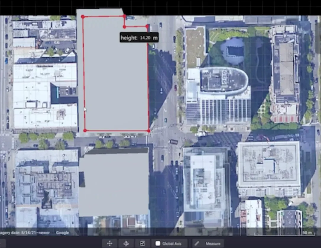
Users can insert their own scenes as a background by using built-in tools for modifying 3D shapes

Lidar specialist Outsight has launched a 3D Lidar simulation tool to help customers answer fundamental questions about deployment.

Deciding which and how many Lidars to use, and working out the best locations for them in terms of height, position and orientation, are among the issues the new tool is designed to overcome.

Users can make up their own simulation and environment to choose the best setting for achieving your performance and functionality goals, anticipating performance depending on each set-up and use case.  .

Outsight sought feedback on its beta version "from more than 300 early customers from various contexts, applications and countries".

It points out there is no need to install any software - users simply connect to their Outsight Cloud account, or request access if they do not already have one. 

Users can browse a list of compatible Lidars and select the right model or combination of models from different manufacturers (e.g. 360º FoV, Narrow Field of View, Dome).

You can find the optimal Lidar coverage by testing different options and coverage levels, establishing the best trade-off between performance, hardware cost and complexity, Outsight says.

It is possible to insert your own scenes as a background by using built-in tools for modifying 3D shapes.

For more information on companies in this article

Related Content

  • Developments in software visualisation packages
    February 3, 2012
    Adrian Greeman looks at developments in software visualisation packages. The capacity to make visualisations has been growing in importance over the last decade, and is now a well-accepted part of consultations and client presentations. But making high-quality images of projects is still a major undertaking and larger consultancies employ specialist departments to do so. Costs are coming down but it can still take a while, and some high-capacity hardware, to produce realistic renderings from drawings and 3D
  • Cohda: CPM helps AVs see through blind spots 
    February 3, 2021
    Collective perceptive messaging allowed RSU to share information by using V2X tech 
  • Qualcomm: How Connected Driving Will Reduce Emissions in the EU
    September 14, 2023
    In an era marked by climate change and an urgent need for greener mobility solutions, the advent of connected driving has emerged as a promising frontier in the realm of transportation.
  • GridMatrix visualizes data
    April 23, 2024

    GridMatrix is using artificial intelligence (AI) and machine learning (ML) to make cities safer, more efficient and more livable, according to Ellee DeGhetto, a business development manager for the company.   While at the show, representatives of the company are highlighting an analytics dashboard that collects data from existing roadway sensors and visually presents the data. Sensor feeds are processed in the cloud to create insights into congestion, signal performance, emissions and safety.