Outsight introduces 3D Lidar simulator

New tool allows customers to work out what kit and coverage - and cost - they require
By Adam Hill November 17, 2022 Read time: 2 mins
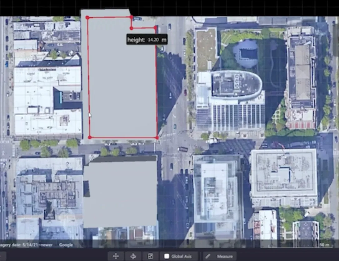
Users can insert their own scenes as a background by using built-in tools for modifying 3D shapes

Lidar specialist Outsight has launched a 3D Lidar simulation tool to help customers answer fundamental questions about deployment.

Deciding which and how many Lidars to use, and working out the best locations for them in terms of height, position and orientation, are among the issues the new tool is designed to overcome.

Users can make up their own simulation and environment to choose the best setting for achieving your performance and functionality goals, anticipating performance depending on each set-up and use case.  .

Outsight sought feedback on its beta version "from more than 300 early customers from various contexts, applications and countries".

It points out there is no need to install any software - users simply connect to their Outsight Cloud account, or request access if they do not already have one. 

Users can browse a list of compatible Lidars and select the right model or combination of models from different manufacturers (e.g. 360º FoV, Narrow Field of View, Dome).

You can find the optimal Lidar coverage by testing different options and coverage levels, establishing the best trade-off between performance, hardware cost and complexity, Outsight says.

It is possible to insert your own scenes as a background by using built-in tools for modifying 3D shapes.

For more information on companies in this article

Related Content

  • Invision AI bolsters rail sensing tech in Canada
    May 7, 2021
    Radars, cameras and Lidars collect data to train system to recognise obstacles and dangers
  • National law enforcement challenge webinar
    January 9, 2015
    Laser Technology (LTI) is partnering with the International Association of Chiefs of Police's (IACP) National Law Enforcement Challenge (NLEC) traffic safety recognition program to broadcast a live webinar on 20 January 2015 at 0930 am (MST). The 2015 National Law Enforcement Challenge Quick-Start Guide webinar will give new and returning applicants helpful information about the Challenge and the most effective tips to jump-start the application process. The NLEC is a friendly competition between agen
  • US Homeland Security designates for-hire sector 'critical infrastructure'
    April 9, 2020
    Industry added to crucial list after letter from the Transportation Alliance.
  • LiDAR sets its sights on future problems
    February 23, 2017
    AAdvances in LiDAR are helping transport authorities improve services and identify potential problem areas, as geospatial technology expert Dr Neil Slatcher explains. The effects of climate change on the transport infrastructure have long been a cause of concern within the transportation sector - and not only on the structures themselves but also on the surrounding areas. This year, those concerns have become reality with landslides, structural collapses and surfacing issues impacting services across the wo