Seoul Robotics opens doors of perception

SENSR-I software can capture actionable data on movement of people and vehicles
March 25, 2022 Read time: 1 min
SENSR-I can simultaneously track the precise movements of people, vehicles and bicycles over expansive areas, says Seoul Robotics

Seoul Robotics has introduced an infrastructure-based version of its SENSR 3D perception software.

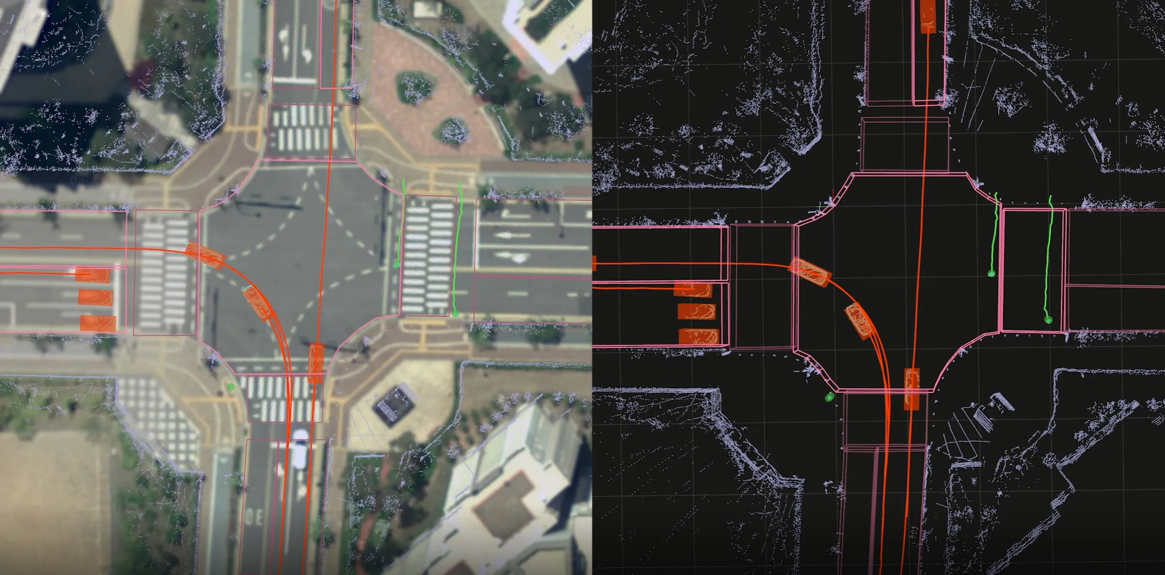
The new product, SENSR-I, processes data captured by 3D sensors to provide high-resolution environmental insights, enabling customers to see how people and vehicles move through large spaces. 

It supports anything from central processing to edge computing and is sensor- and hardware-agnostic, the company says.

When applied to 3D sensors on static infrastructure (indoors and outdoors), SENSR-I can precisely track within an error of 4cm.

“Until now, 2D cameras have been the only accessible, affordable solution, but that is no longer the case," says Jerone Floor, VP of products and solutions at Seoul Robotics.

"Indisputably, 3D systems enable organisations to get deeper, more actionable data. SENSR-I changes the game with its ability to simultaneously track the precise movements of people, vehicles and bicycles over expansive areas – unlocking unprecedented insights that can transform operations in ways never before possible."

3D analytics uses non-biometric data "with more robust 3D vision that is able to accurately detect object movement beyond what is visible from a single perspective, as well as track a single object across multiple sensors", Seoul adds.

The Korean government invested $12m in Seoul Robotics last year.

For more information on companies in this article

Related Content

  • Teledyne Flir views AV safety through Prism
    June 30, 2022
    Software framework is aimed at automotive perception engineers integrating thermal cameras
  • Michael Baker International adds to UAS inspection fleet
    November 18, 2016
    US-based engineering and planning consulting service Michael Baker International has expanded its inspection services with the purchase of a Topcon Falcon 8 unmanned aircraft system (UAS), offering a new perspective for its pilots to achieve precise aerial imagery and mapping during the inspection of infrastructure elements. Combined with the company’s mobile and static Light Detection and Ranging (LiDAR) systems for data collection and by utilising the system’s flight stability and high-resolution 32-me
  • Sick unveils Free Flow Profiler for scanning vehicles
    May 20, 2019
    Sick has launched a vehicle measurement system which it says enables accurate 3D profiling of vehicles across multiple lanes in free-flow traffic. The Free Flow Profiler is an all-weather system suitable for vehicle tolling and classification uses, especially in operations such as optimal weight loading of ferries or trains and for verifying vehicle dimensions to maximise revenue recovery, the company adds. During multi-lane, free road movement, Sick’s 2D Lidar sensors scan traffic and measure vehicle l
  • Navya goes to Minnesota
    August 15, 2022
    Shared mobility autonomous shuttle runs in partnership with MnDoT and Aecom