Authorities in New York are trialling an app from Spanish tech firm NaviLens which helps blind or low-vision riders find bus stops.
The Transit Innovation Partnership, a public-private initiative created by New York Metropolitan Transportation Authority (MTA) and the Partnership for New York City, is responding to governor Andrew M. Cuomo’s call for private sector innovation to improve and modernise public transit.
The NaviLens app uses an algorithm to translate visual signage into audio that allows customers to determine the accurate location and distance to the nearest bus stop.
App users can find out when the next bus will arrive, know if a bus is crowded if the necessary sensor technology is on board and be directed onto the bus when it pulls up to the stop.
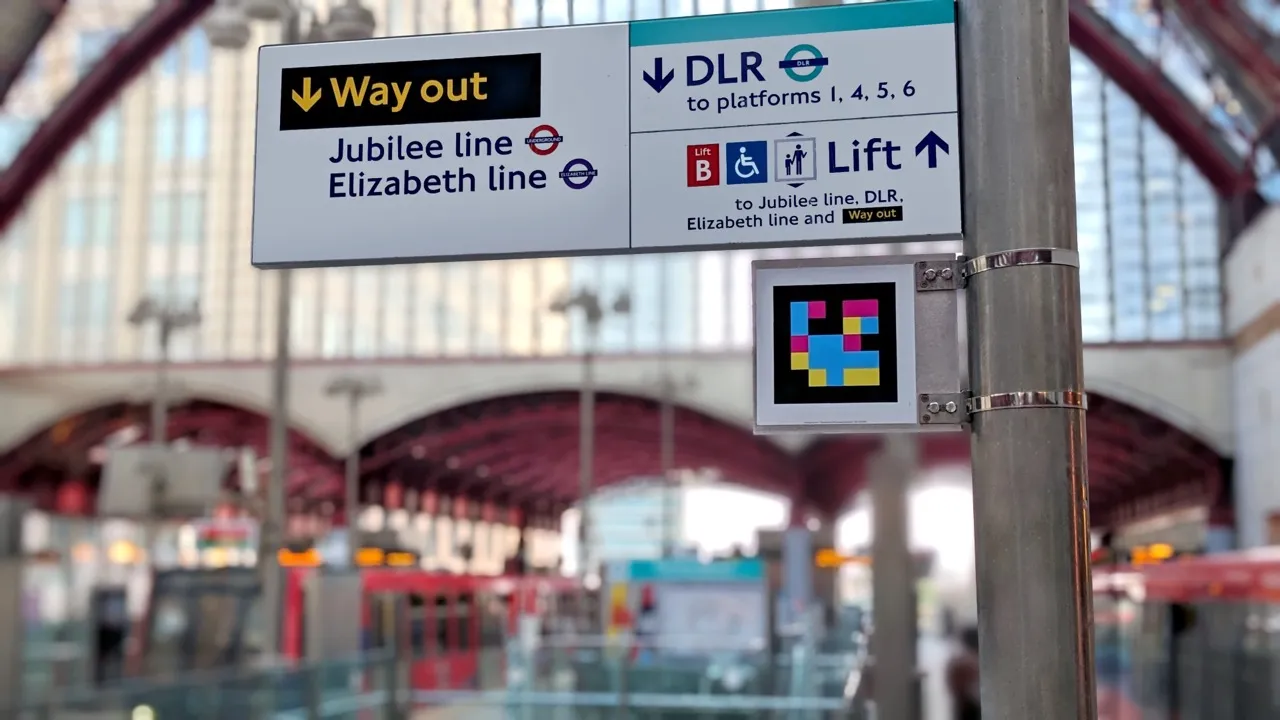
The app is expected to detect QR-style codes installed on the bus stop poles from up to 40 feet away and at an angle of up to 160 degrees.
According to Transit Innovation Partnership, the code does not have to be in focus for app detection and will direct the user by providing audio directional cues including distance and angle from code such as “25 feet away, straight” or “right”.
The organisation claims GPS navigation as a wayfinding tool can only bring users within the vicinity of their location, but NaviLens provides the exact location of a destination.
As part of the project, the partners received assistance from the New York City Department of Transportation (NYCDoT) to ensure signs along the M23 SBS bus route display decals that enable the use of the app.
The partnership says the M23 SBS bus route in Manhattan carried almost 14,500 weekday riders pre-pandemic.
It includes stops near the Selis Manor Residence for the Blind, Visions Services for the Blind and Visually Impaired, and Andrew Heiskell Braille and Talking Book Library.
NaviLens was selected as part of the 2020 Transit Tech Lab, a Transit Innovation Partnership programme which called for private sector solutions to improve public transit accessibility.
It was also one of the technology features tested at the New York City Transit Authority Accessible Station Lab at Jay St-MetroTech Station in downtown Brooklyn in October 2019.


