Skip to main content
Eyebrow
About Us
Advertise
Subscribe
Contact
Social Media
Bluesky
Facebook
Instagram
LinkedIn
YouTube
Search
Main navigation
News
Products
Features
Categories
Air Quality & Weather Systems
C/AV
Charging, Tolling & RUC
Classification & Data Collection
Detection, Monitoring & Machine Vision
Enforcement
GIS/ Mapping & Location Based Systems
Mass Transit & MaaS
Networking & Communication Systems
Parking & Access Control
Urban Traffic Control
Daily News
ITS World Congress 2025
Show News
Digital Edition
Show Information
eNewsletter
ITS World Congress 2024
Digital Edition
Show Information
eNewsletter
Intertraffic Amsterdam 2024
Event Home
Show Information
eNewsletter
Digital Edition
ITS America 2024
Digital Edition
Show Information
eNewsletter
ITS America 2023
Digital Edition
Show Information
eNewsletter
ITS World Congress 2022
Digital Edition
Show Information
eNewsletter
Intertraffic Amsterdam 2022
Digital Edition
Show Information
eNewsletter
ITS World Congress 2021
Digital Edition
Show Information
eNewsletter
ITS America 2021
Digital Edition
Show Information
eNewsletter
Innovation News 2020
Digital Edition
Show Information
eNewsletter
Calendar
Magazine
Videos
Home
Classification & Data Collection
Classification & Data Collection
Western Australia trials C-ITS technology
May 26, 2025
Main Roads WA said city of Perth is ready for connected vehicle technology
Read More
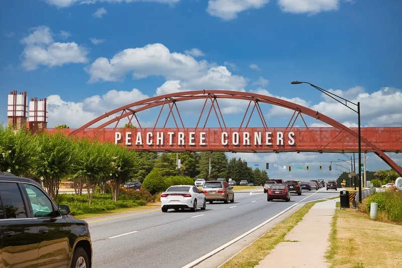
Seyond’s SIMPL formula for success in the US
May 23, 2025
Controller-agnostic platform has been deployed at Peachtree Corners in Georgia
Read More
ITS community 'must lead with conviction', says Eric Sampson
May 22, 2025
ITS European Congress chief rapporteur urges 'fairer, safer and shared' mobility
Read More
ITS UK launches 2025 awards programme
May 22, 2025
Annual event takes place on 21 October 2025 - entries are open now
Read More
Euro road safety at heart of DFRS and Euro NCAP collaboration
May 21, 2025
Two organisations signed MoU at 16th ITS European Congress in Seville
Read More
ITS European Congress 2025 starts today
May 19, 2025
Clean, Resilient & Connected Mobility: #ITSSeville2025 runs until 21 May
Read More
ITS European Congress 2025: Shaping the future of mobility
May 16, 2025
Clean, Resilient & Connected Mobility: #ITSSeville2025 takes place 19-21 May
Read More
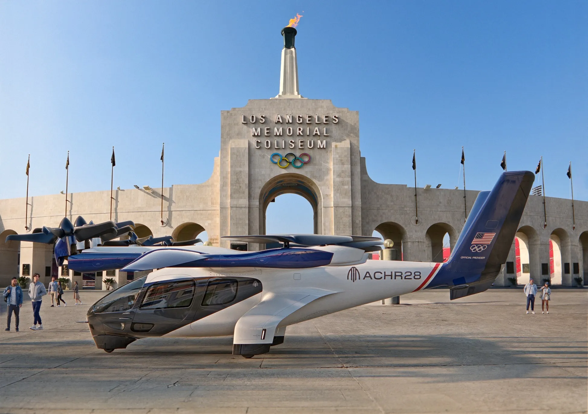
Air taxis added to LA Olympics events
May 16, 2025
Archer Aviation eVTOLs will be used for transport at Los Angeles games
Read More
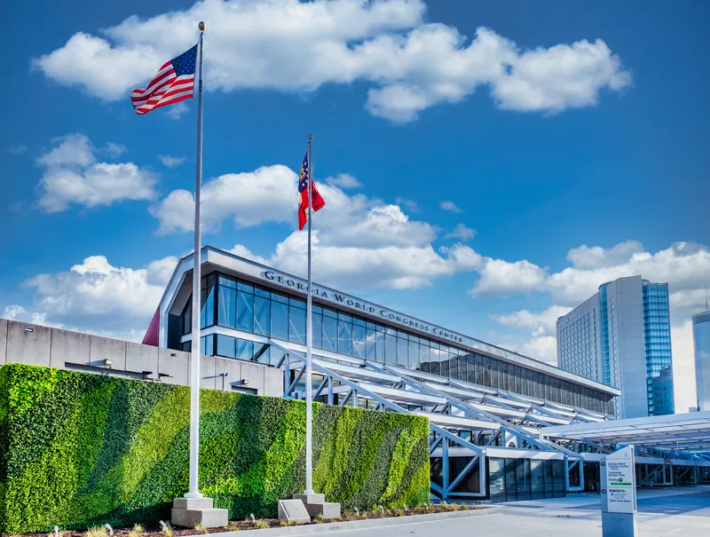
ITS World Congress 2025: registrations are open!
May 15, 2025
Event takes place at the Georgia World Congress Center from 24-28 August
Read More
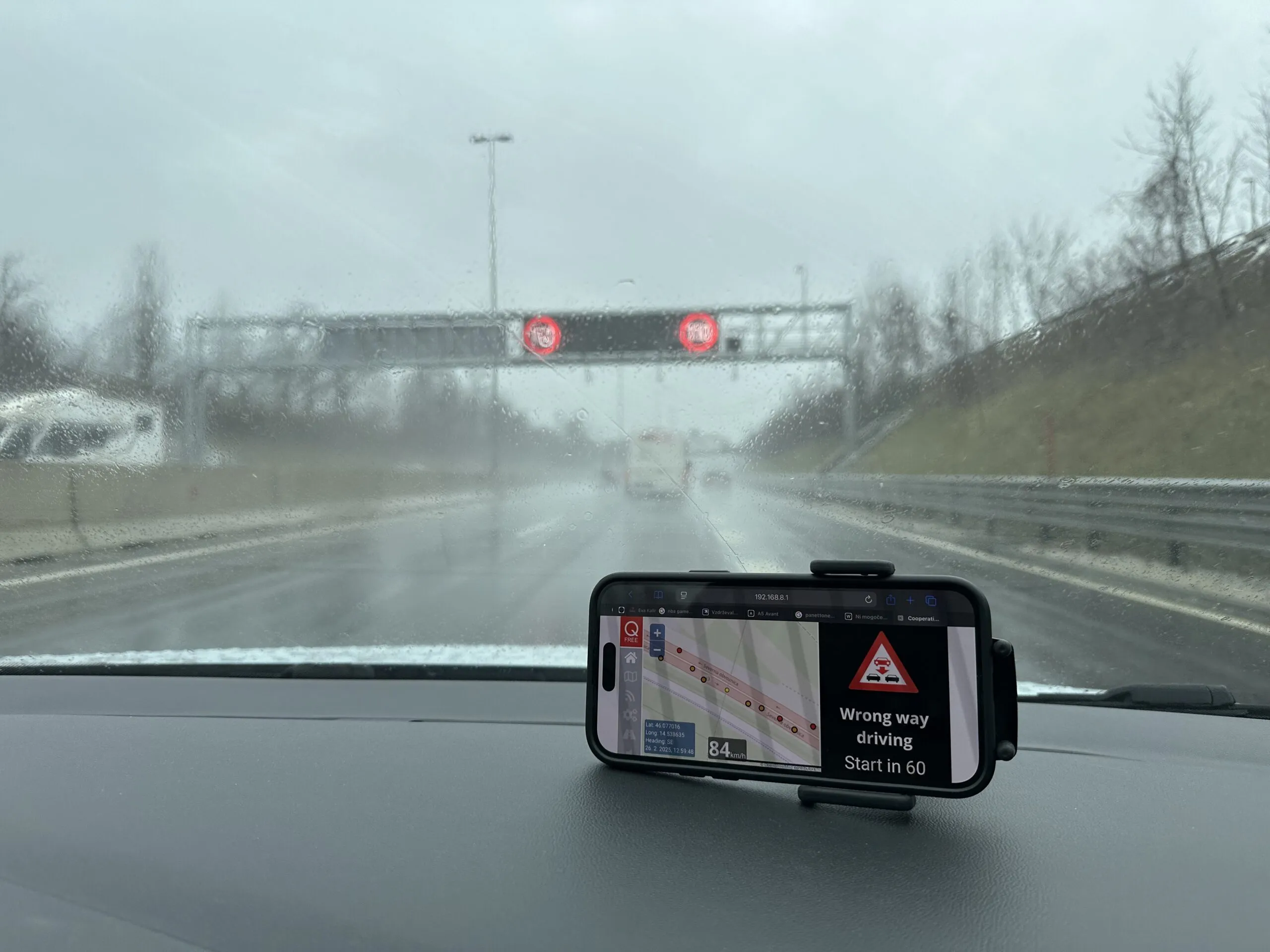
Q-Free and Dars deliver C-ITS in Slovenia
May 15, 2025
Project on Ljubljana's ring road will see some VW vehicles receiving messages
Read More
Pagination
First page
« First
Previous page
‹‹
…
Page
3
Page
4
Page
5
Page
6
Page
7
Page
8
Page
9
Page
10
Page
11
…
Next page
››
Last page
Last »
Editor's Choice
Modaxo buys transport scheduling software provider Siscog
Rotterdam links airport with metro via autonomous bus
EC Road Safety Awards 2025 finalists announced
Highlighted Content
July 14, 2025
Miovision tool allows cities to 'act faster' to prevent crashes
Read More
July 23, 2025
Innovation without the chaos
Read More
July 23, 2025
Modaxo buys transport scheduling software provider Siscog
Read More
July 24, 2025
Rotterdam links airport with metro via autonomous bus
Read More
August 1, 2025
High-precision Theia telephotos for fixed and mobile traffic installations
Read More
Home
News
Products
Features
Categories
Air Quality & Weather Systems
C/AV
Charging, Tolling & RUC
Classification & Data Collection
Detection, Monitoring & Machine Vision
Enforcement
GIS/ Mapping & Location Based Systems
Mass Transit & MaaS
Networking & Communication Systems
Parking & Access Control
Urban Traffic Control
Daily News
ITS World Congress 2025
Show News
Digital Edition
Show Information
eNewsletter
ITS World Congress 2024
Show Information
eNewsletter
Digital Edition
Intertraffic Amsterdam 2024
Event Home
Show Information
eNewsletter
Digital Edition
ITS America 2024
Show Information
eNewsletter
Digital Edition
ITS America 2023
Show Information
eNewsletter
Digital Edition
ITS World Congress 2022
Show Information
eNewsletter
Digital Edition
Intertraffic Amsterdam 2022
Show Information
eNewsletter
Digital Edition
ITS World Congress 2021
Show Information
eNewsletter
Digital Edition
ITS America 2021
Show Information
eNewsletter
Digital Edition
Innovation News 2020
Digital Edition
Show Information
eNewsletter
Calendar
Magazine
Videos