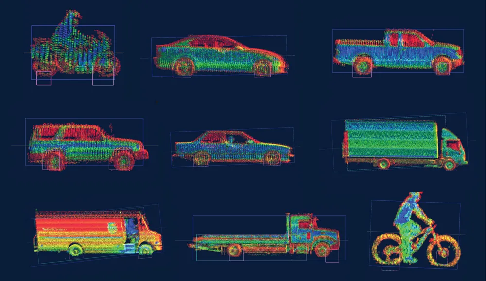
Using a combination of highly technical, stateof- the-art vehicle mounted equipment, Zenrin creates high-precision 3D map databases, which it is highlighting at this week’s ITS World Congress.
Earlier in the year, Zenrin joined a group of Japanese companies, mainly car producers, to form the Dynamic Map Planning Co (DMP) which is designed to examine the methodologies of developing maps for AS/ ADAS applications for expressways and general roads in Japan.
At the ITS World Congress, Zenrin is also demonstra

Using a combination of highly technical, stateof- the-art vehicle mounted equipment, 8516 Zenrin creates high-precision 3D map databases, which it is highlighting at this week’s ITS World Congress.
Earlier in the year, Zenrin joined a group of Japanese companies, mainly car producers, to form the Dynamic Map Planning Co (DMP) which is designed to examine the methodologies of developing maps for AS/ ADAS applications for expressways and general roads in Japan.
At the ITS World Congress, Zenrin is also demonstrating its relationship with IBM’s Watson IoT platform and how the use of the cloud is enabling traffic authorities to communicate with drivers in real time to avoid traffic problems and possible accidents, as well as reporting on incidents such as debris left on the road.