TomTom and Esri fusion transform urban mobility

April 28, 2025 Read time: 2 mins

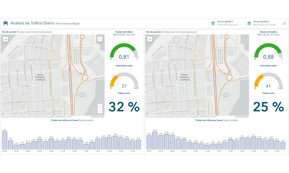
A collaboration between TomTom and Esri will take centre stage at the upcoming Congress with a session titled "Driving Insights: Unlocking the Power of TomTom Historic Traffic Data in ArcGIS.” Led by industry experts Frans Keijzer from TomTom and Jaime Nieves from Esri Spain, this presentation will showcase how integrating TomTom's historical traffic data with the ArcGIS platform has transformed urban mobility in Gran Canaria, Spain.

The initiative, spearheaded by Esri Spain and Sagulpa, sought to create a digital twin of the urban area to enhance planning and management. By leveraging TomTom's robust traffic data and using ArcGIS, the team swiftly deployed interactive maps and applications without extensive IT support. Key tools included TomTom Traffic Stats and TomTom Origin-Destination for traffic analysis and ArcGIS Dashboards and ArcGIS Experience Builder for dynamic visualizations.

This session (on Tuesday 20 May 20 from 11.45 to 12.45 in Hall Madrid D) will showcase the significant potential of TomTom Move data when combined with ArcGIS, making it an essential tool for those interested in advancing urban mobility solutions. Attendees will learn about three main applications derived from this initiative: a safety dashboard for monitoring traffic flow, a public transportation and emergency response planning tool, and an event traffic analysis application for managing large-scale events like football matches. These tools provide decision-makers with valuable insights, leading to improved traffic safety and optimised transportation routes.

For more information on companies in this article

Related Content

  • Transportation analytics to aid growing carrier company
    April 5, 2013
    Pitt Ohio, a transportation solutions provider headquartered in Pittsburgh, Pennsylvania, can now more proactively plan its business by creating routes, managing complex schedules, and monitoring progress throughout the day. The company has licensed Esri's ArcGIS for Transportation Analytics solution, powered by the ArcGIS platform. Pitt Ohio is a member of the Reliance Network, a group of regional carriers that work together to provide seamless service for customers. The company provides less-than-trucklo
  • FOTsis targets ‘socially inclusive’ cooperative ITS
    December 5, 2013
    The FOTsis project addresses the imbalances between the vehicular and infrastructure sides of cooperative ITS infrastructures and looks to ensure road operators can help to enrich future technology applications. By Jason Barnes. Several developments have conspired to push the vehicular side of cooperative infrastructures/cooperative ITS to the fore in recent years. The automotive industry’s rather shorter product development and lifecycles combined with economic slowdown in many regions gave rise to the not
  • Iteris & Otonomo 'unlock mobility infrastructure'
    January 25, 2023
    Connected vehicle data will be shared by companies to improve traffic intelligence
  • Improving, integrating weather monitoring for safer roads
    February 6, 2012
    Paul Pisano, USDOT Federal Highway Administration, and Charles Harris, Noblis Inc, chart progress in the US of Maintenance Decision Support Systems for winter maintenance and weather management