TomTom and Esri fusion transform urban mobility

April 28, 2025 Read time: 2 mins

A collaboration between TomTom and Esri will take centre stage at the upcoming Congress with a session titled "Driving Insights: Unlocking the Power of TomTom Historic Traffic Data in ArcGIS.” Led by industry experts Frans Keijzer from TomTom and Jaime Nieves from Esri Spain, this presentation will showcase how integrating TomTom's historical traffic data with the ArcGIS platform has transformed urban mobility in Gran Canaria, Spain.

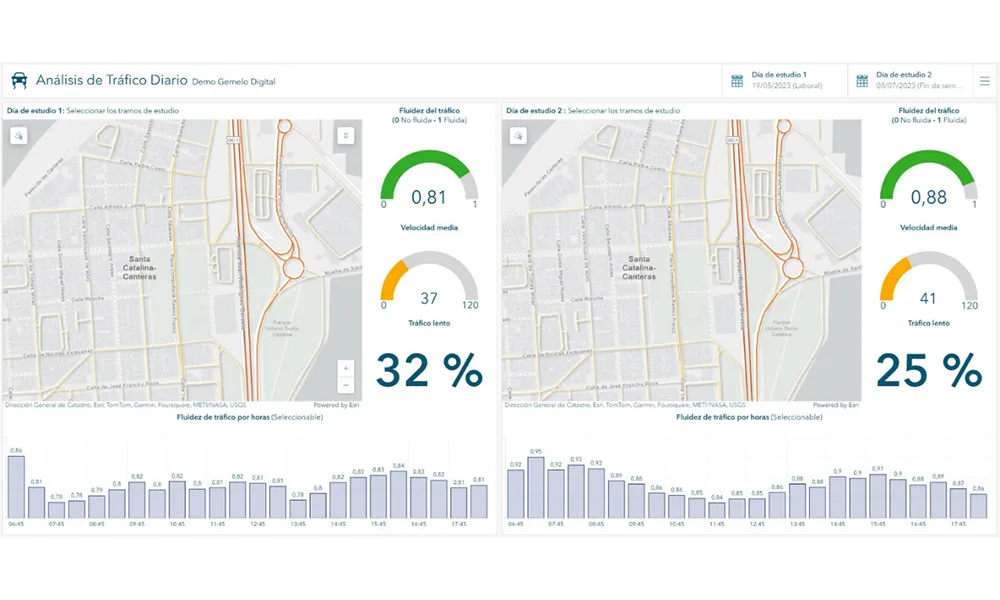
The initiative, spearheaded by Esri Spain and Sagulpa, sought to create a digital twin of the urban area to enhance planning and management. By leveraging TomTom's robust traffic data and using ArcGIS, the team swiftly deployed interactive maps and applications without extensive IT support. Key tools included TomTom Traffic Stats and TomTom Origin-Destination for traffic analysis and ArcGIS Dashboards and ArcGIS Experience Builder for dynamic visualizations.

This session (on Tuesday 20 May 20 from 11.45 to 12.45 in Hall Madrid D) will showcase the significant potential of TomTom Move data when combined with ArcGIS, making it an essential tool for those interested in advancing urban mobility solutions. Attendees will learn about three main applications derived from this initiative: a safety dashboard for monitoring traffic flow, a public transportation and emergency response planning tool, and an event traffic analysis application for managing large-scale events like football matches. These tools provide decision-makers with valuable insights, leading to improved traffic safety and optimised transportation routes.

Related Content

  • April 11, 2024
    How technology is propelling the development of urban shared transport
    Over 18 million people use ride-hailing apps in the UK alone, says Mariusz Zabrocki of Freenow
  • December 5, 2012
    Reducing congestion with Tomtom's historical traffic data
    Historical traffic data provided by TomTom is being used by the local government in Spain’s Basque region to reduce road congestion at less cost. Old habits die hard. Photos from as far back as the 1930s show people counting cars by the roadside in order to provide congestion data to those running road networks. Today, such techniques are still used, albeit augmented by a range of automation technologies such as inductive loops, infra-red sensors and number plate recognition. Even with these advances, howe
  • January 14, 2020
    Colorado DoT locates data-rich environment
    Colorado DoT and Esri have been cooperating to unlock data’s potential. Jason Barnes finds out what that has to do with firing a howitzer at snowy mountains – and exactly why things that happened in the past point the way towards future proofing
  • September 10, 2014
    Esri helps UDOT consolidate maps into single platform
    Utah Department of Transportation (UDOT) has launched a new website that consolidates hundreds of traffic and infrastructure maps on a single platform, following an open government initiative touted by the state. “Utah views transportation infrastructure as the property of its citizens,” said Terry Bills, global transportation industry manager for Esri. “They paid the bills. They should be able to access this type of information.