TomTom and Esri fusion transform urban mobility

April 28, 2025 Read time: 2 mins

A collaboration between TomTom and Esri will take centre stage at the upcoming Congress with a session titled "Driving Insights: Unlocking the Power of TomTom Historic Traffic Data in ArcGIS.” Led by industry experts Frans Keijzer from TomTom and Jaime Nieves from Esri Spain, this presentation will showcase how integrating TomTom's historical traffic data with the ArcGIS platform has transformed urban mobility in Gran Canaria, Spain.

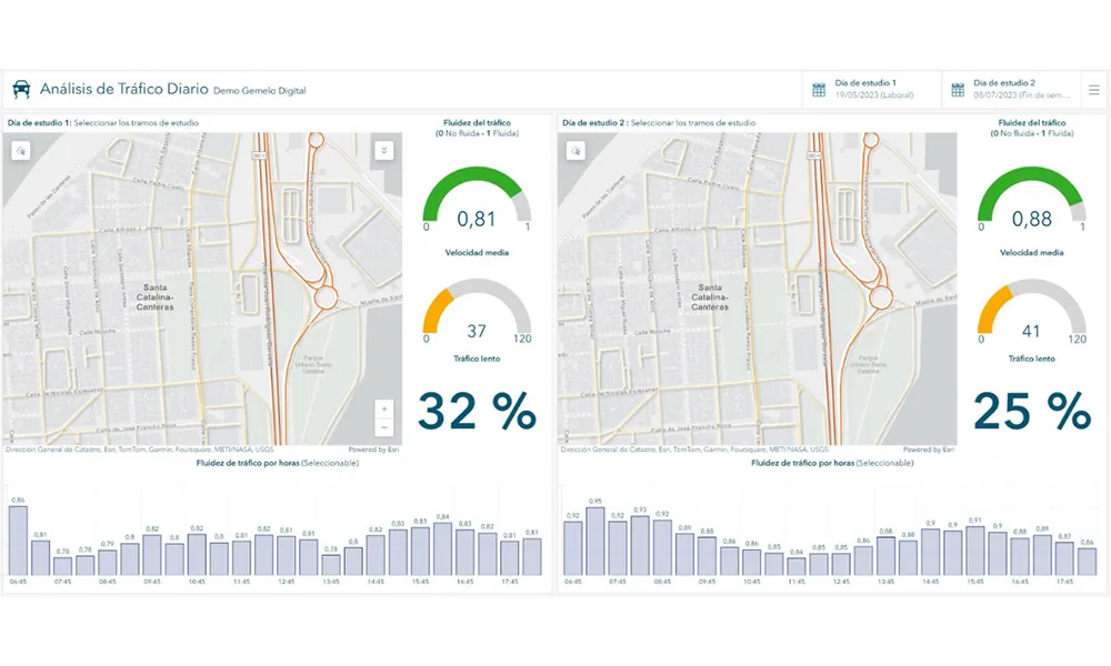
The initiative, spearheaded by Esri Spain and Sagulpa, sought to create a digital twin of the urban area to enhance planning and management. By leveraging TomTom's robust traffic data and using ArcGIS, the team swiftly deployed interactive maps and applications without extensive IT support. Key tools included TomTom Traffic Stats and TomTom Origin-Destination for traffic analysis and ArcGIS Dashboards and ArcGIS Experience Builder for dynamic visualizations.

This session (on Tuesday 20 May 20 from 11.45 to 12.45 in Hall Madrid D) will showcase the significant potential of TomTom Move data when combined with ArcGIS, making it an essential tool for those interested in advancing urban mobility solutions. Attendees will learn about three main applications derived from this initiative: a safety dashboard for monitoring traffic flow, a public transportation and emergency response planning tool, and an event traffic analysis application for managing large-scale events like football matches. These tools provide decision-makers with valuable insights, leading to improved traffic safety and optimised transportation routes.

For more information on companies in this article

Related Content

  • Targeted roadside advertising project uses deep learning to analyse traffic volumes
    June 22, 2016
    A targeted roadside advertising project for digital signage using big data and deep learning just launched in Tokyo, Japan, by US smart data storage company Cloudian will focus on vehicle recognition and the ability to present relevant display ads by vehicle make and model. Together with Dentsu, Smart Insight Corporation, and QCT (Quanta Cloud Technology) Japan, and with support from Intel Japan, the project will conduct, at its first stage, deep learning analysis – artificial intelligence (AI) for recog
  • TRL launches cloud-based collision analysis system
    January 25, 2013
    The UK’s Transport Research Laboratory (TRL) has launched MAAPcloud, the new generation version of its MAAP road traffic collision data software which TRL has supplied in the UK and globally since the 1980s. TRL says this brand new version provides a better fit with today’s technological environments, and offers additional capabilities for the road safety professionals who use it. MAAPcloud has been designed to allow flexible deployment; police forces, local authorities and other road safety stakeholders ca
  • Hard data supports traffic monitoring
    April 30, 2024
    A collaboration between AGD Systems and North Line Canada has demonstrated the value of traffic experts putting their heads together to improve pedestrian safety
  • Reimagining urban mobility – the Estonian way
    July 23, 2025

    Picture a city where transport simply works: quiet, seamless, and efficient. This is not a vision of the distant future — Estonian ITS companies are already reshaping urban mobility around the world, drawing on the country’s digital-first approach and vibrant technology ecosystem.