TomTom and Esri fusion transform urban mobility

April 28, 2025 Read time: 2 mins

A collaboration between TomTom and Esri will take centre stage at the upcoming Congress with a session titled "Driving Insights: Unlocking the Power of TomTom Historic Traffic Data in ArcGIS.” Led by industry experts Frans Keijzer from TomTom and Jaime Nieves from Esri Spain, this presentation will showcase how integrating TomTom's historical traffic data with the ArcGIS platform has transformed urban mobility in Gran Canaria, Spain.

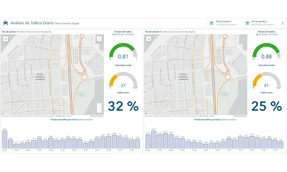
The initiative, spearheaded by Esri Spain and Sagulpa, sought to create a digital twin of the urban area to enhance planning and management. By leveraging TomTom's robust traffic data and using ArcGIS, the team swiftly deployed interactive maps and applications without extensive IT support. Key tools included TomTom Traffic Stats and TomTom Origin-Destination for traffic analysis and ArcGIS Dashboards and ArcGIS Experience Builder for dynamic visualizations.

This session (on Tuesday 20 May 20 from 11.45 to 12.45 in Hall Madrid D) will showcase the significant potential of TomTom Move data when combined with ArcGIS, making it an essential tool for those interested in advancing urban mobility solutions. Attendees will learn about three main applications derived from this initiative: a safety dashboard for monitoring traffic flow, a public transportation and emergency response planning tool, and an event traffic analysis application for managing large-scale events like football matches. These tools provide decision-makers with valuable insights, leading to improved traffic safety and optimised transportation routes.

For more information on companies in this article

Related Content

  • Why integrated traffic management needs a cohesive approach
    April 10, 2012
    Traffic control is increasingly being viewed as one essential element of a wider ‘system of systems’ – the smart city. Jason Barnes, Jon Masters and David Crawford report on latest ideas and efforts for making cities ‘smarter’ Virtually every element of the fabric and utilitarian operations that make urban areas tick can now be found somewhere in the mix that is the ‘smart city’ agenda. Ideas have expanded and projects pursued in different directions as the rhetoric on making cities ‘smarter’ has grown. App
  • PTV reveals next year's models
    October 17, 2022
    2023 release sees upgrades to transportation modelling and multimodal simulation software
  • How digital navigation is key to managing congestion
    March 24, 2023
    Satnav – not costly civil engineering projects – might point us towards better management of congested road networks, argues David Metz of University College London
  • Remote remedies help US authorities identify bridge deficiencies
    September 6, 2017
    Every day 185 million vehicles – cars, trucks, school buses, emergency response units - cross one or more of America’s 55,710 'structurally compromised' steel and concrete road bridges, the highest concentration of which are in Iowa (nearly 5,000), Pennsylvania and Oklahoma. Nearly 2,000 of these crossings are located on interstate highways, according to the American Road and Transportation Builders Association's recent analysis of the US Department of Transportation's 2016 National Bridge Inventory.