TomTom and Esri fusion transform urban mobility

April 28, 2025 Read time: 2 mins

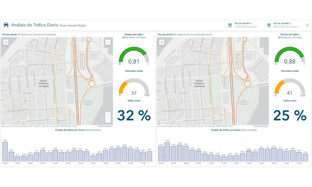
A collaboration between TomTom and Esri will take centre stage at the upcoming Congress with a session titled "Driving Insights: Unlocking the Power of TomTom Historic Traffic Data in ArcGIS.” Led by industry experts Frans Keijzer from TomTom and Jaime Nieves from Esri Spain, this presentation will showcase how integrating TomTom's historical traffic data with the ArcGIS platform has transformed urban mobility in Gran Canaria, Spain.

The initiative, spearheaded by Esri Spain and Sagulpa, sought to create a digital twin of the urban area to enhance planning and management. By leveraging TomTom's robust traffic data and using ArcGIS, the team swiftly deployed interactive maps and applications without extensive IT support. Key tools included TomTom Traffic Stats and TomTom Origin-Destination for traffic analysis and ArcGIS Dashboards and ArcGIS Experience Builder for dynamic visualizations.

This session (on Tuesday 20 May 20 from 11.45 to 12.45 in Hall Madrid D) will showcase the significant potential of TomTom Move data when combined with ArcGIS, making it an essential tool for those interested in advancing urban mobility solutions. Attendees will learn about three main applications derived from this initiative: a safety dashboard for monitoring traffic flow, a public transportation and emergency response planning tool, and an event traffic analysis application for managing large-scale events like football matches. These tools provide decision-makers with valuable insights, leading to improved traffic safety and optimised transportation routes.

For more information on companies in this article

Related Content

  • Esri simplifies location based information
    June 3, 2015
    Every piece of transportation technology and data has some sort of location associated with it, according to Keith King from Esri, a leading Geographic Information System (GIS) solution provider, and transportation organizations need to be able to effectively visualize, analyze, integrate and interpret that location-based information. Esri ArcGIS brings together maps, apps, data and people to make smarter decisions while empowering everyone from line-of-business managers to executives with timely, accura
  • NICTA injects Australian ICT into global transport design
    August 27, 2014
    National ICT Australia (NICTA), Australia’s Information and Communications Technology Research Centre of Excellence is heading to the ITS World Congress in Detroit to unveil its latest innovations that are injecting smart ICT into the complex world of transport infrastructure. Members of NICTA’s infrastructure, transport and logistics team are leading 20 sessions at the Congress, showcasing how NICTA’s research is making transport networks safer, more efficient and more sustainable. The team will demonst
  • Mobility digital twins for Italy from Yunex & Municipia
    March 1, 2024
    Focus is on reducing CO₂ emissions and enhancing the efficiency of urban traffic flow
  • Esri and AgileAssets offer one-stop asset management
    April 5, 2016
    The big news on the stand of geographic information system (GIS) software specialist Esri is its strategic collaboration with infrastructure asset management software AgileAssets on technology development and an implementation services. Not only will this will allow authorities to benefit from the combination of AgileAssets’ asset management solutions and Esri’s ArcGIS, further integration will see Estri’s ArcGIS Server, Roads & Highways, Collector and Survey for ArcGIS 123 available on AgileAssets’ platfo