TomTom and Esri fusion transform urban mobility

April 28, 2025 Read time: 2 mins

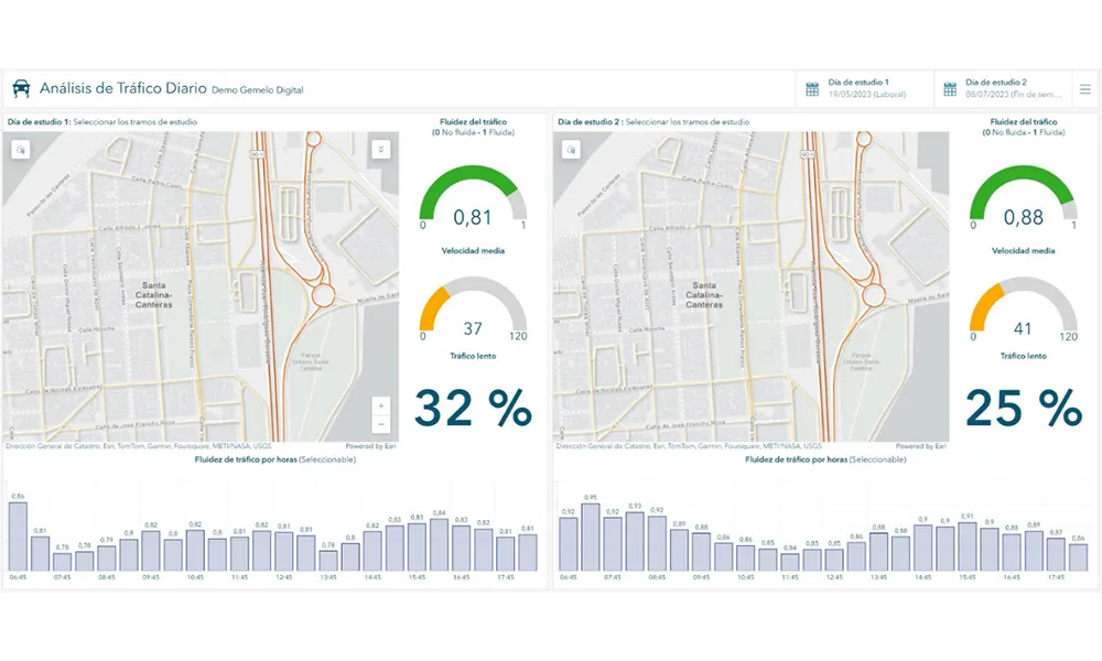
A collaboration between TomTom and Esri will take centre stage at the upcoming Congress with a session titled "Driving Insights: Unlocking the Power of TomTom Historic Traffic Data in ArcGIS.” Led by industry experts Frans Keijzer from TomTom and Jaime Nieves from Esri Spain, this presentation will showcase how integrating TomTom's historical traffic data with the ArcGIS platform has transformed urban mobility in Gran Canaria, Spain.

The initiative, spearheaded by Esri Spain and Sagulpa, sought to create a digital twin of the urban area to enhance planning and management. By leveraging TomTom's robust traffic data and using ArcGIS, the team swiftly deployed interactive maps and applications without extensive IT support. Key tools included TomTom Traffic Stats and TomTom Origin-Destination for traffic analysis and ArcGIS Dashboards and ArcGIS Experience Builder for dynamic visualizations.

This session (on Tuesday 20 May 20 from 11.45 to 12.45 in Hall Madrid D) will showcase the significant potential of TomTom Move data when combined with ArcGIS, making it an essential tool for those interested in advancing urban mobility solutions. Attendees will learn about three main applications derived from this initiative: a safety dashboard for monitoring traffic flow, a public transportation and emergency response planning tool, and an event traffic analysis application for managing large-scale events like football matches. These tools provide decision-makers with valuable insights, leading to improved traffic safety and optimised transportation routes.

Related Content

  • Esri and Microsoft in strategic alliance on disaster maps and applications
    August 2, 2012
    Esri has announced a strategic alliance with Microsoft to assist public and private agencies and communities around the world during disasters. Microsoft will display Esri public information maps on its cloud-based disaster response incident portal, as well as point citizens to the maps via its online outlets, such as MSN and Bing. Esri's ArcGIS integration within a number of Microsoft's disaster response management solutions will provide governments and leading aid organisations with a more comprehensive s
  • Here and Esri partner on real-time traffic information
    July 9, 2013
    Finland’s Here is to provide its real-time traffic information to GIS mapping software specialist Esri, enabling the company to enhance its web and cloud location platform with more precise location data for intelligent routing with Here Traffic. Here’s traffic information will complement its map content, which Esri has been using for a decade, enabling Esri to provide a location-based analytics offering that will help businesses make more informed decisions. Fleet operators will be able to better manage pr
  • TomTom partners with UN-Habitat
    November 29, 2013
    TomTom has announced a partnership with UN-Habitat, the United Nations Human Settlements Programme. TomTom’s global Traffic Index data will be used by UN-Habitat and its stakeholders around the world to make strategic decisions when tackling urban congestion. Recently TomTom released the sixth edition of its Traffic Index which revealed a clear pattern of increased congestion. Commuters around the world are spending on average eight working days stuck in traffic. This shows that traditional responses li
  • Artificial Intelligence applications for commercial vehicle operations
    December 28, 2021
    The combination of machine learning, deep neural networks and computer vision provides opportunities to address in new ways an increasing range of functions that are a part of commercial vehicle operations. Here, IRD’s Rish Malhotra details how.