TomTom and Esri fusion transform urban mobility

April 28, 2025 Read time: 2 mins

A collaboration between TomTom and Esri will take centre stage at the upcoming Congress with a session titled "Driving Insights: Unlocking the Power of TomTom Historic Traffic Data in ArcGIS.” Led by industry experts Frans Keijzer from TomTom and Jaime Nieves from Esri Spain, this presentation will showcase how integrating TomTom's historical traffic data with the ArcGIS platform has transformed urban mobility in Gran Canaria, Spain.

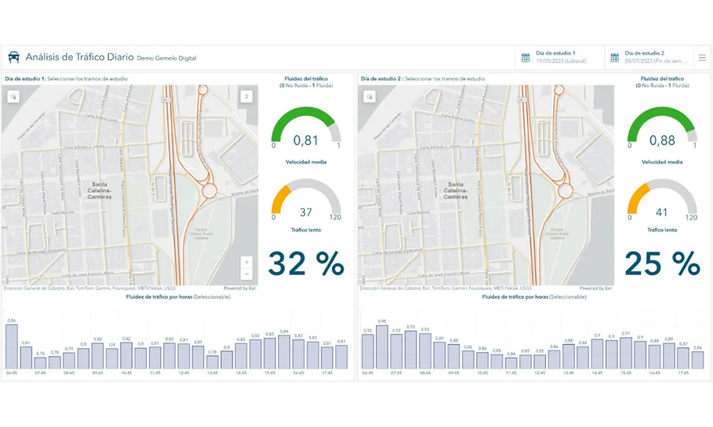
The initiative, spearheaded by Esri Spain and Sagulpa, sought to create a digital twin of the urban area to enhance planning and management. By leveraging TomTom's robust traffic data and using ArcGIS, the team swiftly deployed interactive maps and applications without extensive IT support. Key tools included TomTom Traffic Stats and TomTom Origin-Destination for traffic analysis and ArcGIS Dashboards and ArcGIS Experience Builder for dynamic visualizations.

This session (on Tuesday 20 May 20 from 11.45 to 12.45 in Hall Madrid D) will showcase the significant potential of TomTom Move data when combined with ArcGIS, making it an essential tool for those interested in advancing urban mobility solutions. Attendees will learn about three main applications derived from this initiative: a safety dashboard for monitoring traffic flow, a public transportation and emergency response planning tool, and an event traffic analysis application for managing large-scale events like football matches. These tools provide decision-makers with valuable insights, leading to improved traffic safety and optimised transportation routes.

For more information on companies in this article

Related Content

  • Queensland extends emergency vehcile priority system
    December 18, 2014
    Following encouraging results from an initial small-scale trial of an emergency vehicle priority system in Queensland, Australia, the scheme is now being extended. In an emergency every second counts. Nowhere is this more graphically illustrated than by the survivability statistics for the time to cardiopulmonary resuscitation of pre-hospital cardiac arrest: at four minutes the survival rate is 22% but by 14 minutes the survival has dropped to 5% - as can be seen from the graph below. There is a similar tre
  • Software solution for pedestrian simulation
    January 31, 2012
    VisWalk from PTV is a pedestrian simulation tool specifically designed to assist railway station operators, city planners, architects and event managers in planning and coordinating their projects. The software allows planners to optimise pedestrian flows in and outside buildings.
  • Development of cooperative driving applications for work zones
    July 17, 2012
    The German AKTIV project is researching several cooperative driving applications for use in work zones. PTV's Michael Ortgiese details progress. The steep increases in traffic volumes predicted back in the early 1990s have unfortunately been proven to be more than accurate. In Germany, the AKTIV project continues to look into cooperative technologies' potential to reduce the impact of those increased traffic volumes and keep traffic moving despite limitations in infrastructure capacity.
  • Bluetooth speed and travel data collection shows cost savings
    February 2, 2012
    Houston TranStar is using Bluetooth sensors to collect speed and travel data in a project which is already demonstrating significant cost savings