TomTom and Esri fusion transform urban mobility

April 28, 2025 Read time: 2 mins

A collaboration between TomTom and Esri will take centre stage at the upcoming Congress with a session titled "Driving Insights: Unlocking the Power of TomTom Historic Traffic Data in ArcGIS.” Led by industry experts Frans Keijzer from TomTom and Jaime Nieves from Esri Spain, this presentation will showcase how integrating TomTom's historical traffic data with the ArcGIS platform has transformed urban mobility in Gran Canaria, Spain.

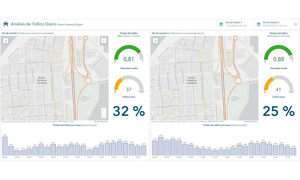
The initiative, spearheaded by Esri Spain and Sagulpa, sought to create a digital twin of the urban area to enhance planning and management. By leveraging TomTom's robust traffic data and using ArcGIS, the team swiftly deployed interactive maps and applications without extensive IT support. Key tools included TomTom Traffic Stats and TomTom Origin-Destination for traffic analysis and ArcGIS Dashboards and ArcGIS Experience Builder for dynamic visualizations.

This session (on Tuesday 20 May 20 from 11.45 to 12.45 in Hall Madrid D) will showcase the significant potential of TomTom Move data when combined with ArcGIS, making it an essential tool for those interested in advancing urban mobility solutions. Attendees will learn about three main applications derived from this initiative: a safety dashboard for monitoring traffic flow, a public transportation and emergency response planning tool, and an event traffic analysis application for managing large-scale events like football matches. These tools provide decision-makers with valuable insights, leading to improved traffic safety and optimised transportation routes.

For more information on companies in this article

Related Content

  • Inrix aids authorities in dealing with data
    August 18, 2015
    New traffic data products and services have been launched to aid transport and urban planners and business with detailed intelligence on journey patterns, reports Jon Masters. Manual travel surveys ought soon to become a thing of the past for transport planners and the business community. The technology now exists for getting sophisticated levels of traffic and trip data from connected vehicles. Cars and commercial fleets carrying a GPS device, or a mobile phone or smartphone are the sources of the informat
  • Vehicle identification systems aid dynamic bus operations
    April 24, 2013
    David Crawford looks at a global trend towards more efficiency in less space As buses gain increased profile in the public transport mix needed for modal shift, attention is turning towards improving terminal layouts for more efficient handling of services and passengers. Locations, too, tend to be in central areas of cities, where sites are restricted and land values high. Enter the dynamic bus station, which uses modern vehicle identification systems to optimise space use and streamline service operation
  • Cubic launches Urban Insights subsidiary to tackle Big Data
    June 23, 2014
    Cubic Transportation Systems has launched a subsidiary called Urban Insights Associates, a consulting and services practice that aims to help the transportation sector utilise stored data to improve the services offered to travellers. The transportation sector gathers large volumes of data on vehicle locations, passenger numbers, ticketing and fare collection as well as from scheduling and asset management systems. According to Cubic, this data has the potential for deriving insights into planning and m
  • Telenav finds way with Iteris’ ClearData
    June 10, 2024
    Traffic and travel information product also offers safety scores on driver behaviour