TomTom and Esri fusion transform urban mobility

April 28, 2025 Read time: 2 mins

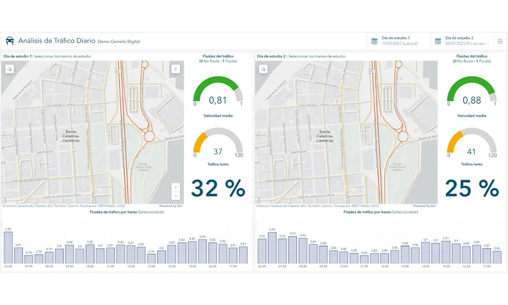
A collaboration between TomTom and Esri will take centre stage at the upcoming Congress with a session titled "Driving Insights: Unlocking the Power of TomTom Historic Traffic Data in ArcGIS.” Led by industry experts Frans Keijzer from TomTom and Jaime Nieves from Esri Spain, this presentation will showcase how integrating TomTom's historical traffic data with the ArcGIS platform has transformed urban mobility in Gran Canaria, Spain.

The initiative, spearheaded by Esri Spain and Sagulpa, sought to create a digital twin of the urban area to enhance planning and management. By leveraging TomTom's robust traffic data and using ArcGIS, the team swiftly deployed interactive maps and applications without extensive IT support. Key tools included TomTom Traffic Stats and TomTom Origin-Destination for traffic analysis and ArcGIS Dashboards and ArcGIS Experience Builder for dynamic visualizations.

This session (on Tuesday 20 May 20 from 11.45 to 12.45 in Hall Madrid D) will showcase the significant potential of TomTom Move data when combined with ArcGIS, making it an essential tool for those interested in advancing urban mobility solutions. Attendees will learn about three main applications derived from this initiative: a safety dashboard for monitoring traffic flow, a public transportation and emergency response planning tool, and an event traffic analysis application for managing large-scale events like football matches. These tools provide decision-makers with valuable insights, leading to improved traffic safety and optimised transportation routes.

For more information on companies in this article

Related Content

  • Future traffic management needs new thinking, new technology
    January 23, 2012
    One of the biggest problems facing US ITS professionals, says Georgia DOT's Hugh Colton, is the constrained thinking which is sometimes forced upon those making procurement decisions. It is time, he says, to look again at how we do things. In the November/December 2010 edition of this journal, Pete Goldin interviewed Joseph Sussman, chairman of the US's ITS Program Advisory Committee. Amongst other observations that Sussman made was that, technologically, ITS in the US is 10 years behind that in the world-l
  • Baidu 'brings autonomous MaaS' to China 
    February 15, 2021
    New venture in Guangzhou includes robotaxis as well as driverless buses on fixed routes
  • Vaisala's RoadAI can optimise maintenance
    August 20, 2019
    Alerts for natural disasters are ones that most of us would rather do without, writes Adam Hill. But the ITS industry still needs help to deal with more common meteorological issues Google Maps has added SOS alerts to its service. For those of us more used to using the phone app to navigate from a metro station to an unfamiliar restaurant, this may seem extreme. But this is not what Google has in mind. Its SOS messages are for “hurricane forecast cones, earthquake shake-maps and flood forecasts”. That
  • Regulating rural road use
    June 20, 2016
    David Crawford looks at problems facing indigenous communities and those unfamiliar with driving in rural areas. While it is well known that the fatality rate for road crashes in rural areas is higher than in towns and cities, some groups suffer far more than others. For instance, the rates of death and serious injury from vehicle accidents is much higher for American Indian and Alaska Native (AI and AN) populations living in rural tribal lands than for any of the country’s other ethnic populations. Crashes