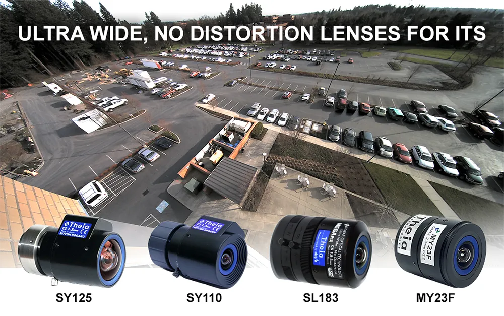
Theia develops innovative distortion-free ultra-wide-angle lenses

Today’s high-resolution cameras have many advantages if they have the right lens for the job. When that includes covering large areas or reducing cost by installing fewer cameras, you need a wide-angle lens. Fisheye style lenses with barrel distortion are routinely used to cover an ultra-wide field of view; however, they create a curved and distorted image which causes significant loss of resolution at the image edges. This presents a variety of issues for ITS applications such as difficulty in identification or recognition of objects and details.
October 26, 2022 Read time: 2 mins


To counter the drawbacks of fisheye-style optics, Theia Technologies has developed a suite of rectilinear lenses offering a different, ultra-wide field of view without the barrel distortion or loss of edge resolution characteristic of fisheye style lenses. Theia achieves this optically, without the use of image correction software or its inherent latency.

The company employs its patented Linear Optical Technology to create a family of multi-megapixel lenses that offer horizontal fields of view up to 135 degrees with very low distortion while improving the resolution at the image edge compared to typical wide-angle lenses.

Applications for Theia’s family of ultra-wide, low distortion lenses include providing great peripheral vision for situational awareness in navigation and remote operation of vehicles and robots used in a variety of ITS applications from logistics to assisted and unmanned vehicles. They capture wide areas at short distances such as in under-vehicle surveillance and shipping container identification, among many other imaging tasks, including applications in close-up applications such as ATMs, card-locked garage entries, and multi-door entryways where both high image detail and wide fields of view are required. Other applications for Theia’s family of ultra-wide, low-distortion lenses include effectively monitoring large areas like parking lots, multi-lane tolling stations, and warehouses.

Choosing the right lens for an application depends on many factors including field of view, required image resolution, multi-spectral capability, image format and mount, among others. To assist in lens selection, Theia offers an image resolution simulator and lens calculator that relates FOV, resolution, and object distance.

Visitors to the Theia website will find it also offers other tools and white papers for a better understanding of its lens technology and selection of the optimal lens for your application.

Content produced in association with Theia Technologies

For more information on companies in this article

Related Content

  • Driver assistance with stereo vision sensing system
    May 14, 2013
    A new stereo vision sensing (SVS) system developed by automotive safety systems supplier Autoliv will, says the company, help vehicle manufacturers meet the new test criteria that EuroNCAP recently announced to promote autonomous emergency braking, intelligent speed assist, lane departure assists and pedestrian protection. The system has a field of view of 50 degrees and can recognise objects within 120 metres. To provide the best view, the stereo vision cameras are mounted high on the front windshield behi
  • Wi-SUN: here’s why mesh networking works
    May 10, 2019
    There are several networking options available for smart city planners. Phil Beecher of Wi-SUN Alliance makes the case for wireless mesh networks when it comes to rolling out IoT solutions The Internet of Things (IoT) is growing fast. Connecting thousands of sensors and control systems in bi-directional networks is paving the way for a new generation of smart city and transport infrastructures. For many of these applications, wireless connectivity is essential where cable installation is not practical.
  • Researchers devise snow ploughing algorithm
    September 16, 2014
    Canadian researchers Olivier Quirion-Blais, Martin Trépanier and André Langevin have developed an algorithm to determine the most efficient routes for snow ploughs and gritters. Snow plough routing has always been something of a ‘black art’: to direct a fleet of show plough to clear priority roads without having the same road cleared several times while others are left untreated. Increasingly, GPS is being used to track the routes the clearing vehicles have taken but until now it has not been possible to ta
  • Outsight White Paper: Lidar in action
    December 20, 2022
    Download here: free practical guide to working with Lidar in Smart City applications