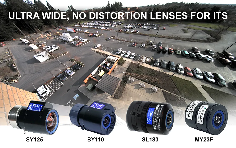
Theia develops innovative distortion-free ultra-wide-angle lenses

Today’s high-resolution cameras have many advantages if they have the right lens for the job. When that includes covering large areas or reducing cost by installing fewer cameras, you need a wide-angle lens. Fisheye style lenses with barrel distortion are routinely used to cover an ultra-wide field of view; however, they create a curved and distorted image which causes significant loss of resolution at the image edges. This presents a variety of issues for ITS applications such as difficulty in identification or recognition of objects and details.
October 26, 2022 Read time: 2 mins


To counter the drawbacks of fisheye-style optics, Theia Technologies has developed a suite of rectilinear lenses offering a different, ultra-wide field of view without the barrel distortion or loss of edge resolution characteristic of fisheye style lenses. Theia achieves this optically, without the use of image correction software or its inherent latency.

The company employs its patented Linear Optical Technology to create a family of multi-megapixel lenses that offer horizontal fields of view up to 135 degrees with very low distortion while improving the resolution at the image edge compared to typical wide-angle lenses.

Applications for Theia’s family of ultra-wide, low distortion lenses include providing great peripheral vision for situational awareness in navigation and remote operation of vehicles and robots used in a variety of ITS applications from logistics to assisted and unmanned vehicles. They capture wide areas at short distances such as in under-vehicle surveillance and shipping container identification, among many other imaging tasks, including applications in close-up applications such as ATMs, card-locked garage entries, and multi-door entryways where both high image detail and wide fields of view are required. Other applications for Theia’s family of ultra-wide, low-distortion lenses include effectively monitoring large areas like parking lots, multi-lane tolling stations, and warehouses.

Choosing the right lens for an application depends on many factors including field of view, required image resolution, multi-spectral capability, image format and mount, among others. To assist in lens selection, Theia offers an image resolution simulator and lens calculator that relates FOV, resolution, and object distance.

Visitors to the Theia website will find it also offers other tools and white papers for a better understanding of its lens technology and selection of the optimal lens for your application.

Content produced in association with Theia Technologies

For more information on companies in this article

Related Content

  • Study shows road markings deliver cost-effective road safety
    June 20, 2012
    Road markings are among the most cost-effective solutions to make roads safer. A recent study carried out for the American Glass Bead Manufacturer’s Association quantifies by just how much Despite only making up 23% of the US mileage, fatalities on America’s rural two-lane highways made up 57% of all traffic fatalities in 2009 — resulting in more than $77Bn in losses for that year alone. Moreover, a rural motorist is 2.7 times more likely to be involved in a fatal crash per mile travelled than their urban
  • Active traffic management increases safety and capacity
    February 2, 2012
    WSDOT is deploying Active Traffic Management in order to increase safety and capacity on its strategic roads. WSDOT's Patricia Michaud elaborates
  • Euromed countries warm to Galileo’s services
    June 6, 2014
    The EU is helping countries in North Africa and the Middle East utilise Galileo’s services. With its Galileo constellation rapidly taking shape, the European Union has opened lines of communication with countries in North Africa and the Middle East with a view to assisting their governments and businesses to utilise the satellite services that extend across the Mediterranean. The services available to countries are provided through the European Global Navigational Satellite System (E-GNSS), which includes a
  • Unmanned vehicles ‘to transform transportation within a few years’
    March 10, 2015
    According to new analysis from Frost and Sullivan, advances in sensor fusion technologies with high imaging capabilities to enhance manoeuvrability are quickening the development of unmanned vehicles. The resulting increase in the use of unmanned vehicles will eventually alter the dynamics of the transportation industry. The report, Innovations in Unmanned Vehicles–Land, Air, and Sea, finds that high-quality image and navigation sensors such as light detection and ranging systems, radar, and advanced global