Septentrio demos AV localisation tech

Septentrio has provided GPS/global navigation satellite system (GNSS) technology for computer vision supplier Artisense’s Visual Inertial Navigation System (VINS).
January 23, 2020 Read time: 1 min


Septentrio says the GNSS technology provides centimetre-level positioning to the VINS system with the accuracy required for lane-level manoeuvring and Vehicle to Vehicle warning systems. Cameras and inertial sensors continue localisation as the vehicle moves into tunnels or parking garages with no line of sight to GNNS satellites, the company adds.

The VINS is expected to combine computer vision, inertial sensors and GNSS measurements to deliver 3D positioning and orientation information in any environment, even indoors.

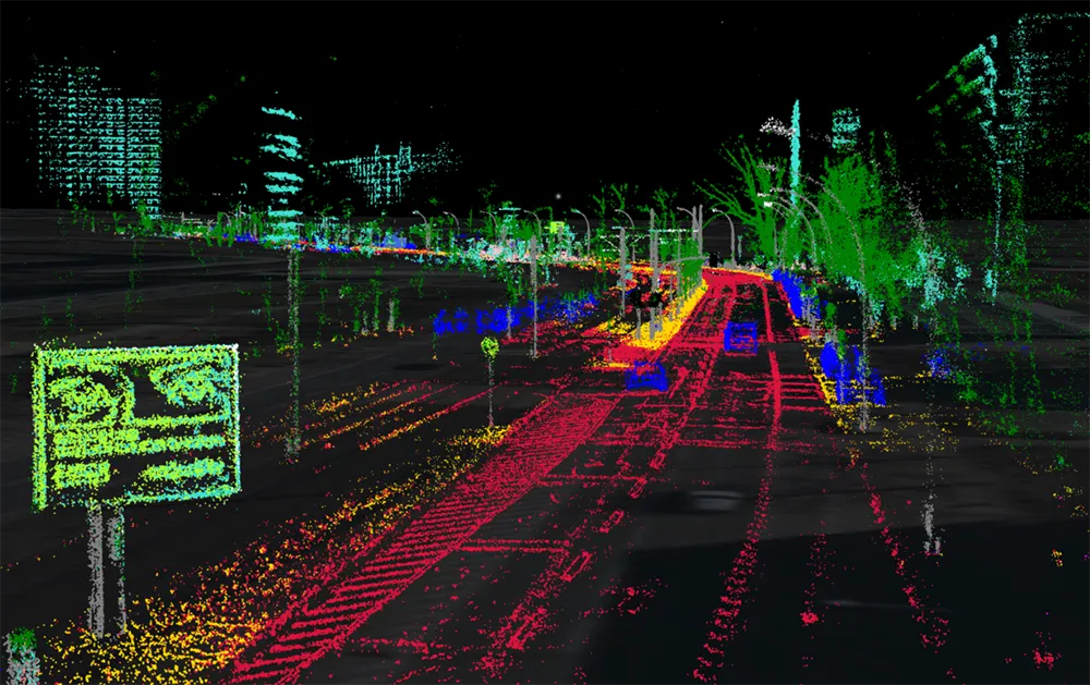
A demonstration at Auto.ai in Berlin offered rides around the German capital in a car featuring VINS technology. One screen inside the car continuously displayed its location as the system continued localisation in all locations including tunnels and parking garages. The second screen featured a real-time 3D point-cloud reconstruction of the car’s surroundings.

Related Content

  • Is Europe's Galileo project value for money?
    February 2, 2012
    Philippe Hamet discusses the progress of the European Union's Galileo Global Navigation Satellite System Project
  • Caltrans trials Xerox’s Passenger Detection System
    October 30, 2015
    Xerox’s Passenger Detection System has been trialled in California and compared with the state’s team of human counters giving some interesting results, as Colin Sowman discovers. Like others adopting high-occupancy and high-occupancy vehicle (HOV) lanes for congestion management, Caltrans has faced challenges with compliance in what has been effectively an ‘honour system’ with drivers trusted to set their tags correctly or comply with the multi-passenger requirement.
  • Auckland reduces airport journey times
    April 16, 2018
    Getting from the centre of Auckland to the city’s airport used to be fraught with unwanted stress for passengers – but a new system combining radar, Bluetooth and Wi-Fi is smoothing things over. Andrew Stone investigates. Struggling to cope with steady growth in passenger numbers and the costly traffic congestion which that can entail, New Zealand’s Auckland International Airport has deployed an innovative system that is smoothing traffic and passenger flows. The same system is also offering new, data-led
  • Dutch approval for Redflex mobile speed enforcement
    September 5, 2014
    RedflexRadarcam, Redflex’s flexible mobile speed enforcement system, has undergone testing by the Dutch metrology institute, NMi Certin (NMi), and verified to meet Dutch approval requirements. Said to be the first speed enforcement system to utilise dual radar detection for accurate speed detection in all weather conditions, RedflexRadarcam also provides lane identification, vehicle position and positive vehicle identification across up to six lanes of traffic simultaneously.