Septentrio demos AV localisation tech

Septentrio has provided GPS/global navigation satellite system (GNSS) technology for computer vision supplier Artisense’s Visual Inertial Navigation System (VINS).
January 23, 2020 Read time: 1 min


Septentrio says the GNSS technology provides centimetre-level positioning to the VINS system with the accuracy required for lane-level manoeuvring and Vehicle to Vehicle warning systems. Cameras and inertial sensors continue localisation as the vehicle moves into tunnels or parking garages with no line of sight to GNNS satellites, the company adds.

The VINS is expected to combine computer vision, inertial sensors and GNSS measurements to deliver 3D positioning and orientation information in any environment, even indoors.

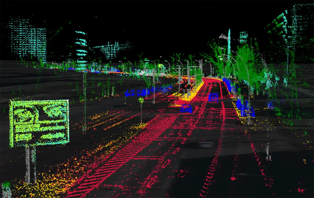
A demonstration at Auto.ai in Berlin offered rides around the German capital in a car featuring VINS technology. One screen inside the car continuously displayed its location as the system continued localisation in all locations including tunnels and parking garages. The second screen featured a real-time 3D point-cloud reconstruction of the car’s surroundings.

Related Content

  • Smart technology keeps infrastructure operating safely
    August 30, 2013
    US Departments of Transportation (DOTs) are using smart technology to warn civil engineers when something is wrong with the infrastructure, says the American Association of State Highway and Transportation Association (AASHTO). Sensors installed on bridges, in roadways, and on maintenance vehicles are communicating real-time performance and weather data, allowing engineers to solve problems before they occur. "Most people look at a road or a bridge and never realise the technology that today's modern tra
  • Transportation applications move to machine vision’s mainstream
    June 11, 2015
    The adaptation of machine vision to transport applications continues apace. That the machine vision industry is taking traffic installations seriously is evident by the amount of hardware and software products tailor-made for ITS applications that are now available on the market. A good example comes from US-based Gridsmart Technologies which has developed a single wire fisheye camera that provides a horizon to horizon view for use at intersections. Not only does the single camera replace four or more in a
  • SICK launches all-weather 3D sensor system for traffic management
    January 29, 2018
    Sick has launched the TIC502 Lidar sensor traffic and warning system which is said to scan vehicles up to 100 times a second with 99% accuracy to generate a 3D profile of each vehicle. The all-weather solution can be used for counting fast lane, free-flowing and static traffic to facilitate real-time management and electronic toll charge assessment of all vehicle types according to standard international transport classifications. TIC502 has a range of up to 40 metres and minimum mounting height of 1.5
  • ITS need not reinvent machine vision
    October 29, 2014
    Machine vision techniques hold the potential to solve a multitude of challenges facing the transportation sector Optical Character Recognition (OCR), the base technology for number plate recognition, has been in industrial use for more than three decades. It is a prime example of how, instead of having to start from scratch, the transportation sector can leverage and adapt the machine vision expertise already used in industry in order to provide robust solutions with new capabilities. “The real val