Septentrio demos AV localisation tech

Septentrio has provided GPS/global navigation satellite system (GNSS) technology for computer vision supplier Artisense’s Visual Inertial Navigation System (VINS).
January 23, 2020 Read time: 1 min


Septentrio says the GNSS technology provides centimetre-level positioning to the VINS system with the accuracy required for lane-level manoeuvring and Vehicle to Vehicle warning systems. Cameras and inertial sensors continue localisation as the vehicle moves into tunnels or parking garages with no line of sight to GNNS satellites, the company adds.

The VINS is expected to combine computer vision, inertial sensors and GNSS measurements to deliver 3D positioning and orientation information in any environment, even indoors.

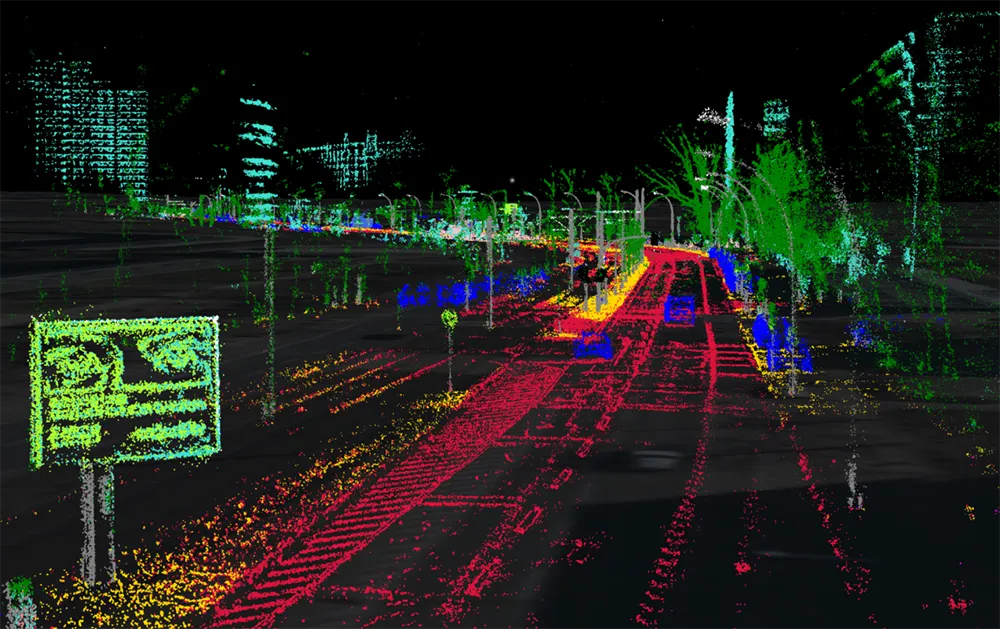
A demonstration at Auto.ai in Berlin offered rides around the German capital in a car featuring VINS technology. One screen inside the car continuously displayed its location as the system continued localisation in all locations including tunnels and parking garages. The second screen featured a real-time 3D point-cloud reconstruction of the car’s surroundings.

Related Content

  • Clarion and Hitachi develop driverless parking system
    March 31, 2017
    Hitachi Automotive Systems and Clarion have developed a remote parking system that automatically performs parallel and perpendicular parking as well as garage parking and exit from outside the vehicle through remote control using smartphones.
  • HOV lanes are Paris Olympics legacy
    November 28, 2024
    There’s a new high-occupancy vehicle lane on the Paris Périphérique: Francois Leblanc of Fareco tells Adam Hill about winning the race to put this technology in place
  • Is machine vision the future of enforcement?
    January 25, 2012
    Leading automated enforcement system suppliers talk about how they see machine vision technology affecting the sector in the coming years
  • Additional accuracy enhances ITS options
    March 19, 2015
    High accuracy and reliability of GNSS location data is available using the EGNOS services to be ready for Galileo’s expanding satellite constellation. Global navigation satellite systems (GNSS) are increasingly a building block for ITS applications from road user charging and E-call to tracking & tracing of freight. Even while the European Space Agency is still assembling the Galileo constellation, EGNOS (the European Geostationary Navigation Overlay Service) is already providing the basis of a range of ser