Septentrio demos AV localisation tech

Septentrio has provided GPS/global navigation satellite system (GNSS) technology for computer vision supplier Artisense’s Visual Inertial Navigation System (VINS).
January 23, 2020 Read time: 1 min


Septentrio says the GNSS technology provides centimetre-level positioning to the VINS system with the accuracy required for lane-level manoeuvring and Vehicle to Vehicle warning systems. Cameras and inertial sensors continue localisation as the vehicle moves into tunnels or parking garages with no line of sight to GNNS satellites, the company adds.

The VINS is expected to combine computer vision, inertial sensors and GNSS measurements to deliver 3D positioning and orientation information in any environment, even indoors.

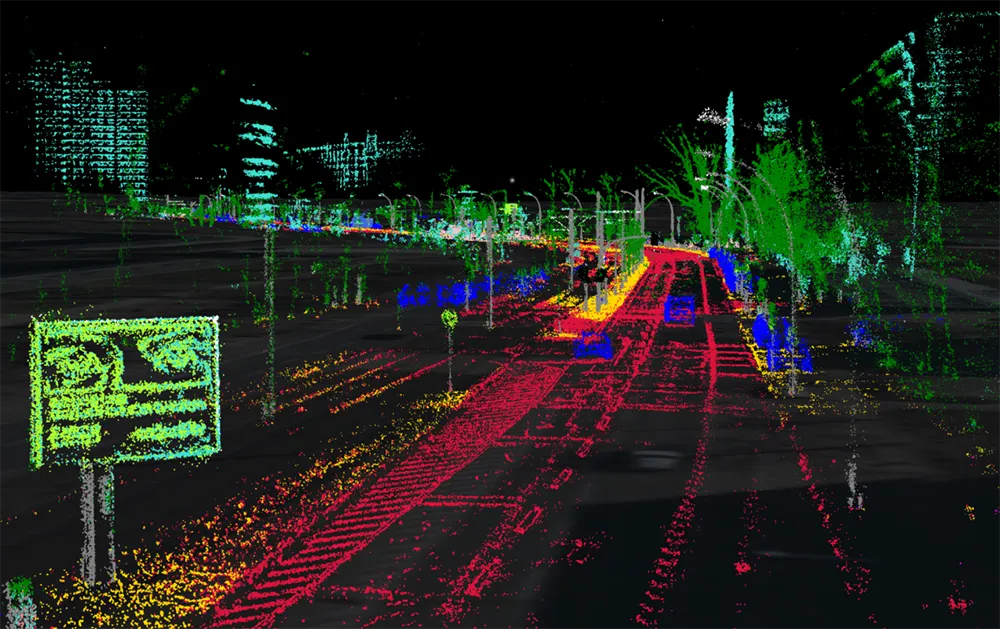
A demonstration at Auto.ai in Berlin offered rides around the German capital in a car featuring VINS technology. One screen inside the car continuously displayed its location as the system continued localisation in all locations including tunnels and parking garages. The second screen featured a real-time 3D point-cloud reconstruction of the car’s surroundings.

Related Content

  • GridMatrix maximises power of existing infrastructure
    August 5, 2023

    GridMatrix’s breakthrough software platform for multimodal data collection and analytics is revolutionising transportation planning and decision making across the US. 

    Powered by artificial intelligence and combining the latest advances in cloud computing, machine learning and advanced sensing, GridMatrix’s platform is deployed in New York City on the world’s busiest bridges and tunnels, trusted by multiple state departments of transportation, and in a fast-growing number of American towns and cities. 

  • Digital Light Processing transforms travel information
    July 19, 2012
    David Crawford investigates the potential of new projection technology. Fifty years on from its invention of the microchip, US company Texas Instruments (TI) has compressed the technology into a surface area of just 4.3mm. As such, it forms the heart of a new Pico Digital Light Processing (DLP) system that is set to transform travel information delivery for millions of users on the move - by making it projectable.
  • Cellint measures speed and travel time without roadside infrastructure
    April 10, 2014
    Collecting speed and travel time data without using roadside infrastructure could offer new possibilities to cash-strapped road authorities. Streaming video may be useful for traffic controllers to monitor incidents and automatic number plate recognition may be required for enforcement, but neither are necessary for many ITS functions. For instance travel times, tailbacks, percentage of vehicles turning, origin and destination analysis can all be done using Bluetooth and/or WI-Fi sensors and without video o
  • TomTom launches RoadDNA
    September 14, 2015
    TomTom has launched TomTom RoadDNA, a new product for vehicle localisation that will help make automated driving a reality, faster. Designed with vehicle data storage and processing limitations in mind, RoadDNA delivers highly accurate location information that can easily be integrated into the on-board system of a vehicle. RoadDNA’s propriety technology delivers a highly optimised lateral and longitudinal view of the roadway. By matching RoadDNA data with vehicle sensor data in real-time a vehicle knows