Septentrio demos AV localisation tech

Septentrio has provided GPS/global navigation satellite system (GNSS) technology for computer vision supplier Artisense’s Visual Inertial Navigation System (VINS).
January 23, 2020 Read time: 1 min


Septentrio says the GNSS technology provides centimetre-level positioning to the VINS system with the accuracy required for lane-level manoeuvring and Vehicle to Vehicle warning systems. Cameras and inertial sensors continue localisation as the vehicle moves into tunnels or parking garages with no line of sight to GNNS satellites, the company adds.

The VINS is expected to combine computer vision, inertial sensors and GNSS measurements to deliver 3D positioning and orientation information in any environment, even indoors.

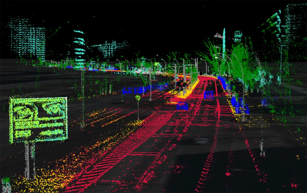
A demonstration at Auto.ai in Berlin offered rides around the German capital in a car featuring VINS technology. One screen inside the car continuously displayed its location as the system continued localisation in all locations including tunnels and parking garages. The second screen featured a real-time 3D point-cloud reconstruction of the car’s surroundings.

Related Content

  • Machine vision’s image of road management’s future
    June 11, 2015
    Q-Free’s Marco Sinnema looks at how the commoditisation of high-quality vision-based solutions is widening their application. Machine vision technology’s entry into the ITS/traffic management sector has followed a classic top-down path. This is unsurprising given the extremely demanding performance criteria which are the standard in its market of origin, manufacturing processing. Very high image qualities combined with frame rates often in the hundreds per second range resulted in vision systems with capabi
  • Hazen.ai pioneers 3D video analytics
    March 30, 2022
    Hazen.ai is announcing a revolutionary new 3D video analytics engine that transforms an ordinary video camera into a sophisticated 3D sensor for advanced traffic analytics. And it is demonstrating the system on its stand here at Intertraffic.
  • The benefits of Lidar
    March 21, 2022

    While Lidar is gaining ground in the ITS industry, it has not yet reached the level of mass adoption where it shows up frequently in requests for proposals (RFPs) from cities and DoTs.

  • Jenoptik uses sensor fusion to avoid monitoring confusion
    January 26, 2018
    Jenoptik’s Uwe Urban looks at the advantages of ‘sensor fusion’ for the ITS sector. When considering the ideal sensing and monitoring system to enable the ITS sector to deliver improvements in mobility and road safety, for general policing security and border protection, we have to think beyond radar-base systems or laser scanners. What is needed today are solutions for detecting and tracking vehicles while recording evidence to deacide if any action is necessary. There is no sole sensor capable of