
Parsons shows off Intelligent NETworks platform

Imagine what your morning commute might be like in the future. An autonomous vehicle picks you up, syncs with your mobile devices to determine where you need to be and when, calculates the best route, and places your order at the local coffee shop moments before stopping to pick it up along the way. This is the future of mobility, and Parsons is helping to build it.
June 5, 2018 Read time: 2 mins
Dan Lukasik of Parsons
Imagine what your morning commute might be like in the future. An autonomous vehicle picks you up, syncs with your mobile devices to determine where you need to be and when, calculates the best route, and places your order at the local coffee shop moments before stopping to pick it up along the way. This is the future of mobility, and 4089 Parsons is helping to build it.


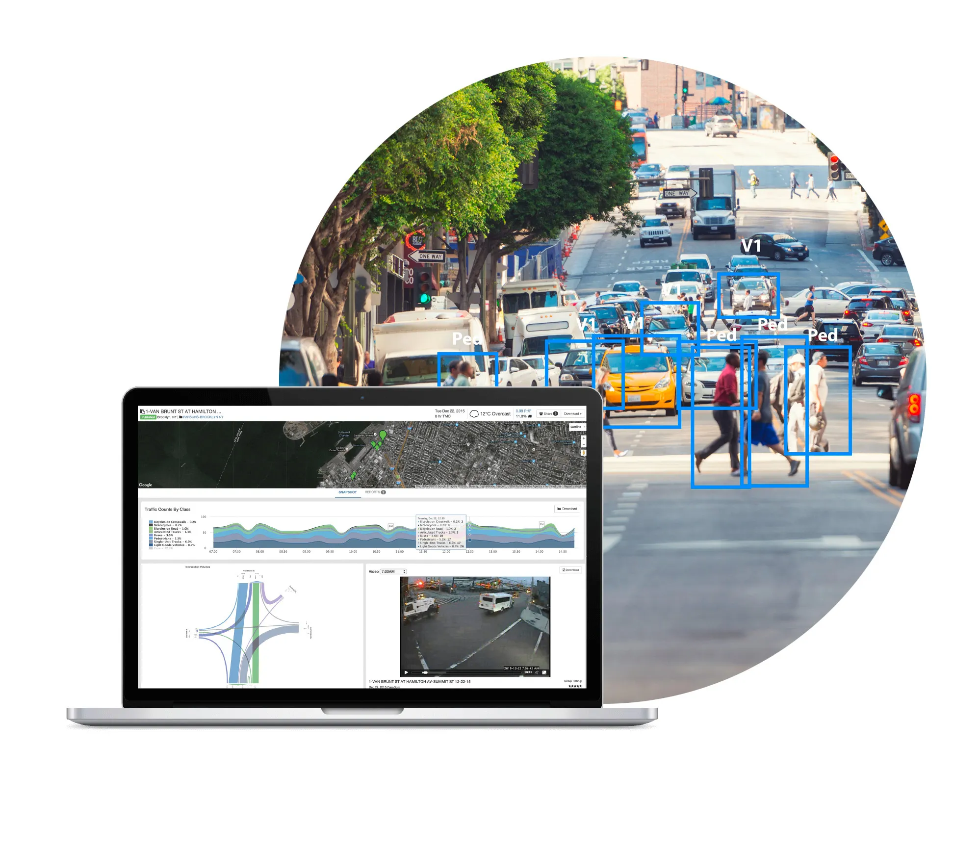
Parsons’ proprietary Intelligent NETworks (iNET) is a smart cities platform incorporating technologies which enable users to make actionable decisions. Visitors to the company’s booth here at ITS America Detroit will get a first-hand insight into innovative applications of iNET in use or coming soon. For instance, linking to connected and autonomous vehicles, analysing data, and translating it into meaningful information. Or making use of prediction, artificial intelligence (AI), and machine learning (ML) platforms to improve usability and decision making for smart cities agencies and citizens. Visitors can also see natural language-based 511 response that provides users with relevant, real-time information based on advanced AI capabilities and ML technologies. This cost-effective system provides users with a superior experience compared to conventional 511 systems, and leverages natural language expertise rather than non-user, unfriendly interactive voice response systems.

Other features that will be covered include protecting physical/intellectual assets by creating active monitoring systems, as well as automated inspections/monitoring to predict when bridges need maintenance, allowing proactive maintenance prior to failure.

As Parsons points out, iNET is the system of the future powering smart cities and enables transportation systems to deliver on the promise of improved mobility and quality of life.

Booth 725

Related Content

  • December 15, 2022
    Multimodal simulation helps to improve the airport experience
    The vision of the IMHOTEP project is a multimodal European transport system, where different modes of travel are seamlessly integrated to give passengers a great door-to-gate and gate-to-door experience. Marcel Sala, scientific researcher at Aimsun, explains how this works at airports
  • July 16, 2012
    Adopting universal technology platforms for tolling
    Dave Marples of Technolution argues that the continuing development of tolling-specific onboard equipment is leading us up a blind alley. We should, he says, be looking to realise universal platforms with universal application. The near-future automobile contains information systems of a sophistication to rival a jet airliner of only a few years ago, yet is 'piloted' by a considerably less well-trained individual of highly variable mental and physical capacity, and operated in a hostile, unpredictable and p
  • March 15, 2016
    Creative finance enables parking progress in LA
    David Crawford investigates an innovative public/private partnership. Los Angeles entered the second decade of the 21st century facing major challenges to its parking operations. With a population of 3.8 million, and its car-oriented culture still predominant, the city's parking meters were technically outdated - with most only accepting coins and many regularly out of service - resulting in a substantial loss of revenue. This coincided with a number of Californian cities looking to parking income to boost
  • May 3, 2019
    Toyota enters partnership to build HD maps for AVs from space
    Toyota Research Institute-Advanced Development (TRI-AD), technology company Maxar Technologies and NTT Data are working together to build high-definition (HD) maps for autonomous vehicles (AV) using satellite imagery. TRI-AD carried out an analysis, saying that current HD maps cover less than 1% of the global road network and there is a need to broaden the coverage of urban areas and local roads before AVs can become a mainstream mobility technology. A HD map created from satellite imagery would all