Esri simplifies location based information

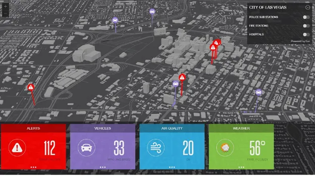
Every piece of transportation technology and data has some sort of location associated with it, according to Keith King from Esri, a leading Geographic Information System (GIS) solution provider, and transportation organizations need to be able to effectively visualize, analyze, integrate and interpret that location-based information. Esri ArcGIS brings together maps, apps, data and people to make smarter decisions while empowering everyone from line-of-business managers to executives with timely, accura
June 3, 2015 Read time: 1 min
Every piece of transportation technology and data has some sort of location associated with it, according to Keith King from 50 Esri, a leading Geographic Information System (GIS) solution provider, and transportation organizations need to be able to effectively visualize, analyze, integrate and interpret that location-based information.

Esri ArcGIS brings together maps, apps, data and people to make smarter decisions while empowering everyone from line-of-business managers to executives with timely, accurate information and collaboration.

For more information on companies in this article

Related Content

  • Esri shows benefits of aggregating multiple data live streams
    November 18, 2020
    The age of connected vehicles is fast becoming a reality. While it brings great promise, it also brings new challenges for those seeking to derive insights from the voluminous data each connected vehicle will transmit. Any number of transportation agencies are beginning to grapple with the challenge of monitoring the live streams of data for traffic management, and ultimately for greater safety of their roadways.
  • Students develop GPS traffic monitoring system
    July 15, 2013
    A collaborative summer research project between students from the University of Delaware (UD) and Delaware Department of Transportation (DelDOT) is compiling traffic data using global position system technology to quantify the severity of congestion on roads leading to and from the Delaware beaches. The students use two UD vehicles equipped with GPS devices programmed to capture travel time from one point to another, mean travel speed and delay using longitude and latitude measurements taken while the vehic
  • Huawei’s clearer vision for safe traffic
    August 4, 2020
    Rates of compliance with traffic laws are often linked to the chances of detection. Andrew Watson explains how intelligent traffic management solutions can help change drivers’ behaviour
  • Pan-European travel information is a reality – at a price
    November 26, 2013
    Pan-European, multi-modal traffic and travel information is now available, for drivers willing to pay for it. Jon Masters reports. Those able to afford a new car with all the latest options including internet connectivity can now look forward to getting detailed up-to-the-minute traffic information. They can also access multi-modal travel data, such as train times, plus weather forecasts and parking availability. Take the connected car to any Western European country and the system still works with live