Esri and AgileAssets offer one-stop asset management

The big news on the stand of geographic information system (GIS) software specialist Esri is its strategic collaboration with infrastructure asset management software AgileAssets on technology development and an implementation services. Not only will this will allow authorities to benefit from the combination of AgileAssets’ asset management solutions and Esri’s ArcGIS, further integration will see Estri’s ArcGIS Server, Roads & Highways, Collector and Survey for ArcGIS 123 available on AgileAssets’ platfo
April 5, 2016 Read time: 2 mins

The big news on the stand of geographic information system (GIS) software specialist 50 Esri is its strategic collaboration with infrastructure asset management software AgileAssets on technology development and an implementation services.

Not only will this will allow authorities to benefit from the combination of AgileAssets’ asset management solutions and Esri’s ArcGIS, further integration will see Estri’s ArcGIS Server, Roads & Highways, Collector and Survey for ArcGIS 123 available on AgileAssets’ platform.

In addition, AgileAssets has established a new consultation and deployment practice that offers transportation authorities a ‘one-stop shop’ for implementing integrated AgileAssets-Esri solutions.

According to AgileAssets’ CEO Stuart Hudson, the move is a turning point for the industry and offers benefits for those responsible for the maintenance and operations of high-value infrastructure assets. Terry Bills, transportation industry manager at Esri, said the collaboration provides users with a combination of advanced geospatial analytics and elegant mapping that outlines where, when and how to optimally invest their budgets.

For more information on companies in this article

Related Content

  • New version of free GIS portal toolkit
    March 13, 2012
    To further improve Geographic Information System (GIS) data access over the Web, ESRI has updated its GIS Portal Toolkit for ArcGIS. The toolkit is a free technology and services solution for implementing local, regional, national and global Spatial Data Infrastructure (SDI) portals. The toolkit gives users a website starter and all the functional capabilities needed to deploy a GIS portal for an organisation's SDI.
  • Esri highlights benefits of a state-wide data-rich environment
    September 7, 2020
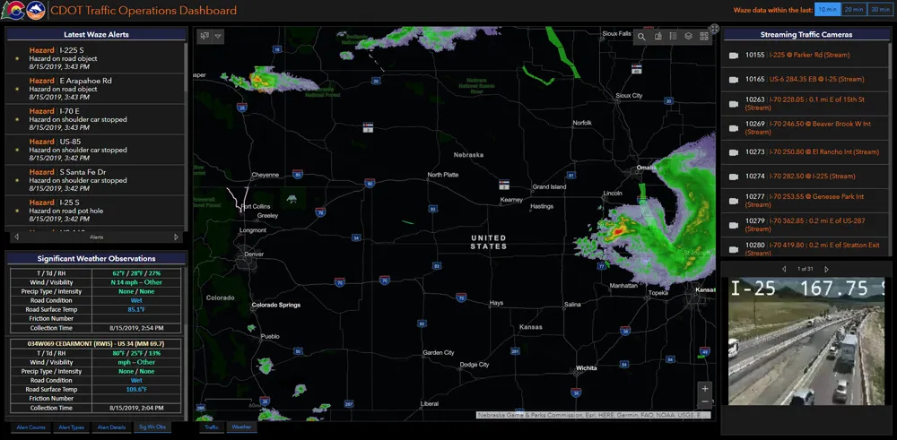
    Walk into virtually any traffic operations centre and you will be confronted by people flipping between different screens and CCTV monitors, and individually viewing a large number of stand-alone applications to try to understand a comprehensive picture of their live traffic, weather, incident, and snow conditions from these disparate sources.
  • Tolling faces up to unprecedented challenge
    October 9, 2020
    The next five years are likely to see a number of changes – but the tolling industry will be equal to them, thinks the IBTTA’s Bill Cramer. The best minds in the business are on the case…
  • Study - Move to digital railway systems fuels need for big data
    March 13, 2015
    New analysis from Frost & Sullivan, Strategic Analysis of Big Data in Rapid Transit, finds that global annual rail investment in big data will reach over US$2.14 billion by 2021. Investments will grow at a minimum of 60.3 per cent. The study covers hardware, big data distributions, data management components, analytics and visualisations, and services. The global rail market offers huge opportunities for big data technology providers. As some of the signalling equipment on rail networks is nearly 80 years o