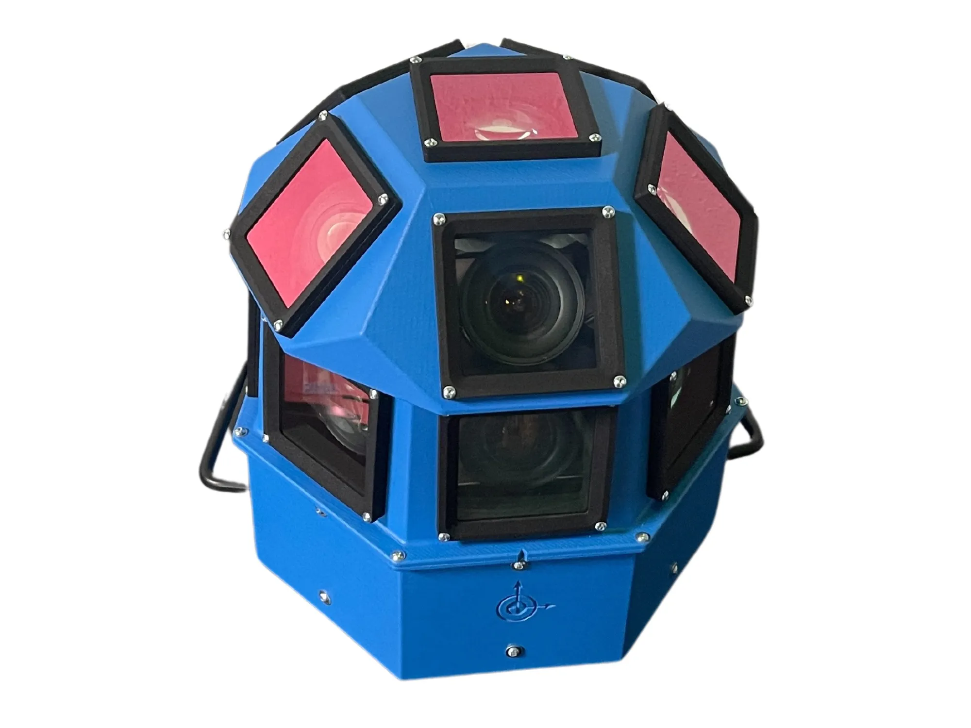
AI-InfraSolutions and Stemmer go the full 360°

Panoramic camera head designed for automated data collection in traffic applications
By David Arminas November 13, 2024 Read time: 2 mins
The head delivers 180 MPixel resolution with 360° horizontal and 120° vertical coverage

AI-InfraSolutions, a geospatial mapping technology business, has partnered with Stemmer Imaging to develop a 360°-degree panoramic camera head.

It is designed for automated data collection in applications such as traffic sign identification, road condition assessments and environmental monitoring. The technology enables municipalities and companies to efficiently manage assets and adopt predictive maintenance strategies.

AI-InfraSolutions said the new head will “redefine the future of geospatial mapping”. Engineered through machine vision specialist Stemmer’s More Engineering Services, the head delivers 180 MPixel resolution with 360° horizontal and 120° vertical coverage. It captures synchronised images every 5m at driving speeds of up to 100km/h, making it an ideal solution for large-scale geospatial mapping projects.

Development of the head posed several technical challenges, including selecting optimal sensors, synchronising image capture with GNSS systems and minimising parallax for smooth panoramic stitching. Stemmer's engineering expertise and precise intrinsic calibration were instrumental in addressing these challenges. This resulted in a robust solution capable of continuous high-speed recording for up to 247km, expandable to 496km.

Once the images are captured, AI-InfraSolutions’ powerful AI-driven data processing algorithms automatically prepare the data for further analysis. This system is particularly effective in areas such as infrastructure asset management and road condition monitoring. Offline post-processing features, including tone mapping and panoramic stitching, ensure that the collected data is refined for optimal accuracy

“By combining our innovative approach with Stemmer Imaging’s leading vision, we are elevating our solutions to an unmatched level,” said Jeroen Zanen, founder and chief executive of AI-InfraSolutions.

For more information on companies in this article

Related Content

  • Maintaining momentum: learning lessons from the London Olympics
    November 15, 2013
    Japan will not only host this year’s ITS World Congress but has been selected for the 2020 Olympics. So what can Japan, and indeed Brazil, learn from the traffic management for London 2012 - Geoff Hadwick finds out. It was a key moment when Olympic boss Jacques Rogge signed off London 2012, calling the Games “happy and glorious.” Scarred by the logistical disaster of Atlanta 1996 and the last-minute building panic for Athens 2008, Rogge clearly thought London 2012 was an object lesson in how to plan and
  • Introducing Hitachi’s HD optical zoom camera
    January 15, 2013
    Hitachi’s DI-SC120R camera includes a new feature, defog, that the camera processes in real time. Images are resolved for highly magnified stable images in foggy conditions such as urban surveillance, traffic monitoring and pole mounted applications. The camera measures each pixel for fog thickness and applies contrast to the image to offer a uniform image. The camera’s one-third inch CCD sensor provides a full resolution of 1280x720. Hitachi has combined its proprietary Digital Signal Processor (DSP) to a
  • Telegra showcases TopXview
    June 6, 2018
    Telegra is here at ITS America Detroit with a range of ITS solutions that provide better utilisation of existing resources and deploying new technologies in understandable, yet safe and future-proof ways. As the company points out, this is of real value in a world of rapidly evolving information technologies, and even faster growing traffic problems. As one of the leading ITS solutions providers in the world, Telegra says it has unmatched expertise built on 25 years of continuous focus on innovation, and
  • Ordnance Survey and Mobileye to deliver roadside infrastructure data in UK
    January 16, 2019
    National mapping agency Ordnance Survey (OS) has joined forces with Mobileye, an Intel company, to deliver high precision road network location data in the UK. OS’ geospatial and technology resources will be paired with Mobileye’s automotive camera-based mapping capabilities to offer a location information service. The partnership, unveiled at Consumer Electronics show 2019 in Las Vegas, also seeks to use the data to support the rollout of connected autonomous vehicles, intelligent mobility and 5G.